
 United Kingdom
 France
 Germany
 Netherlands
 Sweden
 USA
USA
 Italy
Italy
 Spain
Spain
More From Contributor


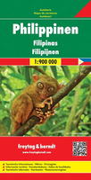
Philippines F&B
Philippines at 1:900, 000 on a double-sided, indexed map from Freytag & Berndt with ferry connections for island hopping and icons prominently highlighting numerous places of interest, locations with tourist accommodation including campsites, etc. The map divides the country north/south, with Batan and Babuyan Islands north of Luzon shown as an inset at the same scale as the main map, and the Sulu Archipelago in the far south presented at 1:1, 500, 000. Topography is indicated by relief shading with spot heights and names of mountain ranges, peaks, etc. Throughout the whole country numerous smaller islands are named. The map shows the network of road and rail connections on the islands, as well as ferry connections and local airports. Also marked are internal administrative
boundaries with names of the provinces. Icons indicate various places of interest including national parks and other protected areas, UNESCO World Heritage sites and other historical sites, temples, etc. The map is indexed and has latitude and longitude lines at intervals of 1°. Map legend includes English.
boundaries with names of the provinces. Icons indicate various places of interest including national parks and other protected areas, UNESCO World Heritage sites and other historical sites, temples, etc. The map is indexed and has latitude and longitude lines at intervals of 1°. Map legend includes English.

Product Description
Reviews/Comments
Add New
Vouchers
No voucher codes found.
Do you know a voucher code for this product or supplier? Add it to Insights for others to use.
Do you know a voucher code for this product or supplier? Add it to Insights for others to use.
 Denmark