
 United Kingdom
 France
 Germany
 Netherlands
 Sweden
 USA
USA
 Italy
Italy
 Spain
Spain
More From Contributor


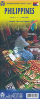
Philippines ITMB
Philippines at 1: 1, 100, 000 from ITMB on a double-sided, indexed road map including street plans of central Davao city and Cebu city and Manila city centre.Road networks include motorways, secondary and minor roads and tracks, with intermediate distances in kilometres. Symbols clearly indicate international and domestic airports, railways and ferry routes. Topography is represented by altitude colouring and spot heights; graphics indicate rivers, lakes, coral reefs etc. Symbols mark locations of various places of interest including museums, churches, caves, national parks, beaches, dive sites, ports, etc. International, regional and provincial boundaries are clearly marked.The map is indexed and annotated with historical and tourist information of places of interest,
illustrated with colour pictures and includes a small inset showing major national air routes.It includes street plans of central Davao city and Cebu city and Manila city centre at approximately 1:12, 000. Latitude and longitude lines are drawn at intervals of 2°.
illustrated with colour pictures and includes a small inset showing major national air routes.It includes street plans of central Davao city and Cebu city and Manila city centre at approximately 1:12, 000. Latitude and longitude lines are drawn at intervals of 2°.

Product Description
Reviews/Comments
Add New
Vouchers
No voucher codes found.
Do you know a voucher code for this product or supplier? Add it to Insights for others to use.
Do you know a voucher code for this product or supplier? Add it to Insights for others to use.
 Denmark