
 United Kingdom
 France
 Germany
 Netherlands
 Sweden
 USA
USA
 Italy
Italy
 Spain
Spain
More From Contributor


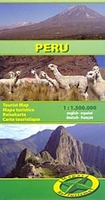
Peru
Double sided, indexed road map on durable, waterproof paper, dividing the country into north and south sections. The map combines clear road and tourist detail with relief indicated by contours, altitude and bathymetric tinting, and peak heights. Salt pans, swamps and glaciers are indicated. Road detail distinguishes unsurfaced roads and selected tracks and also shows intermediate driving distances on main roads. Main railways, ferries, airports, airfields and harbours are indicated and a range of symbols depicts many features eg. various antiquities and places of interest, lighthouses, notable churches, viewpoints, thermal baths. National parks, reserves and regional boundaries and names are also marked. The index includes archaeological sites, parks and reserves as well as
locations. Longitude and latitude lines are drawn at 1
locations. Longitude and latitude lines are drawn at 1
Product Description
Reviews/Comments
Add New
Intelligent Comparison
Archived Product
Peru Stanfords
£9.95
Archived Product
Peru Stanfords
£12.79
Archived Product
Peru Stanfords
£15.99
Archived Product
Peru Stanfords
£9.95
Archived Product
Peru Stanfords
£9.50
Archived Product

Peru Stanfords
£17.50
Archived Product
Peru Stanfords
£10.99
Archived Product

Perugia Stanfords
£9.99
Vouchers
No voucher codes found.
Do you know a voucher code for this product or supplier? Add it to Insights for others to use.
Do you know a voucher code for this product or supplier? Add it to Insights for others to use.
 Denmark