
 United Kingdom
 France
 Germany
 Netherlands
 Sweden
 USA
USA
 Italy
Italy
 Spain
Spain
More From Contributor


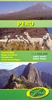
Peru
Peru at 1:1, 500, 000 on an indexed double-sided map from Mapas NaTurismo with very clear presentation of the country’s topography through relief based on satellite imagery, subtle altitude colouring and plenty of stop heights. The map divides the country north/south across the Cordillera Blanca, with Huaraz shown on both sides. Coverage on the northern side extends well beyond Ambato in Ecuador to include at the map edge both Cotopaxi and Sincholagua. The southern half includes La Paz and Cordillera Real in Bolivia.Excellent use of relief shading and altitude colouring gives an almost 3-D presentation of the terrain. National parks and other protected areas are clearly marked. Additional graphics indicate swamps and salt pans.Road network includes seasonal tracks and indicates driving
distances on main routes. Railway lines are included and domestic airports are marked. Symbols highlight various places of interest including UNESCO World Heritage sites, hiking areas, locations for observing local fauna, etc. Latitude and longitude lines are drawn at 1° intervals. The map is indexed and its legend includes English.
distances on main routes. Railway lines are included and domestic airports are marked. Symbols highlight various places of interest including UNESCO World Heritage sites, hiking areas, locations for observing local fauna, etc. Latitude and longitude lines are drawn at 1° intervals. The map is indexed and its legend includes English.

Product Description
Reviews/Comments
Add New
Vouchers
No voucher codes found.
Do you know a voucher code for this product or supplier? Add it to Insights for others to use.
Do you know a voucher code for this product or supplier? Add it to Insights for others to use.
 Denmark