
 United Kingdom
 France
 Germany
 Netherlands
 Sweden
 USA
USA
 Italy
Italy
 Spain
Spain
More From Contributor


Peak District AA We Know Britain Guide
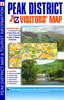
The Peak District is a remarkable area of contrasting yet compatible characters: the rolling limestone of White Peak country and the brooding, atmospheric moorland of Dark Peak terrain. The AA Guide to The Peak District gives you all you need to know to get the most out of your visit to this wonderful region. From the origins of mass rambling on Kinder Scout to the ducal home of the Devonshires at Chatsworth, each entry is packed with the very best sites to see, things to do, recommendations for eating and drinking, and places to explore nearby. With everything from local legends to must-see festivals and events, this authoritative and practical guide ensures you will never be lost for something to do.
Product Description
Reviews/Comments
Add New
Vouchers
No voucher codes found.
Do you know a voucher code for this product or supplier? Add it to Insights for others to use.
Do you know a voucher code for this product or supplier? Add it to Insights for others to use.
 Denmark