
 United Kingdom
 France
 Germany
 Netherlands
 Sweden
 USA
USA
 Italy
Italy
 Spain
Spain
More From Contributor


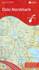


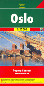
Oslo F&B
Indexed street plan of Stockholm and the adjoining districts. Coverage extends from Nittedal in the north-east to Sandvika in the west and Oppegård in the south.The plan shows ferries, bus/tram routes, railways and underground lines (T-banelinje) and stations. Other details include road tolls, one-way streets, pedestrian zones, tourist information offices, notable buildings, car parks, campsites, ski-slopes and ski-lifts etc. An enlargement covers the city centre in greater detail at 1:10, 000. Also includes a road map of the city`s surroundings at 1:800, 000.Map legend includes English. Index on reverse.

Product Description
Reviews/Comments
Add New
Vouchers
No voucher codes found.
Do you know a voucher code for this product or supplier? Add it to Insights for others to use.
Do you know a voucher code for this product or supplier? Add it to Insights for others to use.
 Denmark