
 United Kingdom
 France
 Germany
 Netherlands
 Sweden
 USA
USA
 Italy
Italy
 Spain
Spain
More From Contributor


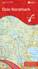
Oslo Borch
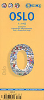
Laminated and waterproof map for visitors to Oslo, combining a street plan of the city with maps of the Holmenkollen - Tryvannshøgda area, the Oslo region, and a large part of southern Norway including Stavanger and Bergen.The street plan at 1:11, 000 covers the city’s central districts including the Bygdøy peninsula. A separate inset covers the recreational area of Holmenkollen - Tryvannshøgda area in northern Oslo. Both plans show the metro stations, one way streets and car parks, selected accommodation, places of interest, etc. A panel with top 30 sights lists Oslo’s main places of interest, all highlighted on the plans. Also provided is a large, easy-to-read diagram of the city’s metro network.On the reverse are two road maps: Oslo and its environs at 1:200, 000,
plus a large part of central Norway at 1:800, 000 stretching from Stavanger in the south across the Hardangervidda National Park to the Jotunheimen and Jostedalbreen National Parks. The maps highlight various places of interest and show locations of campsites and tourist lodges.Both plans and maps are indexed. Multilingual map legend includes English.
plus a large part of central Norway at 1:800, 000 stretching from Stavanger in the south across the Hardangervidda National Park to the Jotunheimen and Jostedalbreen National Parks. The maps highlight various places of interest and show locations of campsites and tourist lodges.Both plans and maps are indexed. Multilingual map legend includes English.

Product Description
Reviews/Comments
Add New
Vouchers
No voucher codes found.
Do you know a voucher code for this product or supplier? Add it to Insights for others to use.
Do you know a voucher code for this product or supplier? Add it to Insights for others to use.
 Denmark