More From Contributor

£6.99
Oregon Coast Camping, Hiking & Fishing in the Moon Spotlight guide series; covering a range of specific local cities, districts, areas & regions in North, Central & South America & targeted at those seeking to travel to a specific area within a country. Each of the guides has been extracted in full from the relevant country * Moon Handbook* & individual titles focus on a particular city, region or notable area of the destination. Many of the guides in the series are unique in their coverage, although are limited in putting the destination into its wider geographical context that a more comprehensive guide would provide. Stylistically, Moon’s editorial style is strongly American in focus, often offering insights & observations with an American audience in mind. However, each Moon Spotlight guide is comprehensive in the information it provides & gives visitors the flexibility to opt for a more compact guide if they know in advance where they will be staying or travelling. ...
Archived Product
£9.99
Oregon on a laminated & waterproof Easy-to-Fold map from Rand Mc Nally, the country’s leading publisher of road maps & street plans. For clarity of road information Rand Mc Nally state maps present the road network on a plain background, with no or little topographic detail. Driving distances are indicated on all principal highways & on many local routes. National or state parks & other protected areas, Indian Reservations & restricted entry military zones are highlighted & symbols indicate campsites, rest areas, various places of interest, etc. Each map shows local administrative boundaries with names of the counties, is indexed & gives geographical coordinates as margin ticks usually at 1° intervals. Rand Mc Nally state maps are available in two formats: double-sided Easy-to-Read maps with numerous enlargements for cities and/or most visited areas, & laminated Easy-to-Fold maps in a more handy format but with smaller print. TO SEE THE LIST OF RAND Mc NALLY STATE MAPS PLEASE CLICK ON THE SERIES LINK. ...
Archived Product
£6.99
Oregon Easy-to-Read map from Rand Mc Nally, US leading publisher of road maps & street plans, in their extensive series of state maps. Additional panels provide enlargements for: Corvallis, Eugene, Medford, Portland & Vicinity, downtown Portl&, Salem & Crater Lake National Park. For clarity of road information Rand Mc Nally state maps present the road network on a plain background, with no or little topographic detail. Driving distances are indicated on all principal highways & on many local routes. National or state parks & other protected areas, Indian Reservations & restricted entry military zones are highlighted & symbols indicate campsites, rest areas, various places of interest, etc. Each map shows local administrative boundaries with names of the counties, is indexed & gives geographical coordinates as margin ticks usually at 1° intervals. Rand Mc Nally state maps are available in two formats: double-sided Easy-to-Read maps with numerous enlargements for cities and/or most visited areas, & laminated Easy-to-Fold maps in a more handy format but with smaller print. TO SEE THE LIST OF RAND Mc NALLY STATE MAPS PLEASE CLICK ON THE SERIES LINK. ...
Archived Product
£13.99
Oregon Fishing in the Moon Outdoor Guides series; exploring a wide range of outdoor activities
- including camping, biking fishing
...
Archived Product
£10.99
Oregon Hiking in the Moon Outdoor Guides series; exploring a wide range of outdoor activities
- including camping, biking fishing
...
Archived Product
£19.95
Oregon Recreational Atlas & Gazetteer at 1:157, 000 approx. in a series of large format paperback state atlases from De Lorme, with detailed, contoured, GPS compatible topographic mapping plus extensive recreational information, with lists of sites & facilities, etc. Each title covers one state & presents it on impressively detailed mapping at scales much more detailed than used on most state road maps. Particularly popular areas are often also presented on enlargements. The maps are contoured, show variation of terrain (deserts, glaciers, wetlands, woodlands, etc) & have latitude & longitude and/or UTM grid lines for GPS use. Various types of protected areas are distinguished by the colouring of their boundaries, e.g. national or state parks, forests, etc. Also marked are Indian Reservations & restricted entry military zones. Road network is shown in much more detail than on other state mapping, with local roads, unsurfaced back roads & tracks, forest trails, etc. Where appropriate, old historical routes are marked. Railway lines & local airports or landing strips are included & the maps also indicate administrative boundaries. Symbols highlight various recreational areas & facilities such as campgrounds, unique natural features, etc. Each title contains extensive lists of outdoor adventure sites (grouped into activities such as hiking, biking, paddling, fishing, skiing, etc.), diverse family outing sites, campgrounds, & tables showing what facilities can be found in the state ...
Archived Product
£24.99
Oregon Recreational Atlas & Gazetteer at 1:157, 000 approx. in a series of large format paperback state atlases from De Lorme, with detailed, contoured, GPS compatible topographic mapping, with additional more detailed mapping of the Crater Lake area at 1:100, 000. Recreational information

Includes::
lists of recommended family outings, unique natural features, outdoor adventure sites for hiking, biking, paddling & skiing. Tables present facilities in campgrounds & recreational areas, plus fishing (extensive list of over 4 pages) & hunting areas with lists of species. Each title in this De Lorme series covers one state & presents it at a scale much more detailed than used on most state road maps. Particularly popular areas are often also presented on enlargements. The maps are contoured, show variation of terrain (deserts, glaciers, wetlands, woodlands, etc) & have latitude & longitude and/or UTM grid lines for GPS use. Various types of protected areas are distinguished by the colouring of their boundaries, e.g. national or state parks, forests, etc. Also marked are Indian Reservations & restricted entry military zones. Road network is shown in much more detail than on other state mapping, with local roads, unsurfaced back roads & tracks, forest trails, etc. Where appropriate, old historical routes are marked. Railway lines & local airports or landing strips are included & the maps also indicate administrative boundaries. Symbols highlight various recreational areas & facilities such as campgrounds, unique natural features, etc. Each title contains extensive lists of outdoor adventure sites (grouped into activities such as hiking, biking, paddling, fishing, skiing, etc.), diverse family outing sites, campgrounds, & tables showing what facilities can be found in the state’s recreational areas. Each atlas also has an index of localities. To see the list of titles in this series please click on the series link.

...
Archived Product
£8.95
The Benchmark Recreational Map of Oregon is a comprehensive road map of the state of Oregon with exceptional detail of campsites & recreational activities. This map covers the whole state at 1:800, 000. The map contains listings for over 230 campgrounds, over 55 Forests & wildlife areas, & over 100 boating & fishing areas. Benchmark Maps ...
Archived Product
£9.99
Oregon at 1:800, 000 in a series of very detailed state maps of the western states of USA from Benchmark Maps designed to highlight national/state parks or forests & other protected areas, & to provide information on recreational possibilities, campgrounds & RV parks, etc. The base map is derived from satellite imagery to show the topography, with plenty of names of individual mountain ranges, peaks, valleys, etc. Colouring is used to distinguish between various types of protected areas & land in public ownership, from BLM (Bureau of Land Management) lands to wilderness or wildlife areas. Indian Reservations & military zones are also marked. Some titles also provide additional information such as the numbering of hunting zones, etc. Road network indicates tracks requiring high clearance or 4WD vehicles. A very wide range of symbols identifies recreational possibilities & indicates locations of campgrounds & RV parks, trailheads, various places of interest, etc. The maps have no geographical coordinates.IN THIS TITLE: on the reverse is the index of towns/cities & counties, plus the following with, where appropriate, full contact

Details:
- climate information for several locations for January April, July & October- an extensive list campgrounds- lists of protected areas & recreational possibilities including state/national parks & monuments, forests & wildlife areas, ski areas & snowparks, boating & fishing locations- lists of other useful organizations

...
Archived Product
£22.95
Oregon at 1:225, 000 in a series of excellent, detailed, GPS compatible state atlases from Benchmark Maps with extensive information on diverse recreational opportunities & facilities, covering The Rockies & the western states of the United States. Each atlas consists of three main sections: Landscape: with detailed mapping at scales around 1:250, 000, according to the size of the state. Excellent use of relief shading & altitude colouring provides a vivid picture of the topography, with plenty of names of physical features such a mountain & hill ranges, peaks, valleys, etc. All heights are given in feet. Boundaries of national parks, state forests, Indian reservations & military areas are marked. The presentation of the road network

Includes::
finely graded paved roads, 4WD tracks & other unclassified roads (rough 4WD tracks, logging & private roads, etc). Symbols highlight various recreational facilities. The maps are fully GPS compatible, with a latitude & longitude grid at 10

...
Archived Product

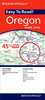
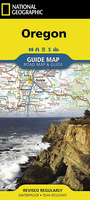
Oregon NGS Guide Map

Expertly researched and full of high functional travel information, National Geographic`s Oregon Guide Map combines a comprehensive road map and a travel guide in one easy to use resource. Roads are clearly designated as toll roads, highways, major and secondary routes, and scenic byways. The road network in annotated with mileage markers and points of interest, such as national and state parks, national forests, campgrounds, ski areas, airports, visitor information centers, hospitals and much more.Inset maps of Eugene, Salem, Portland and its downtown provide extra detail to these popular areas in the state. Crater National Park, Columbia River Gorge and Rogue Umpqua Scenic Byway are given special coverage including both maps and descriptions. A calendar of events, chart of
park service sites and an overview of points of interest along with contact information will help you plan your visit. An index of cities, towns and counties along with a chart of driving distances will aid in your finding your destination and planning your route.Every State Guide Map is printed on durable synthetic paper, making them waterproof, tear-resistant and tough — capable of withstanding the rigors of any kind of travel.
RIP - This product is no longer available on our network. It was last seen on 25.09.2019

This page now acts as a permanent archive for this product. Add more information using the comments box below to ensure it can still be found by future generations.

Use our search facility to see if it is available from an alternative contributor.
  • Availability: Out Of Stock
  • Supplier: Stanfords
  • SKU: 9781566957755
Availability: In Stock
£8.99

Product Description

Expertly researched & full of high functional travel information, National Geographic`s Oregon Guide Map combines a comprehensive road map & a travel guide in one easy to use resource. Roads are clearly designated as toll roads, highways, major & secondary routes, & scenic byways. The road network in annotated with mileage markers & points of interest, such as national & state parks, national forests, campgrounds, ski areas, airports, visitor information centers, hospitals & much more. Inset maps of Eugene, Salem, Portland & its downtown provide extra detail to these popular areas in the state. Crater National Park, Columbia River Gorge & Rogue Umpqua Scenic Byway are given special coverage including both maps & descriptions. A calendar of events, chart of park service sites & an overview of points of interest along with contact information will help you plan your visit. An index of cities, towns & counties along with a chart of driving distances will aid in your finding your destination & planning your route. Every State Guide Map is printed on durable synthetic paper, making them waterproof, tear-resistant & tough — capable of withstanding the rigors of any kind of travel.

Reviews/Comments

Add New

Intelligent Comparison

Oooops!
We couldn't find anything!
Perhaps this product's unique.... Or perhaps we are still looking for comparisons!
Click to bump this page and we'll hurry up.

Price History

Vouchers

No voucher codes found.
Do you know a voucher code for this product or supplier? Add it to Insights for others to use.

Facebook

Jargon Buster

Paper - A thin sheet mainly used for writing. Available in a variety of colours. Made mainly from wood pulp.
Calendar - A system for organising dates
Waterproof - Resistant to water, usualy specified by depth in metres
Network - A link and communication between things. Often computers or people.
Road - a manmade lane or a path that is used to speed up travel.
Resistant - Something that can repel against something.
Popular - Something that is admired and liked by many people.

Supplier Information

Stanfords
Stanfords was established in 1853 and opened their iconic Covent Garden flagship store in 1901. They have become the top retailer of maps, travel books and accessories in the UK and arguably offer the largest selection of maps and travel books worldwide. Famous names such as Captain Robert Falcon Scott, Ranulph Fiennes and Michael Palin have purchased from Stanfords. They now have a shop in Bristol and both stores together with other venues operate a calendar of events including talks, book signings and exhibitions. As a specialist map retailer, the map selection is comprehensive and includes road maps, street maps and walking maps from worldwide destinations, as well as a selection of world atlases and wall maps. Books include travel guides and travel literature. Stanfords also stock globes, from miniatures made of blue marble to magnificent floor-standing globes. The website features a selection of interesting articles on travel topics.
Page Updated: 2023-11-12 20:15:36

Community Generated Product Tags

Oh No! The productWIKI community hasn't generated any tags for this product yet!
Menu