
 United Kingdom
 France
 Germany
 Netherlands
 Sweden
 USA
USA
 Italy
Italy
 Spain
Spain
More From Contributor
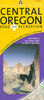
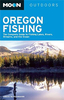

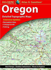
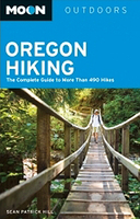
Oregon Hiking
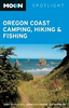
Oregon Hiking in the Moon Outdoor Guides series; exploring a wide range of outdoor activities - including camping, biking fishing and hiking - in a number of various American states and regions. Moon is one of America’s leading travel publishers and its outdoor guides often cover areas and activities that are not covered by other publishers. Its editorial style is strongly American in focus; often offering insights and observations with an American audience in mind, yet each of the guides in the series offers valuable practical advice on navigating and exploring a range of activities. Introductory sections provide a range of tips on the activity covered in the guide, including equipment, dangers and advice on how to make the most of your trip. Each guide is organised into chapters
explored geographically by region. Scenic ratings are given for each campsite, hike or other activity and information on facilities, reservations (where relevant), directions and local contact details is also provided. A Resources section at the back of each guide also offers contact details of local organisations including national parks, state and federal offices, state and regional parks and national forests.
explored geographically by region. Scenic ratings are given for each campsite, hike or other activity and information on facilities, reservations (where relevant), directions and local contact details is also provided. A Resources section at the back of each guide also offers contact details of local organisations including national parks, state and federal offices, state and regional parks and national forests.

Product Description
Reviews/Comments
Add New
Vouchers
No voucher codes found.
Do you know a voucher code for this product or supplier? Add it to Insights for others to use.
Do you know a voucher code for this product or supplier? Add it to Insights for others to use.
 Denmark