
 United Kingdom
 France
 Germany
 Netherlands
 Sweden
 USA
USA
 Italy
Italy
 Spain
Spain
More From Contributor


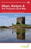
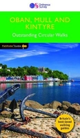
Oban, Mull & Kintyre
The rock of Dunadd, a few miles north of Lochgilphead, marks the place where the Scots established their headquarters after landing from Ireland around 500AD, and it can rightfully claim to be the birthplace of Scotland. It is also at the heart of present-day Argyll, which roughly corresponds to the area covered by this guide. There are a range of routes across different terrains, including a walk around the Isle of Iona, with its wealth of ancient monuments, superb beaches and an ascent up Ben More, the highest peak on Mull.

Product Description
Reviews/Comments
Add New
Vouchers
No voucher codes found.
Do you know a voucher code for this product or supplier? Add it to Insights for others to use.
Do you know a voucher code for this product or supplier? Add it to Insights for others to use.
 Denmark