
 United Kingdom
 France
 Germany
 Netherlands
 Sweden
 USA
USA
 Italy
Italy
 Spain
Spain
More From Contributor

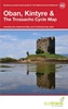

Oban, Mull & Kintyre Walks
Oban, Mull & Kintyre in the Pathfinder Guides series, produced in association with Ordnance Survey and published by Crimson; comprising a range of walking guides to popular British destinations. Each Pathfinder guide includes 28 varied walks ranging from easy strolls to exhilarating hikes and is accompanied by 1:25, 000 Ordnance Survey mapping with marked, colour-coded routes. Introductory sections profile the county or region covered, with recommendations on the best time to visit and a brief explanation of GPS. An ‘at-a-glance’ table gives an overview of the walks covered in the guide, with information on the starting point, National Grid reference, distance, time, highest point and general brief comments.Each walk described in the guide has a dedicated information box
profiling the walk, with useful information such as the starting point, distance, approximate time, parking, refreshments and the relevant Ordnance Survey map for navigation. Clear and easy to follow directions are provided and are accompanied by practical information about the route, including the location of toilets, refreshment areas and picnic sites, as well as colour photography illustrating some of the highlights of the walk. A Further Information section contains information on walking safety and responsible walking, as well as a list of useful contacts.
profiling the walk, with useful information such as the starting point, distance, approximate time, parking, refreshments and the relevant Ordnance Survey map for navigation. Clear and easy to follow directions are provided and are accompanied by practical information about the route, including the location of toilets, refreshment areas and picnic sites, as well as colour photography illustrating some of the highlights of the walk. A Further Information section contains information on walking safety and responsible walking, as well as a list of useful contacts.
Product Description
Reviews/Comments
Add New
Intelligent Comparison
Archived Product

Oban, Mull & Kintyre Stanfords
£12.99
Vouchers
No voucher codes found.
Do you know a voucher code for this product or supplier? Add it to Insights for others to use.
Do you know a voucher code for this product or supplier? Add it to Insights for others to use.
 Denmark