
 United Kingdom
 France
 Germany
 Netherlands
 Sweden
 USA
USA
 Italy
Italy
 Spain
Spain
More From Contributor


Nice - Walk And Eat
This pocket-sized full-colour guide is designed for short-break holidays around Nice with a gastronomic touch. Even if you're not a walker, it's worth having just for the restaurant suggestions, the excursions and the information about local food. The book describes two excursions for all-comers (including the superb narrow-gauge Train de Pignes into the hinterland), plus 12 easy to moderate walks in or easily accessible from Nice, all illustrated with 1:35, 000 topographical maps. Each excursion or walk recommends at least one restaurant en route serving local cuisine, with photograph, price guide, opening times, sample menus, and recipes for some of their specialities. Other sections include: planning your trip, getting about, food shopping (including health foods and local
markets), glossary of food terms and restaurant mini-vocabulary. A special feature is the emphasis on natural local foods suitable for those with food intolerances. All recipes have been made by the authors and are known to 'work'. On-line updates keep readers abreast of route/restaurant changes.
markets), glossary of food terms and restaurant mini-vocabulary. A special feature is the emphasis on natural local foods suitable for those with food intolerances. All recipes have been made by the authors and are known to 'work'. On-line updates keep readers abreast of route/restaurant changes.
Product Description
Reviews/Comments
Add New
Intelligent Comparison
Archived Product
Nice - Walk And Eat Stanfords
£8.99
Archived Product

Corsica - Walk And Eat Stanfords
£7.99
Archived Product
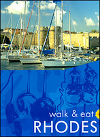
Rhodes - Walk And Eat Stanfords
£8.99
Archived Product
Avignon - Walk And Eat Stanfords
£8.99
Archived Product

Madeira - Walk And Eat Stanfords
£8.99
Archived Product
Mallorca - Walk And Eat Stanfords
£8.99
Archived Product

Amsterdam - Walk And Eat Stanfords
£8.99
Archived Product
Stockholm - Walk And Eat Stanfords
£8.99
Vouchers
No voucher codes found.
Do you know a voucher code for this product or supplier? Add it to Insights for others to use.
Do you know a voucher code for this product or supplier? Add it to Insights for others to use.
 Denmark