More From Contributor

£8.75
Aviemore & its environs, including Rothiemurchus, Glenmore, Boat of Garten & Inshriach Forest on a light, waterproof & tear-resistant, contoured & GPS compatible map at 1:35, 000 from Footprint Walks, designed to highlight best local routes for walkers, trail runners & mountain bikers. On one side is a map of the whole area around Aviemore, from Kincraig to Boat of Garten & with the Cairngorm Mountain Railway & Ski Centre in the south-eastern corner. Topography is very effectively presented by contours at 10m intervals enhanced by relief shading plus colouring for woodlands. The map shows local tracks & paths, with the specially waymarked routes highlighted. Also indicated is the course of the No.7 route of the National Cycle Network. Symbols indicate various facilities including car parks, pubs & cafes, public toilets, etc. The map has 1km lines of the British National Grid. On the reverse are seven panels presenting extracts from the main map (at the same scale) accompanied by route descriptions: three walking & running routes (Loch an Eilein, Loch Morlich & the Ryvoan Pass, Craigellachie) & five mountain biking & running routes (Old Logging Way, Loch an Eilein, Speyside Way, Loch Einich, An Slugan). ...
Archived Product
£6.99
Britain`s largest National Park, where mountains rise in a vast wilderness of high plateaux, deep corries & empty glens, is not just a place for the intrepid
- the vast tracts of surviving Caledonian forest, sparkling lochs, heather moors & tumbling rivers also make it fantastic walking country for those who want to enjoy it at a more gentle pace. ” Aviemore & the Cairngorms” features 40 shorter walks, including many perfect for families, stretching from the ancient region of Badenoch & the uppermost reaches of the Spey Valley, through the outdoor hub of Aviemore to Grantown & Tomintoul, then over Ballater & Royal Deeside to Braemar.
...
Archived Product
£6.99
Street plan of Avignon at 1:8, 000 with an enlargement showing the town centre greater detail, plus a small road map of the city’s environs including Orange, Carpentras & Les Alpilles with St-Remy- & les Baux-de-Provence, in extensive series of street plans of French towns from Blay-Foldex, the country’s largest, oldest & most experienced publisher of urban mapping. Blay plans include outer suburbs &, where appropriate, adjoining localities forming part of the urban agglomeration & provide brief descriptions of the town’s main sights, contact details for hotels & other places of interest, etc. The plans show one way streets, car parks & pedestrian zones. Important public buildings are clearly marked & identified. Blay street maps are usually double-sided & include an enlargement for the town centre & a street index with separate lists of “edifices publics”: main public buildings, places of worship, schools, sport facilities, stations, etc. Each of the outer suburbs or the adjoining localities, identified with its postcode, has a separate index. Many titles also provide a road map of the environs. All the text is in French only.PLEASE NOTE: to see the list of Blay-Foldex street plans of French towns & cities please click on the series link – the series description also

Includes::
a comparison between Blay & IGN street plans.

...
Archived Product
£12.99
Topographic survey of France at 1:25, 000 in IGN`s excellent TOP25 / Série Bleue series. All the maps are GPS compatible, with a 1km UTM grid plus latitude & longitude lines at 5’ intervals. Contours are at 5m intervals except for mountainous areas where the maps have contours at 10m intervals, vividly enhanced by hill shading & graphics for rocky terrain. Colouring with graphics indicates different types of vegetation or land use (deciduous or coniferous forests, moors, orchards, vineyards, etc). PLEASE NOTE: coverage of France at this scale is currently being revised – the format & the presentation of each title are indicated by the letters at the end of its Sheet Reference number (e.g. 0416ET, 3531ETR, 1923SB, etc.)MAPS WITH FULL TOURIST OVERPRINT & AN ENGLISH MAP LEGEND: all TOP25 maps & the SB editions of Série Bleue have an overprint highlighting waymarked walking trails including long-distance GR routes &, where appropriate, ski routes. Symbols indicate campsites, gîtes d’etape, refuges, equestrian centres & other recreational facilities or sites, tourist information centres, cultural heritage, etc. Towns & locations of particular interest are highlighted.- ET or OT = single-sided TOP25 map covering approx. 29x 21 km / 18x 13 miles.- ETR or OTR = waterproof & tear resistant TOP25 map covering the same area as the corresponding ET or OT number, but double-sided, printed on a smaller size sheet with a good overlap between the sides.- SB = Série Bleue map with full tourist overprint; these maps, first introduced in summer 2014, each cover approx. 29x 24km / 18x 15 miles.SÉRIE BLEUE maps with numbers ending in E (Est) or O (Ouest): most editions now indicate the GR routes, but do not show any other tourist information. Map legend is in French only. Each map covers approx. 14x 20km / 9x 12 miles. ...
Archived Product
£8.99
Map No. 163, Avignon
- Nîmes, at 1:100, 000, part of the TOP100 series from the Institut Géographique National (IGN). These
...
Archived Product
£7.50
Avignon & its Environs in a series of detailed road maps at 1:80, 000 from the IGN, designed to highlight places of interest & recreational possibilities, with a city centre street plan & an enlargement of a selected hiking area. Coverage extends north to Vaison-la-Romaine, east to Apt, & south to the Alpilles with St-Rémy-de-Provence & Les Baux-de-Provence. Cartography is an enlargement from 1:100, 000 to 1:80, 000 of the publisher’s highly popular TOP100 series, with very detailed presentation of the road network, including classification of local roads according to lanes, rest areas, access restrictions, etc. Railway lines are shown with stations. Topography is shown by relief shading, with spot heights & colouring for woodlands, vineyards, orchards, etc. Cycle tracks & long-distance GR routes are marked. A wide range of symbols indicate various places of interest & recreational facilities, historical & cultural sites, golf courses, rock climbing, nature reserves, etc. Refuges & gîtes d’etape are marked, but no campsites. The maps have no geographical coordinates for GPS. Each title has an index of communes. Map legend

Includes::
English.A special feature of this series is the inclusion of a large city centre street plan & an enlargement of a particularly interesting recreational area. Presentation of these features varies, so please check the individual descriptions for more information.* IN THIS TITLE: a large street plan of Avignon’s city centre highlighting main traffic arteries & indicating one way streets. An additional panel presents an extract from IGN’s topographic coverage of the south-western slopes of Mont Ventoux shown here at 1:30, 000 & highlighting local hiking trails. The map also indicates how its whole area is covered by IGN’s topographic survey at 1:25, 000. Other locations covered by the main map include Orange, Carpentras, Beaumes-de-Venise, Malaucène, Pernes-les-Fontaines, L’ Isle-sur-la Sorgue, Fontaine-de-Vaucluse, Gordes, Tarascon, Cavaillon & the western part of the Luberon Regional Park.

...
Archived Product
£7.50
Street plan of Avignon at 1:10, 000 from the Institut Géographique National, the country’s national survey organization, with an enlargement showing the town centre in greater detail. IGN street plans include outer suburbs &, where appropriate, adjoining localities forming part of the urban agglomeration. The plans prominently highlight principal traffic arteries & show one way streets, car parks & pedestrian zones. Latest editions also indicate 24h petrol stations & streets with separate cycle paths. Many streets are annotated with selected house for easier identification of addresses. Important public buildings are named & symbols mark locations of tourist information centres & other facilities. Street index, arranged by an administrative area, is next to the map. Map legend

Includes::
English.PLEASE NOTE: to see the list of IGN street plans of French towns & cities please click on the series link – the series description also

Includes::
a comparison between IGN & Blay-Foldex street plans.


...
Archived Product
£9.99
At the beginning of the fourteenth century, anarchy in Italy led to the capital of the Christian world being moved from Romefor the first & only time in history. It was a critical moment, & it resulted in seven successive popes remaining in exile for the next seventy years. The city chosen to replace Rome was Avignon. & depending on where you stood at the time they were seventy years of heaven, or of hellopinions invariably ran to extremes, as did the behaviour of the popes themselves. ...
Archived Product
£19.95
This is a dual language (English & French) rock climbing guide to the Mont Ventoux area in the Avignon region of Southern France. The South of France with its excellent record of fine weather & superb quality limestone cliffs, has always been one of the most popular climbing destinations in Europe. This is a highly modern & up-to-date topo guidebook, with over 1000 routes from beginners 3a`s up to an 8c`s, & will suit anyone going on holiday, & at any time of the year. With over 200 colour photos & 100 colour topos that evocatively illustrate both the climbing & the region, this book will be the ideal holiday companion for anyone that seeks sunshine & climbing. ...
Archived Product
£6.95
Topographic coverage of mainland Spain at 1:50, 000 in the MTN50 (Mapa Topográfico Nacional) series from the Centro Nacional de Información Geografica, the country’s civilian survey organization. The maps have contours at 20m intervals, enhanced by relief shading, plus colouring and/or graphics to show different types of terrain, vegetation or land use. Boundaries of national parks & other protected areas are marked. In addition to all the usual information featured on topographic mapping at this scale, detailed presentation of the road & rail networks, rural tracks & paths, etc, the maps also show campsites & mountain refuges. On more recent editions some GRs, the official long-distance hiking routes, are also marked (although not as clearly as on hiking maps from other publishers). Each map covers 29.5x 18.5 km (with adjustments in the border or coastal areas). The maps have a 1-km UTM grid, plus margin ticks for latitude & longitude at 1` intervals. Map legend is in Spanish only.HOW TO CHOOSE THE RIGHT 50K MAP: all the titles in CNIG’s 200K Provincial Road Maps series at 1:200, 000 are overprinted with the grid for the 1:50, 000 maps & can be used to see the area covered by each 50K title. TO SEE THE LIST OF TITLES IN THIS SERIES PLEASE CLICK ON THE SERIES LINK.PLEASE NOTE
- MAP TITLES: the grids shown on our website serve both the civilian & the military 1:50, 000 topographic series. Although the areas covered by maps in both series are identical (apart from some border or coastal sheets), occasionally map titles differ – only one title is shown on the grid, usually the military one. In Galicia, the Basque country & in the Catalan speaking areas the tendency now is to use local place names rather than the often better known Castilian ones. Where possible, both versions are included in our titles. Map titles listed on our website are based on information received by us at the time of publication, but sometimes maps arrive showing a completely different title! As long as the map number is as ordered, the correct map has been supplied.
...
Archived Product

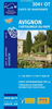
Avignon - Walk And Eat

Avignon is the Sunflower Walk and Eat guide to finding the best places to combine a short walk with sampling the city’s culinary delights. Pocket-sized, the guide covers walks in Avignon, Nimes, Arles, St-Remy and the surrounding countryside, accompanied with a selection of restaurants easily accessible using local public transport. The walks also take in some of the area’s most famous sights such as Pont du Gard, Les Baux and Barbentane. There are also city plans of each of the major cities that are covered. A detailed introduction provides useful guidance on when to go, where to stay, what to take, planning your walk, local transport details and an area map. There are also suggestions for excursions by bus or coach. Each of the 10 walks is accompanied by information on
total distance, difficulty grading, local transport options and refreshments en route, as well as any relevant opening times or entry fees at local attractions. Uniquely, each walk is accompanied by a recommended restaurant and a recipe that it specialises in. Fold-out flaps at the front and back of the book provide a basic street plan of Avignon and a glossary of useful French food and restaurant vocabulary.
RIP - This product is no longer available on our network. It was last seen on 25.09.2019

This page now acts as a permanent archive for this product. Add more information using the comments box below to ensure it can still be found by future generations.

Use our search facility to see if it is available from an alternative contributor.
  • External links may include paid for promotion
  • Availability: Out Of Stock
  • Supplier: Stanfords
  • SKU: 9781856914536
Availability: In Stock
£8.99

Product Description

Avignon is the Sunflower Walk & Eat guide to finding the best places to combine a short walk with sampling the city’s culinary delights. Pocket-sized, the guide covers walks in Avignon, Nimes, Arles, St-Remy & the surrounding countryside, accompanied with a selection of restaurants easily accessible using local public transport. The walks also take in some of the area’s most famous sights such as Pont du Gard, Les Baux & Barbentane. There are also city plans of each of the major cities that are covered. A detailed introduction provides useful guidance on when to go, where to stay, what to take, planning your walk, local transport details & an area map. There are also suggestions for excursions by bus or coach. Each of the 10 walks is accompanied by information on total distance, difficulty grading, local transport options & refreshments en route, as well as any relevant opening times or entry fees at local attractions. Uniquely, each walk is accompanied by a recommended restaurant & a recipe that it specialises in. Fold-out flaps at the front & back of the book provide a basic street plan of Avignon & a glossary of useful French food & restaurant vocabulary.

Reviews/Comments

Add New

Intelligent Comparison

Oooops!
We couldn't find anything!
Perhaps this product's unique.... Or perhaps we are still looking for comparisons!
Click to bump this page and we'll hurry up.

Price History

Vouchers

No voucher codes found.
Do you know a voucher code for this product or supplier? Add it to Insights for others to use.

Facebook

Jargon Buster

Pocket - A bag shaped insert in clothing used to carry items
Transport - Something that carries people or goods.
Vocabulary - The collaboration of words used in a language.

Supplier Information

Stanfords
Stanfords was established in 1853 and opened their iconic Covent Garden flagship store in 1901. They have become the top retailer of maps, travel books and accessories in the UK and arguably offer the largest selection of maps and travel books worldwide. Famous names such as Captain Robert Falcon Scott, Ranulph Fiennes and Michael Palin have purchased from Stanfords. They now have a shop in Bristol and both stores together with other venues operate a calendar of events including talks, book signings and exhibitions. As a specialist map retailer, the map selection is comprehensive and includes road maps, street maps and walking maps from worldwide destinations, as well as a selection of world atlases and wall maps. Books include travel guides and travel literature. Stanfords also stock globes, from miniatures made of blue marble to magnificent floor-standing globes. The website features a selection of interesting articles on travel topics.
Page Updated: 2023-11-12 20:15:36

Community Generated Product Tags

Oh No! The productWIKI community hasn't generated any tags for this product yet!
Menu