
 United Kingdom
 France
 Germany
 Netherlands
 Sweden
 USA
USA
 Italy
Italy
 Spain
Spain
More From Contributor
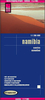


Namibia Tracks4Africa
Namibia at 1:1, 000, 000 on a large, double-sided map from Tracks4Africa: GPS compatible, with roads and tracks showing both driving times and distances, two city maps, and printed on light, waterproof and tear-resistant plastic paper.The map divides the country north/south with a generous overlap and Windhoek included on both sides. The Caprivi Strip is shown as an inset at the same scale of 1:1, 000, 000. Topography is presented by altitude colouring with graphics/colouring for salt pans, swamps and marshes, etc, plus plenty of peaks, passes, names of mountain ranges, etc. National parks and other protected areas are highlighted. The map provides for independent travellers an excellent picture of Namibia’s road network as well as of its places of interest and tourist
facilities. Road network is graded into eight categories, indicates unpaved roads and includes off-road tracks. Virtually all the routes are annotated with both distances and driving times. Riverbed tracks, selected mountain bike tracks and hiking trails are also marked. A very wide range of symbols provides information for drivers and other travellers, including border crossing points, checkpoints and toll gates, fuels supplies and repair facilities, lodgings and campsites, locations with shops/markets or banks, pharmacies and medical facilities, etc. Also indicated are various places of interest such as animal waterholes and bird watching sites, scenic views, historical sites, beaches and scuba diving spots, etc. The map is indexed and has latitude and longitude lines drawn
at 2’ intervals.Windhoek area is presented on a large inset at 1:25, 000 showing main routes across the city and location of various services. Also provided is a similarly annotated plan of Swakopmund, two travel time/distances tables – for the whole country and separately for Kaokoland, plus general advice for drivers on bridges and river crossings, etc.
Product Description
Reviews/Comments
Add New
Vouchers
No voucher codes found.
Do you know a voucher code for this product or supplier? Add it to Insights for others to use.
Do you know a voucher code for this product or supplier? Add it to Insights for others to use.
 Denmark