More From Contributor
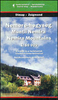
£4.99
The highly successful Globetrotter Travel Series, which

Includes::
Travel Guides, Maps & Road Atlases, presently

...
Archived Product
£24.99
Namibia at 1:1, 000, 000 on a large, double-sided map from Tracks 4 Africa: GPS compatible, with roads & tracks showing both driving times & distances, two city maps, & printed on light, waterproof & tear-resistant plastic paper. The map divides the country north/south with a generous overlap & Windhoek included on both sides. The Caprivi Strip is shown as an inset at the same scale of 1:1, 000, 000. Topography is presented by altitude colouring with graphics/colouring for salt pans, swamps & marshes, etc, plus plenty of peaks, passes, names of mountain ranges, etc. National parks & other protected areas are highlighted. The map provides for independent travellers an excellent picture of Namibia’s road network as well as of its places of interest & tourist facilities. Road network is graded into eight categories, indicates unpaved roads &

Includes::
off-road tracks. Virtually all the routes are annotated with both distances & driving times. Riverbed tracks, selected mountain bike tracks & hiking trails are also marked. A very wide range of symbols provides information for drivers & other travellers, including border crossing points, checkpoints & toll gates, fuels supplies & repair facilities, lodgings & campsites, locations with shops/markets or banks, pharmacies & medical facilities, etc. Also indicated are various places of interest such as animal waterholes & bird watching sites, scenic views, historical sites, beaches & scuba diving spots, etc. The map is indexed & has latitude & longitude lines drawn at 2’ intervals. Windhoek area is presented on a large inset at 1:25, 000 showing main routes across the city & location of various services. Also provided is a similarly annotated plan of Swakopmund, two travel time/distances tables – for the whole country & separately for Kaokol&, plus general advice for drivers on bridges & river crossings, etc.

...
Archived Product
£7.99
In 2007, businessman Russell Edwards bought a shawl believed to have been left beside the body of the fourth victim, Catherine Eddowes. He knew that, if genuine, the shawl would be the only piece of crime scene evidence still in existence. It was the start of an extraordinary seven-year quest for Russell as he sought to authenticate the shawl & learn its secrets. He had no idea that this journey would take him so far. After undergoing extensive forensic testing by one of the country`s top scientists, the shawl was not only shown to be genuine, & stained with Catherine Eddowes` blood, but in a massive breakthrough the killer`s DNA was also discovered
- DNA that would allow Russell to finally put a name to Jack the Ripper.. .
...
Archived Product
£9.99
Namira Mountains at 1:60, 000 in a series of detailed contoured maps covering popular hiking areas of Transylvania published by Dimap, one of Hungary’s leading publishers specializing in mapping of that region. The maps show local hiking routes & provide tourist information such as campsites, places of interest, etc. Many titles include street plans and/or English language descriptions of recommended hiking trails.* In this title:* hiking map with contours at 50m intervals, showing local footpaths & trails with their waymarking signs. Symbols mark various types of accommodation, springs & waterfalls, caves, places of interest, petrol stations, etc. The map has a latitude & longitude grid at intervals of 2’. Also included is a street plan of Târgu Secuiesc showing various facilities & places of interest.* Map legend & all the notes include English.* ...
Archived Product
£17.99
The 1:50 000 topographic map gives a more general picture of the ground features than a basic map. It shows settlements, houses, roads, cultivated areas, waterways, cutting areas, mires, rock exposures, & relief. One map sheet covers an area of 30 x 40 km & one centimetre corresponds to 500 metres on the ground. The 1:50, 000 topographic map is also an ideal complement to nautical charts as it provides useful information about the land areas adjacent to waterways. For example, all Finnish sea areas are covered by 1:50 000 topographic map sheets. ...
Archived Product
£11.99
Topographical survey of Belgium at 1:50, 000 from the country’s national survey organization, Nationaal Geografisch Instituut / Institut Géographique National. Contour interval varies according to the terrain, from 2.5 metres in the coastal areas to 10 metres in the Ardennes. The maps provide all the information expected of topographic mapping at this scale & in addition have an unusually large amount of vegetation and/or land use information (different types of woodlands, gardens, orchards, heath, etc). Each standard sheet covers Approx. 32 x 20 km / 20 x 12 miles, with larger maps published for the border or coastal areas. The maps have a 1-km UTM grid, with margin ticks for latitude & longitude at intervals of 1`. Map legend & a glossary of terms used on the maps include English.PLEASE NOTE: the Long-Distance Footpaths Map of Belgium at 1:300, 000 is overprinted with the grid for the 1:50, 000 topographic survey, showing the exact coverage of each sheet. Stanfords keeps as regular stock 50K maps for the World War I battlefields around the Ypres, Messines & Passchendaele, & for the area of the Battle of Waterloo. Maps for other regions can be supplied as special orders – to see the list of all the titles in this series please click on the series link. ...
Archived Product
£9.99
Namur Province at 1:100, 000 in a series of GPS compatible topographic maps from the Nationaal Geografisch Instituut/ Institut Géographique National, Belgium`s national survey organization, each with a separate index booklet covering the whole country. Described by the publishers as a topographic series, the maps do carry all the information expected of topographic mapping at this scale, but are not contoured & show altitude only by spot heights. Colours & graphics present the terrain & land cover: rocks, dunes, moors & heathl&, orchards, woodlands, swamps & marshl&, etc. Road network is finely graded according to width & the number of lanes. Footpaths are marked, but the maps do not distinguish between waymarked hiking paths or long-distance GR routes & other local paths. The maps also indicate administrative subdivisions of the provinces into districts & communes. The maps have latitude & longitude lines at intervals of 5’. Titles covering larger provinces are double-sided. The index booklet supplied with each map covers the whole country &, where appropriate, list alternative versions of place names. Map legend & explanatory text in the booklet include English. ...
Archived Product
£25.00
Nanban: Japanese Soul Food is an exploration of southern Japanese cookery focused on authentic yet easy-to-follow recipes. ...
Archived Product
£6.95
Topographic coverage of mainland Spain at 1:50, 000 in the MTN50 (Mapa Topográfico Nacional) series from the Centro Nacional de Información Geografica, the country’s civilian survey organization. The maps have contours at 20m intervals, enhanced by relief shading, plus colouring and/or graphics to show different types of terrain, vegetation or land use. Boundaries of national parks & other protected areas are marked. In addition to all the usual information featured on topographic mapping at this scale, detailed presentation of the road & rail networks, rural tracks & paths, etc, the maps also show campsites & mountain refuges. On more recent editions some GRs, the official long-distance hiking routes, are also marked (although not as clearly as on hiking maps from other publishers). Each map covers 29.5x 18.5 km (with adjustments in the border or coastal areas). The maps have a 1-km UTM grid, plus margin ticks for latitude & longitude at 1` intervals. Map legend is in Spanish only.HOW TO CHOOSE THE RIGHT 50K MAP: all the titles in CNIG’s 200K Provincial Road Maps series at 1:200, 000 are overprinted with the grid for the 1:50, 000 maps & can be used to see the area covered by each 50K title. TO SEE THE LIST OF TITLES IN THIS SERIES PLEASE CLICK ON THE SERIES LINK.PLEASE NOTE
- MAP TITLES: the grids shown on our website serve both the civilian & the military 1:50, 000 topographic series. Although the areas covered by maps in both series are identical (apart from some border or coastal sheets), occasionally map titles differ – only one title is shown on the grid, usually the military one. In Galicia, the Basque country & in the Catalan speaking areas the tendency now is to use local place names rather than the often better known Castilian ones. Where possible, both versions are included in our titles. Map titles listed on our website are based on information received by us at the time of publication, but sometimes maps arrive showing a completely different title! As long as the map number is as ordered, the correct map has been supplied.
...
Archived Product
£8.50
Street plan of Nancy, part of an extensive series covering French cities & towns from Blay-Foldex, the country’s largest, oldest & most experienced publisher of urban mapping. Blay plans include outer suburbs &, where appropriate, adjoining localities forming part of the urban agglomeration & provide brief descriptions of the town’s main sights, contact details for hotels & other places of interest, etc. The plans show one way streets, car parks & pedestrian zones. Important public buildings are clearly marked & identified. Blay street maps are usually double-sided & include an enlargement for the town centre & a street index with separate lists of “edifices publics”: main public buildings, places of worship, schools, sport facilities, stations, etc. Each of the outer suburbs or the adjoining localities, identified with its postcode, has a separate index. Many titles also provide a road map of the environs. All the text is in French only.PLEASE NOTE: to see the list of Blay-Foldex street plans of French towns & cities please click on the series link – the series description also

Includes::
a comparison between Blay & IGN street plans.

...
Archived Product

Namrun

Namrun, sheet no. 2884-08, in the topographic survey of Nepal at 1:50, 000 published by the Nepali Government in the late 1990s and early 2000s and produced from remote sensing data by Finnish cartographers as part of that country’s international aid program. The maps cover 15’ x 15’ quadrangles.IMPORTANT – PLEASE NOTE BEFORE ORDERING: AVAILABILITY: although, theoretically at least, still in print, these maps are very difficult to get locally in Nepal and/or from various suppliers elsewhere specializing in obtaining such maps. DELIVERIES MAY TAKE SEVERAL WEEKS OR EVEN MONTHS.PROBLEMS WITH PLACE NAMES: reports from previous users indicate that transliteration of place names differs from that used widely not only on other maps and in guide books but also on the ground itself,
in road signs and in the tourist and trekking industry in general. Whilst most names are similar enough to be easily recognizable, e.g. Namche Bajar for Namche Bazar or Lantan for Langtang, we have been told of confusion and difficulties arising from different spellings appearing on these maps.TREKKING ROUTES AND TOURIST INFORMATION: whilst the maps show foot trails and mark locations of temples, etc, they carry no specific trekking information. Major trekking routes and places of interest are not highlighted. There is no marking for base camps and other tourist facilities.Map specifications:Contours are at 40m intervals, with graphics and/or coloring to show various features of the terrain (glaciers with moraines and crevasses, quarries, gravel or clay pits, etc.) and vegetation
(forests, bush, grass, orchards and plantations, etc). Additional comments such as “open mixed forest mainly bajh and pine” annotate many area. The maps have numerous spot heights, but relatively few peaks are named. Areas outside the country’s borders are left blank.Settlements in remote areas are indicated by markings for individual buildings and the placing of names does not always make it clear which group of buildings they refer to. Road network distinguishes between major and minor foot trails. Symbols mark features such as temples, schools and hospitals, police stations, etc. Also shown are the country’s administrative divisions. The maps have a 1-km UTM grid, plus latitude and longitude lines at intervals of 5’. Map legend and all the text is in English.Coverage:
the whole country is now covered, with the north at 1:50, 000, plus central and southern Nepal at 1:25, 000. The two series are complementary, do not overlap and use the same grid and numbering system (apart from the Lumbini Zone, where a different grid and numbering are used). For areas not shown on our grid and titles not listed here, please contact us by e-mail, but please do bear in mind the problems with availability and the likely very long delivery time.
RIP - This product is no longer available on our network. It was last seen on 25.09.2019

This page now acts as a permanent archive for this product. Add more information using the comments box below to ensure it can still be found by future generations.

Use our search facility to see if it is available from an alternative contributor.
  • Availability: Out Of Stock
  • Supplier: Stanfords
  • SKU: XL104598
Availability: In Stock
£9.99

Product Description

Namrun, sheet no. 2884-08, in the topographic survey of Nepal at 1:50, 000 published by the Nepali Government in the late 1990s & early 2000s & produced from remote sensing data by Finnish cartographers as part of that country’s international aid program. The maps cover 15’ x 15’ quadrangles.IMPORTANT – PLEASE NOTE BEFORE ORDERING: AVAILABILITY: although, theoretically at least, still in print, these maps are very difficult to get locally in Nepal and/or from various suppliers elsewhere specializing in obtaining such maps. DELIVERIES MAY TAKE SEVERAL WEEKS OR EVEN MONTHS.PROBLEMS WITH PLACE NAMES: reports from previous users indicate that transliteration of place names differs from that used widely not only on other maps & in guide books but also on the ground itself, in road signs & in the tourist & trekking industry in general. Whilst most names are similar enough to be easily recognizable, e.g. Namche Bajar for Namche Bazar or Lantan for Langtang, we have been told of confusion & difficulties arising from different spellings appearing on these maps.TREKKING ROUTES & TOURIST INFORMATION: whilst the maps show foot trails & mark locations of temples, etc, they carry no specific trekking information. Major trekking routes & places of interest are not highlighted. There is no marking for base camps & other tourist facilities. Map specifications: Contours are at 40m intervals, with graphics and/or coloring to show various features of the terrain (glaciers with moraines & crevasses, quarries, gravel or clay pits, etc.) & vegetation (forests, bush, grass, orchards & plantations, etc). Additional comments such as “open mixed forest mainly bajh & pine” annotate many area. The maps have numerous spot heights, but relatively few peaks are named. Areas outside the country’s borders are left blank. Settlements in remote areas are indicated by markings for individual buildings & the placing of names does not always make it clear which group of buildings they refer to. Road network distinguishes between major & minor foot trails. Symbols mark features such as temples, schools & hospitals, police stations, etc. Also shown are the country’s administrative divisions. The maps have a 1-km UTM grid, plus latitude & longitude lines at intervals of 5’. Map legend & all the text is in English. Coverage: the whole country is now covered, with the north at 1:50, 000, plus central & southern Nepal at 1:25, 000. The two series are complementary, do not overlap & use the same grid & numbering system (apart from the Lumbini Zone, where a different grid & numbering are used). For areas not shown on our grid & titles not listed here, please contact us by e-mail, but please do bear in mind the problems with availability & the likely very long delivery time.

Reviews/Comments

Add New

Intelligent Comparison

Oooops!
We couldn't find anything!
Perhaps this product's unique.... Or perhaps we are still looking for comparisons!
Click to bump this page and we'll hurry up.

Price History

Vouchers

No voucher codes found.
Do you know a voucher code for this product or supplier? Add it to Insights for others to use.

Facebook

Jargon Buster

Grass - A narrow leaved green plant
Forest - A area with a high density of trees
Foot - A part of the body at the bottom end of the leg
Foot - or Feet - a measurement equivilent to 30cm
police - Persons empowered to reduce civil disorder and enforce the law.
delivery - The method by which something is delivered from one location to another
Graphics - A general term for visual aspects of an item/display
Mail - Or post is a service for transmitting physical objects or letters between locations
Gravel - A size of rock between 2mm and 64mm
Network - A link and communication between things. Often computers or people.
Km - Kilometre. A unit of measurement equal to 1000 metres.
Road - a manmade lane or a path that is used to speed up travel.
Borders - A line that sometimes can be built up separating off an area, e.g. countries "the welsh boarder"
Individual - A single separate item or person.
Print - A mechanical process of putting text onto paper. It can also relate to a pattern on an item.

Supplier Information

Stanfords
Stanfords was established in 1853 and opened their iconic Covent Garden flagship store in 1901. They have become the top retailer of maps, travel books and accessories in the UK and arguably offer the largest selection of maps and travel books worldwide. Famous names such as Captain Robert Falcon Scott, Ranulph Fiennes and Michael Palin have purchased from Stanfords. They now have a shop in Bristol and both stores together with other venues operate a calendar of events including talks, book signings and exhibitions. As a specialist map retailer, the map selection is comprehensive and includes road maps, street maps and walking maps from worldwide destinations, as well as a selection of world atlases and wall maps. Books include travel guides and travel literature. Stanfords also stock globes, from miniatures made of blue marble to magnificent floor-standing globes. The website features a selection of interesting articles on travel topics.
Page Updated: 2023-11-12 20:15:36

Community Generated Product Tags

Oh No! The productWIKI community hasn't generated any tags for this product yet!
Menu