
 United Kingdom
 France
 Germany
 Netherlands
 Sweden
 USA
USA
 Italy
Italy
 Spain
Spain
More From Contributor


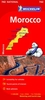

Morocco ITMB
Morocco at 1:1, 200, 000 on a waterproof and tear-resistant map from ITMB, with large, clear street plans of central Tangier, Rabat – Salé, Marrakesh and Casablanca. The map is double-sided and presents the whole of Morocco itself on one side, with the Western Sahara on the reverse at the same scale.Topography is shown by altitude colouring and spot heights, both in feet, with names of various mountain ranges, valleys, etc. Road network includes selected local tracks, indicates distance on main routes and shows locations of petrol supplies. Railway lines are included and domestic airports are marked. A range of symbols indicate various places of interest, including campsites, forts, mosques, parks and reserves, beaches, etc. Latitude and longitude lines are drawn at 1°
intervals. Each side has a separate index.The four street plans highlight selected hotels, various facilities and places of interest. Additional notes provide a geographical and historical overview of the country.
intervals. Each side has a separate index.The four street plans highlight selected hotels, various facilities and places of interest. Additional notes provide a geographical and historical overview of the country.
Product Description
Reviews/Comments
Add New
Vouchers
No voucher codes found.
Do you know a voucher code for this product or supplier? Add it to Insights for others to use.
Do you know a voucher code for this product or supplier? Add it to Insights for others to use.
 Denmark