
 United Kingdom
 France
 Germany
 Netherlands
 Sweden
 USA
USA
 Italy
Italy
 Spain
Spain
More From Contributor


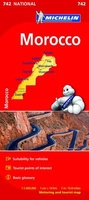
Morocco Michelin
Morocco at 1:1, 000, 000 on a road map from Michelin, with enlargements showing in greater detail four of the country’s most visited areas, including the High Atlas around Marrakesh and Jbel Toubkal, plus an additional map of the whole country with Western Sahara. Current edition of this title was published in January 2015.Morocco itself is covered at 1:1, 000, 000 with detailed classification of the road network characteristic of Michelin’s road maps: width, surface, usability in bad weather, difficult or dangerous sections, gradients, seasonal closures due to snow, entry restrictions, load and height limits, etc. The map also indicates locations with fuel supplies and vehicle repair facilities. Scenic routes and viewpoints are prominently highlighted. Railway lines are
included and ferry connections with Spain and Gibraltar are marked.Towns or villages and other sights worth visiting are highlighted. The map also indicates which locations have tourist accommodation. Symbols mark locations of other places of interest including historical, cultural and religious sites, industrial location such as mineral mines or the oil/gas pipelines, etc. Topography is very effectively presented by relief shading with plenty of names of mountain ranges, peaks, etc. Surprisingly, the map has no geographical coordinates and is not indexed. Map legend includes English.Enlargements at 1:600, 000 show in greater detail the High Atlas between Marrakesh and Ouarzazate, the Middle Atlas range, the coastal area between Rabat and Casablanca, plus The Rif mountains with
Fès and Meknès. Another large inset covers Morocco with Western Sahara at 1:4, 000, 000 with less detailed presentation of the road network. Also provided is a glossary of Berber terns used on the map, plus climate information for selected locations.

Product Description
Reviews/Comments
Add New
Vouchers
No voucher codes found.
Do you know a voucher code for this product or supplier? Add it to Insights for others to use.
Do you know a voucher code for this product or supplier? Add it to Insights for others to use.
 Denmark