
 United Kingdom
 France
 Germany
 Netherlands
 Sweden
 USA
USA
 Italy
Italy
 Spain
Spain
More From Contributor


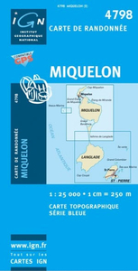
Miquelon IGN Map
Topographic survey of the French islands off the Canadian coast, published by the Institut GTographique National in Paris. The maps have contours at 5-metre intervals with additional relief shading. In addition to the usual information shown on topographic survey, the maps indicate different types of vegetation and include an overprint highlighting tourist information: hiking paths, places of interest, recreational and nautical facilities, etc. A grid gives latitude and longitude in steps of 5Æ. Map legend is in French only./Map No.4798S covers the island of Miquelon and the isthmus connecting it to Langlade.

Product Description
Reviews/Comments
Add New
Intelligent Comparison
Archived Product
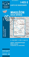
Mauléon IGN Map Stanfords
£11.50
Archived Product

Martinique IGN Map Stanfords
£11.99
Archived Product
Ouesso IGN Map Stanfords
£11.99
Archived Product
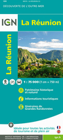
Reunion IGN Map Stanfords
£11.99
Vouchers
No voucher codes found.
Do you know a voucher code for this product or supplier? Add it to Insights for others to use.
Do you know a voucher code for this product or supplier? Add it to Insights for others to use.
 Denmark