
 United Kingdom
 France
 Germany
 Netherlands
 Sweden
 USA
USA
 Italy
Italy
 Spain
Spain
More From Contributor


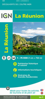
Reunion IGN Map
Reunion on a detailed, contoured and GPS compatible map at 1:75, 000 from the IGN with a vivid presentation of the island’s topography, hiking routes, places of interest and tourist facilities, plus a street plan of Saint-Denis.The island’s topography is presented by contours at 200m intervals, vividly enhanced by bold relief shading, plus plenty of names of geographical features and colouring or graphics to show forests, brushwood, marshland and areas liable to flooding. Boundaries of protected areas are marked.Road network indicates unsurfaced roads and includes cart tracks and local paths. Driving distances are marked on main and many secondary routes and scenic roads are prominently highlighted. The map also shows both local hiking paths and the island’s two GR
long-distance walking trails. A range of symbols indicate tourist accommodation (holiday villages, campsites and mountain shelters), numerous sport and recreational facilities including beaches and diving sites, local markets and handicraft, etc. The map has a UTM grid, plus latitude and longitude lines. Map legend includes English.
long-distance walking trails. A range of symbols indicate tourist accommodation (holiday villages, campsites and mountain shelters), numerous sport and recreational facilities including beaches and diving sites, local markets and handicraft, etc. The map has a UTM grid, plus latitude and longitude lines. Map legend includes English.

Product Description
Reviews/Comments
Add New
Vouchers
No voucher codes found.
Do you know a voucher code for this product or supplier? Add it to Insights for others to use.
Do you know a voucher code for this product or supplier? Add it to Insights for others to use.
 Denmark