
 United Kingdom
 France
 Germany
 Netherlands
 Sweden
 USA
USA
 Italy
Italy
 Spain
Spain
More From Contributor


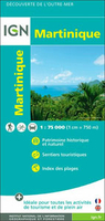
Martinique IGN Map
Martinique at 1:75, 000 on a map from the IGN, the national mapping agency of France, with highlighting for places of interest and hiking trails, presentation of topography through contours and relief shading, etc, plus aerial photographic plans of Fort-de-France and St-Pierre. Detailed classification of the road network includes country tracks and local paths. Driving distances are marked on main and secondary routes, and scenic roads are highlighted. Also marked are waymarked walking trails. A wide range of symbols indicate various places of interest including beaches and water sports sites, other recreational facilities, cultural heritage, different types of tourist accommodation including campsites, etc. Topography is presented by contours enhancde by relief shading, with
colouring and/or graphics for different types of terrain and vegetation (rain forests, mangroves, plantations, etc). Also marked are internal administrative boundaries and towns are annotated with population figures. The map has both UTM and latitude/longitude grids for GPS. The index lists the beaches marked on the map. Map legend includes English.Arial photos of Fort-de-France and St-Pierre highlight various places of interest in both towns.The map also shows coverage of Martinique by the topographic survey of the island at 1:25, 000: the three maps at that scale, all available from Stanfords, also highlight trails and places of interest.
colouring and/or graphics for different types of terrain and vegetation (rain forests, mangroves, plantations, etc). Also marked are internal administrative boundaries and towns are annotated with population figures. The map has both UTM and latitude/longitude grids for GPS. The index lists the beaches marked on the map. Map legend includes English.Arial photos of Fort-de-France and St-Pierre highlight various places of interest in both towns.The map also shows coverage of Martinique by the topographic survey of the island at 1:25, 000: the three maps at that scale, all available from Stanfords, also highlight trails and places of interest.

Product Description
Reviews/Comments
Add New
Vouchers
No voucher codes found.
Do you know a voucher code for this product or supplier? Add it to Insights for others to use.
Do you know a voucher code for this product or supplier? Add it to Insights for others to use.
 Denmark