
 United Kingdom
 France
 Germany
 Netherlands
 Sweden
 USA
USA
 Italy
Italy
 Spain
Spain
More From Contributor


Mendoza
Indexed street plan of Mendoza with a map showing road access to the city and main routes across it. The plan covers the whole of the city including its outer suburbs. The index on the reverse side groups streets by districts and includes separate lists with names of barrios.Also included is a more general road map, showing access to the city and main routes across its central areas. Map legend is in Spanish only.Please note:Availability of all Automapa
Product Description
Reviews/Comments
Add New
Intelligent Comparison
Archived Product
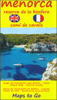
Menorca Stanfords
£8.50
Archived Product
Menorca Stanfords
£12.99
Archived Product
Menorca Stanfords
£9.95
Archived Product

Menorca Stanfords
£8.50
Archived Product
Menorca Stanfords
£8.50
Vouchers
No voucher codes found.
Do you know a voucher code for this product or supplier? Add it to Insights for others to use.
Do you know a voucher code for this product or supplier? Add it to Insights for others to use.
 Denmark