
 United Kingdom
 France
 Germany
 Netherlands
 Sweden
 USA
USA
 Italy
Italy
 Spain
Spain
More From Contributor

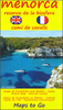
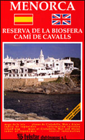
Menorca
Menorca at 1:75, 000 on an indexed road map from Telstar, highlighting numerous places of interest and the long-distance trail around the island, plus indexed street plans of Ciutadella, Maó and Alaior.The road map shows the island with altitude colouring to indicate its topography. Road network includes small local roads and cart tracks. Driving distances are marked on main routes. A wide range of icons indicate various places of interest including campsites, historical and archaeological sites, viewpoints, etc. Also marked is the course of the Camí de Cavalls, a long-distance trail around the island. The map is indexed and has no geographical coordinates. Map legend (in very small print) includes English.On the reverse are indexed street plans of Ciutadella, Maó and Alaior,
indicating car parks, petrol stations, taxi ranks, etc. Also provided are detailed descriptions of the island’s main places interest, plus a list of useful telephone numbers. All the text includes English.
indicating car parks, petrol stations, taxi ranks, etc. Also provided are detailed descriptions of the island’s main places interest, plus a list of useful telephone numbers. All the text includes English.

Product Description
Reviews/Comments
Add New
Vouchers
No voucher codes found.
Do you know a voucher code for this product or supplier? Add it to Insights for others to use.
Do you know a voucher code for this product or supplier? Add it to Insights for others to use.
 Denmark