More From Contributor
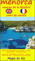
£10.99
An authoritative guide to understanding & navigating the hormonal changes & health issues women experience in midlife & beyond, from one of the leading medical experts in the field. The physical changes that occur after women turn forty are unavoidable-and can be unnerving. Menopause affects every aspect of life-from sex & sleep to mood & mental clarity to weight & body temperature. While there are a number of resources available, many are confusing & contradictory. Now, Manhattan gynecologist Dr. Tara Allmen, an experienced, nationally board-certified menopause practitioner & the recipient of the 2015 Doctor`s Choice National Award for Obstetrics & Gynecology, shares her knowledge to help women be their happiest & healthiest, & turn this challenging time into an exciting one. Written in her effervescent yet assured voice, Menopause Confidential provides simple strategies & cutting-edge information on:hormonal changes & the symptoms of perimenopause & menopause;the health risks associated with midlife-from cutting through the conflicting opinions & advice about health screenings (Do I really need a colonoscopy? How often should I get a mammogram?) to common medical conditions, such as osteoporosis;various remedies, both allopathic & natural, to combat symptoms & empower women to make the best choices for their individual needs;practical tips & resources for mitigating the effects of menopause. Fifty-one-year-old Dr. Allmen knows firsthand what women are going through, & shares stories of her own personal travails & solutions. Women can`t turn back the clock, but they can take control of their health & flourish in midlife. Menopause Confidential encourages them to be informed, be proactive, & be their greatest selves. ...
Archived Product
£8.50
Menorca on a map at 1:35, 000 from Freytag & Berndt prominently highlighting with large icons various places of interest. Topography of the island is shown by bold relief shading with a few spot heights & colouring for wooded areas. Road network shows distances on main roads. Various places of interest including campsites are prominently marked by large icons. The map has latitude & longitude lines at intervals of 5 ...
Archived Product
£12.99
Menorca is the Sunflower Landscapes guide to exploring the best walking & touring possibilities on the isl&. The guide covers a range of routes including walks in Mahon, Alaior, Ferreries & Ciutadella. A double-sided, fold-out touring map at the back of the book gives an overview of the island & the location of each walk. Detailed information about touring by hired car or public transport, as well as on foot, is provided, helping walkers to navigate & plan day-trips. Shorter strolls are also included as an alternative for each main route for those seeking more leisurely days out. The guide is structured in two main parts ...
Archived Product
£9.95
Double-sided detailed map, ideal for exploring Menorca by car or by bike, or hiking. Contours at 50-m intervals, spot-hights & subtle relief shading provide a representation of the terrain. An overprint highlights hiking trails, indicating the general of difficulty, & cycling paths. The map also highlights numerous places of interest, landmarks, recreational facilities, beaches, campsides & youth hostels, etc. Small plans at 1:9, 000 show the centres of Mah ...
Archived Product
£8.50
Menorca at 1:75, 000 on an indexed road map from Telstar, highlighting numerous places of interest & the long-distance trail around the isl&, plus indexed street plans of Ciutadella, Maó & Alaior. The road map shows the island with altitude colouring to indicate its topography. Road network

Includes::
small local roads & cart tracks. Driving distances are marked on main routes. A wide range of icons indicate various places of interest including campsites, historical & archaeological sites, viewpoints, etc. Also marked is the course of the Camí de Cavalls, a long-distance trail around the isl&. The map is indexed & has no geographical coordinates. Map legend (in very small print)

Includes::
English. On the reverse are indexed street plans of Ciutadella, Maó & Alaior, indicating car parks, petrol stations, taxi ranks, etc. Also provided are detailed descriptions of the island’s main places interest, plus a list of useful telephone numbers. All the text

Includes::
English.


...
Archived Product
£14.99
Menorca at 1:50, 000 on a contoured, GPS compatible map from Editorial Alpina with a special overprint for the GR223 – Camí de Cavalls, a long-distance hiking path along the island’s coast, plus local trails, mountain bike routes, accommodation, sights, etc, plus a booklet in Catalan only. The map has contours at 20m intervals, with additional colouring indicating vegetation. The overprint highlights the GR223 – Camí de Cavalls, PR trails & other waymarked local hiking paths, plus waymarked mountain bike routes. Symbols show country hotels, campsites, & youth hostels, selected restaurants, information centres, viewpoints, picnic sites, climbing areas, museums, etc. Also marked are locations with bus service. Road network has been updated to show current road numbering & indicates locations of petrol stations. The map has a UTM grid & 1’ margin ticks. Map legend

Includes::
English.PLEASE NOTE BEFORE ORDERING: this title comes with a separate booklet, available in two versions, as indicated in the map title, either in Spanish/ English/ German (regular stock) or in Catalan (stocked only when the other version is not available). The booklet provides descriptions of selected local hiking & mountain bike trails, plus a stage-by-stage description of the 185-km GR223 – Camí de Cavalls, including information on accommodation. If not in stock, the latest information on the availability of the Spanish/ English/ German version can be provided on request, please contact us by email.

...
Archived Product
£14.99
Menorca at 1:50, 000 on a contoured, GPS compatible map from Editorial Alpina with a special overprint for the GR223 – Camí de Cavalls, a long-distance hiking path along the island’s coast, plus local trails, mountain bike routes, accommodation, sights, etc. Current edition of this title was published in May 2015. The map has contours at 20m intervals, with additional colouring indicating vegetation. The overprint highlights the GR223 – Camí de Cavalls, PR trails & other waymarked local hiking paths, plus waymarked mountain bike routes. Symbols show country hotels, campsites, & youth hostels, selected restaurants, information centres, viewpoints, picnic sites, climbing areas, museums, etc. Also marked are locations with bus service. Road network indicates locations of petrol stations. The map has a UTM grid & 1’ margin ticks. Map legend

Includes::
English.PLEASE NOTE BEFORE ORDERING: this title comes with a separate booklet, available in two versions, as indicated in the map title, either in Spanish/ English/ German (regular stock) or in Catalan (stocked only when the other version is not available). The booklet provides descriptions of selected local hiking & mountain bike trails, plus a stage-by-stage description of the 185-km GR223 – Camí de Cavalls, including information on accommodation. If not in stock, the latest information on the availability of the Spanish/ English/ German version can be provided on request, please contact us by email.

...
Archived Product
£13.99
Double-sided detailed map, ideal for exploring Menorca by car or by bike, or hiking. Contours at 50-m intervals, spot-hights & subtle relief shading provide a representation of the terrain. An overprint highlights hiking trails, indicating the general of difficulty, & cycling paths. The map also highlights numerous places of interest, landmarks, recreational facilities, beaches, campsides & youth hostels, etc. Small plans at 1:9, 000 show the centres of Mahón & Cuidadella de Menorca, indicating main places of interest. The map shows latitude/longitude lines at 2` intervals & a UTM grid. Map legend

Includes::
English. The accompanying booklet describing the highlights of the island is in German only.* Please note: current edition of this map does not yet show recent changes in road numbering.*

...
Archived Product
£5.99
Menorca in the Essential Guide Series from the AA exploring the best places to see & things to do in a range of popular destinations. Each illustrated, pocket-sized guide is divided into five sections
- the essence of the area, planning your trip, the best places to see, best things to do & an exploration of notable highlights, organised by area. An introductory chapter profiles each destination &

Includes::
notes on local cuisine & recommendations for short breaks. A planning section advises on pre-trip preparations & getting there & around as well as outlining useful language tips & what


...
Archived Product
£7.99
Most travellers want to have fun & feel relaxed from the moment they arrive at their holiday destination
- that`s what Marco Polo
...
Archived Product

Menorca

Menorca at 1:58, 000 on an indexed touring map from Spanish publishers Telstar Distrimapas, with on the reverse large indexed street plan of Mahón (Maó) and Ciutadella, plus English language descriptions of six recommended tourist routes and general notes about the island.The islands topography is presented by bold altitude colouring. Road network emphasises main and connecting secondary routes, but many smaller local road are omitted. Also marked is the course of Camino de Cavalls hiking circuit around the island. Icons prominently indicate various tourist facilities and places of interest, including petrol stations, campsites, beaches, prehistoric remains, etc. The map has no geographical coordinates. The index is next to the map.On the reverse are indexed street plan of Mahón
(Maó) and Ciutadella, descriptions of six recommended walks on the island, plus general notes and useful addresses. Map legend and the text include English.
RIP - This product is no longer available on our network. It was last seen on 25.09.2019

This page now acts as a permanent archive for this product. Add more information using the comments box below to ensure it can still be found by future generations.

Use our search facility to see if it is available from an alternative contributor.
  • External links may include paid for promotion
  • Availability: Out Of Stock
  • Supplier: Stanfords
  • SKU: 9788415347507
Availability: In Stock
£8.50

Product Description

Menorca at 1:58, 000 on an indexed touring map from Spanish publishers Telstar Distrimapas, with on the reverse large indexed street plan of Mahón (Maó) & Ciutadella, plus English language descriptions of six recommended tourist routes & general notes about the isl&. The islands topography is presented by bold altitude colouring. Road network emphasises main & connecting secondary routes, but many smaller local road are omitted. Also marked is the course of Camino de Cavalls hiking circuit around the isl&. Icons prominently indicate various tourist facilities & places of interest, including petrol stations, campsites, beaches, prehistoric remains, etc. The map has no geographical coordinates. The index is next to the map. On the reverse are indexed street plan of Mahón (Maó) & Ciutadella, descriptions of six recommended walks on the isl&, plus general notes & useful addresses. Map legend & the text include English.

Reviews/Comments

Add New

Intelligent Comparison

Oooops!
We couldn't find anything!
Perhaps this product's unique.... Or perhaps we are still looking for comparisons!
Click to bump this page and we'll hurry up.

Price History

Vouchers

No voucher codes found.
Do you know a voucher code for this product or supplier? Add it to Insights for others to use.

Facebook

Jargon Buster

Hiking - An outdoor activity envolving walking in nature
Spanish - The main language spoken in Spain and Latin America.
Network - A link and communication between things. Often computers or people.
Language - the method of communication used in different areas. Humans and computers have many different languages.
Large - something that takes up more space than normal.
Road - a manmade lane or a path that is used to speed up travel.
Altitude - Something that can be quite high in relation to sea or ground level.
Language - The way humans communicate either written and spoken.

Supplier Information

Stanfords
Stanfords was established in 1853 and opened their iconic Covent Garden flagship store in 1901. They have become the top retailer of maps, travel books and accessories in the UK and arguably offer the largest selection of maps and travel books worldwide. Famous names such as Captain Robert Falcon Scott, Ranulph Fiennes and Michael Palin have purchased from Stanfords. They now have a shop in Bristol and both stores together with other venues operate a calendar of events including talks, book signings and exhibitions. As a specialist map retailer, the map selection is comprehensive and includes road maps, street maps and walking maps from worldwide destinations, as well as a selection of world atlases and wall maps. Books include travel guides and travel literature. Stanfords also stock globes, from miniatures made of blue marble to magnificent floor-standing globes. The website features a selection of interesting articles on travel topics.
Page Updated: 2023-11-12 20:15:36

Community Generated Product Tags

Oh No! The productWIKI community hasn't generated any tags for this product yet!
Menu