More From Contributor

£10.99
”1871. Cattle-dealer Solomon Meijer has made a reputation for himself as one of the few honest Jews in Endingen, a rare Swiss town in which Jews are allowed to reside. He leads a largely untroubled life, rewarded by his work & comforted at home by his wife & two daughters. But all of this is set to end when he answers a knock at the door in the middle of the night. On the doorstep stands his young distant cousin, Janki, half-dead & begging for refuge. The pitiful figure is invited in & given a coveted place in the bosom of the family, but when Janki recovers & regains his ambition & his fine-looks, he will change the Meijer family`s lives for generations to come... In the tradition of the great family romances of the nineteenth century, Melnitz is the saga of the Swiss-Jewish Meijer family, spanning five generations from the Franco-Prussian War to World War II. It is a novel of fate, fortune & great falls; a homage to the sunken world of yiddish culture & a celebration of the enduring spirit of biting Jewish humour.” ...
Archived Product
£15.99
This chocolate lollypop kit guaranties hours of yummy fun for the whole family: perfect for a kids party, a rainy day activity or just general fun at home with the family. Follow simple the instructions inside to make your own chocolate lollies. Adult supervision required. Suitable for children aged 5+. The box
Includes:: a chef's hat, milk chocolate buttons, animal moulds, sticks & full instructions.
...
Archived Product
£15.99
Create a grand day out in your very own kitchen with this melt & make chocolate London kit. Use the most delicious Belgian chocolate to build a Big Ben, a London taxi & a bus. Very simple to do with all you need in the box & perfect for a kids party, a rainy day activity or just general fun at home with the family. Adult supervision required. Suitable for children aged 6 +. The Make Your Own Chocolate London Kit
Includes:: a Chef's hat, milk Chocolate buttons for melting, a mould for Big Ben, London bus & taxi & full instructions.
...
Archived Product
£17.99
The 1:50 000 topographic map gives a more general picture of the ground features than a basic map. It shows settlements, houses, roads, cultivated areas, waterways, cutting areas, mires, rock exposures, & relief. One map sheet covers an area of 30 x 40 km & one centimetre corresponds to 500 metres on the ground. The 1:50, 000 topographic map is also an ideal complement to nautical charts as it provides useful information about the land areas adjacent to waterways. For example, all Finnish sea areas are covered by 1:50 000 topographic map sheets. ...
Archived Product
£16.99
Tibetans have experienced waves of genocide since the 1950s. Now they are facing ecocide. The Himalayan snowcaps are in meltdown mode, due to climate change
- accelerated by a rain of black soot from massive burning of coal & other fuels in both China & India. The mighty rivers of Tibet are being dammed by Chinese engineering consortiums to feed the mainland`s thirst for power, & the land is being relentlessly mined in search of minerals to feed China`s industrial complex. On the drawing board are plans for a massive engineering project to divert water from Eastern Tibet to water-starved Northern China. Ruthless Chinese repression leaves Tibetans powerless to stop the reckless destruction of their sacred l&, but they are not the only victims of this campaign: the nations downstream from Tibet rely heavily on rivers sourced in Tibet for water supply, & for rich silt used in agriculture. This ecocide has been happening with little scrutiny until now. Meltdown in Tibet turns the spotlight on the darkest side of China`s emergence as a global super power.
...
Archived Product
£4.50
Melton Mowbray & District in 1898 in a series of reproductions of Ordnance Survey’s famous ” Inch to the Mile” maps published in the Alan Godfrey Editions to provide a historical record of England & Wales in the second half of 19th & early 20th century. Two versions have been published for this area, with coverage stretching from the eastern outskirts of Loughborough eastward to Stonesby, & from Barkestone southward to Burton Lazars. Other locations on the map include: in LEICESTERSHIRE Ab Kettleby, Asfordby, Belvoir, Bescaby, Branston, Brooksby, Burton on the Wolds, Cotes, Eastwell, Freeby, Frisby on the Wreak, Goadby Marwood, Grimston, Harby, Hoby, Holwell, Hose, Horton, Kirby Bellars, Knipton, Long Clawson, Melton Mowbray, Nether Broughton, Old Dalby, Plungar, Quorndon, Ragdale, Rotherby, Saxby, Saxelby, Seagrave, Shoby, Stapleford, Stathern, Sysonby, Thorpe Arnold, Waltham on the Wolds, Walton on the Wolds, Wartnaby, Woodthorpe & Wymeswold; plus in NOTTINGHAMSHIRE Bradmore, Bunny, Clipston, Colston Basset, Costock, East Leake, Edwalton, Hickling, Keyworth, Kinoulton, Langar cum Barnstone, Owthorpe, Plumtree, Rempstone, Ruddington, Stanford upon Soare, Stanton on the Wolds, Tollerton, Upper Broughton, Widnerpool, Willoughby on the Wolds & Wysall. The 1898 version is in colour & has a map of Barrow upon Soar on the reverse. The 1912 version

Includes::
a map of Scalford, complete with directory. About the Alan Godfrey Editions of the OS Inch to the Mile Maps: the maps provide an invaluable overview of a wider area, typically 18 x 12 miles (29 x 19 kms approx.), & offer historical mapping for small towns & villages not covered by the more detailed series for which the Godfrey Editions are better known. On the reverse all the maps have historical notes & most titles also include a more detailed, large scale map of a small town or a village in the area. To see other titles in this series please click on the series link.

...
Archived Product
£3.50
Melton Mowbray & District in 1912 in a series of reproductions of Ordnance Survey’s famous ” Inch to the Mile” maps published in the Alan Godfrey Editions to provide a historical record of England & Wales in the second half of 19th & early 20th century. Two versions have been published for this area, with coverage stretching from the eastern outskirts of Loughborough eastward to Stonesby, & from Barkestone southward to Burton Lazars. Other locations on the map include: in LEICESTERSHIRE Ab Kettleby, Asfordby, Belvoir, Bescaby, Branston, Brooksby, Burton on the Wolds, Cotes, Eastwell, Freeby, Frisby on the Wreak, Goadby Marwood, Grimston, Harby, Hoby, Holwell, Hose, Horton, Kirby Bellars, Knipton, Long Clawson, Melton Mowbray, Nether Broughton, Old Dalby, Plungar, Quorndon, Ragdale, Rotherby, Saxby, Saxelby, Seagrave, Shoby, Stapleford, Stathern, Sysonby, Thorpe Arnold, Waltham on the Wolds, Walton on the Wolds, Wartnaby, Woodthorpe & Wymeswold; plus in NOTTINGHAMSHIRE Bradmore, Bunny, Clipston, Colston Basset, Costock, East Leake, Edwalton, Hickling, Keyworth, Kinoulton, Langar cum Barnstone, Owthorpe, Plumtree, Rempstone, Ruddington, Stanford upon Soare, Stanton on the Wolds, Tollerton, Upper Broughton, Widnerpool, Willoughby on the Wolds & Wysall. The 1898 version is in colour & has a map of Barrow upon Soar on the reverse. The 1912 version

Includes::
a map of Scalford, complete with directory. About the Alan Godfrey Editions of the OS Inch to the Mile Maps: the maps provide an invaluable overview of a wider area, typically 18 x 12 miles (29 x 19 kms approx.), & offer historical mapping for small towns & villages not covered by the more detailed series for which the Godfrey Editions are better known. On the reverse all the maps have historical notes & most titles also include a more detailed, large scale map of a small town or a village in the area. To see other titles in this series please click on the series link.

...
Archived Product
£7.99
Operation Meltwater: Free Flow, a group of internet activists committed to the freedom of information have video evidence of a military atrocity in the Middle East & have chosen Iceland as their HQ while they prepare to unleash their greatest coup on the world`s media. On the glacial rim of erupting volcano Eyjafjallajokull, they christen their endeavour Operation Meltwater. Minutes later, in the steam & mist, one of them is murdered. The list of people Freeflow has antagonized is long
- the Chinese government, Israeli military, a German Bank, Italian politicians, even American College Fraternities. Magnus Jonson has a long list of suspects but he`s getting precious little help from Free Flow
- for an organization dedicated to the transparency of information, they`re a secretive bunch. But they are not the only ones with secrets. Asta, a newly qualified priest, has contacted Free Flow with information about a scandal in the church. Her involvement with Free Flow will cost her dear. & with the return of Magnus`s brother Ollie to Icel&, the feud that has haunted their family for three generations is about to reignite.

...
Archived Product
£12.99
Topographic survey of France at 1:25, 000 in IGN`s excellent TOP25 / Série Bleue series. All the maps are GPS compatible, with a 1km UTM grid plus latitude & longitude lines at 5’ intervals. Contours are at 5m intervals except for mountainous areas where the maps have contours at 10m intervals, vividly enhanced by hill shading & graphics for rocky terrain. Colouring with graphics indicates different types of vegetation or land use (deciduous or coniferous forests, moors, orchards, vineyards, etc). PLEASE NOTE: coverage of France at this scale is currently being revised – the format & the presentation of each title are indicated by the letters at the end of its Sheet Reference number (e.g. 0416ET, 3531ETR, 1923SB, etc.)MAPS WITH FULL TOURIST OVERPRINT & AN ENGLISH MAP LEGEND: all TOP25 maps & the SB editions of Série Bleue have an overprint highlighting waymarked walking trails including long-distance GR routes &, where appropriate, ski routes. Symbols indicate campsites, gîtes d’etape, refuges, equestrian centres & other recreational facilities or sites, tourist information centres, cultural heritage, etc. Towns & locations of particular interest are highlighted.- ET or OT = single-sided TOP25 map covering approx. 29x 21 km / 18x 13 miles.- ETR or OTR = waterproof & tear resistant TOP25 map covering the same area as the corresponding ET or OT number, but double-sided, printed on a smaller size sheet with a good overlap between the sides.- SB = Série Bleue map with full tourist overprint; these maps, first introduced in summer 2014, each cover approx. 29x 24km / 18x 15 miles.SÉRIE BLEUE maps with numbers ending in E (Est) or O (Ouest): most editions now indicate the GR routes, but do not show any other tourist information. Map legend is in French only. Each map covers approx. 14x 20km / 9x 12 miles. ...
Archived Product
£6.95
Topographic coverage of mainland Spain at 1:50, 000 in the MTN50 (Mapa Topográfico Nacional) series from the Centro Nacional de Información Geografica, the country’s civilian survey organization. The maps have contours at 20m intervals, enhanced by relief shading, plus colouring and/or graphics to show different types of terrain, vegetation or land use. Boundaries of national parks & other protected areas are marked. In addition to all the usual information featured on topographic mapping at this scale, detailed presentation of the road & rail networks, rural tracks & paths, etc, the maps also show campsites & mountain refuges. On more recent editions some GRs, the official long-distance hiking routes, are also marked (although not as clearly as on hiking maps from other publishers). Each map covers 29.5x 18.5 km (with adjustments in the border or coastal areas). The maps have a 1-km UTM grid, plus margin ticks for latitude & longitude at 1` intervals. Map legend is in Spanish only.HOW TO CHOOSE THE RIGHT 50K MAP: all the titles in CNIG’s 200K Provincial Road Maps series at 1:200, 000 are overprinted with the grid for the 1:50, 000 maps & can be used to see the area covered by each 50K title. TO SEE THE LIST OF TITLES IN THIS SERIES PLEASE CLICK ON THE SERIES LINK.PLEASE NOTE
- MAP TITLES: the grids shown on our website serve both the civilian & the military 1:50, 000 topographic series. Although the areas covered by maps in both series are identical (apart from some border or coastal sheets), occasionally map titles differ – only one title is shown on the grid, usually the military one. In Galicia, the Basque country & in the Catalan speaking areas the tendency now is to use local place names rather than the often better known Castilian ones. Where possible, both versions are included in our titles. Map titles listed on our website are based on information received by us at the time of publication, but sometimes maps arrive showing a completely different title! As long as the map number is as ordered, the correct map has been supplied.
...
Archived Product

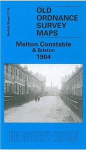
Melton Constable And Briston 1904

Melton Constable and Briston in 1904 in a fascinating series of reproductions of old Ordnance Survey plans in the Alan Godfrey Editions, ideal for anyone interested in the history of their neighbourhood or family. Coverage stretches from Melton Constable station eastward to Hall Farm, Briston. Melton Constable, a village with just 118 people in 1881, became a railway `town` when the Midland & Great Northern Joint Railway opened their works here; the population then rose to 1, 157 by 1911. The map shows that Locomotive Works (the full track layout is given) and the handful of streets that were built next to it for workers. Burgh Hall and the remains of St Mary`s church are also shown. The map continues eastward and on the right side of the map is much of Briston, including Manor Farm,
Horseshoe Common, All Saints church, Church Street, etc. The directory describes Briston as a `small town` but it appears more of a village here. Directories for both Briston and Melton Constable are included. About the Alan Godfrey Editions of the 25” OS Series:Selected towns in Great Britain and Ireland are covered by maps showing the extent of urban development in the last decades of the 19th and early 20th century. The plans have been taken from the Ordnance Survey mapping and reprinted at about 15 inches to one mile (1:4, 340). On the reverse most maps have historical notes and many also include extracts from contemporary directories. Most maps cover about one mile (1.6kms) north/south, one and a half miles (2.4kms) across; adjoining sheets can be combined to provide wider
coverage.FOR MORE INFORMATION AND A COMPLETE LIST OF ALL AVAILABLE TITLES PLEASE CLICK ON THE SERIES LINK.
RIP - This product is no longer available on our network. It was last seen on 25.09.2019

This page now acts as a permanent archive for this product. Add more information using the comments box below to ensure it can still be found by future generations.

Use our search facility to see if it is available from an alternative contributor.
  • Availability: Out Of Stock
  • Supplier: Stanfords
  • SKU: 9781841517766
Availability: In Stock
£3.50

Product Description

Melton Constable & Briston in 1904 in a fascinating series of reproductions of old Ordnance Survey plans in the Alan Godfrey Editions, ideal for anyone interested in the history of their neighbourhood or family. Coverage stretches from Melton Constable station eastward to Hall Farm, Briston. Melton Constable, a village with just 118 people in 1881, became a railway `town` when the Midland & Great Northern Joint Railway opened their works here; the population then rose to 1, 157 by 1911. The map shows that Locomotive Works (the full track layout is given) & the handful of streets that were built next to it for workers. Burgh Hall & the remains of St Mary`s church are also shown. The map continues eastward & on the right side of the map is much of Briston, including Manor Farm, Horseshoe Common, All Saints church, Church Street, etc. The directory describes Briston as a `small town` but it appears more of a village here. Directories for both Briston & Melton Constable are included. About the Alan Godfrey Editions of the 25” OS Series: Selected towns in Great Britain & Ireland are covered by maps showing the extent of urban development in the last decades of the 19th & early 20th century. The plans have been taken from the Ordnance Survey mapping & reprinted at about 15 inches to one mile (1:4, 340). On the reverse most maps have historical notes & many also include extracts from contemporary directories. Most maps cover about one mile (1.6kms) north/south, one & a half miles (2.4kms) across; adjoining sheets can be combined to provide wider coverage.FOR MORE INFORMATION & A COMPLETE LIST OF ALL AVAILABLE TITLES PLEASE CLICK ON THE SERIES LINK.

Reviews/Comments

Add New

Intelligent Comparison

Oooops!
We couldn't find anything!
Perhaps this product's unique.... Or perhaps we are still looking for comparisons!
Click to bump this page and we'll hurry up.

Price History

Vouchers

No voucher codes found.
Do you know a voucher code for this product or supplier? Add it to Insights for others to use.

Facebook

Jargon Buster

Contemporary - Modern era design
Rose - Commonly associated with a light pink colour
Rose - A fragrant garden plant
Contemporary - A design reference to indicate post war modern design
Locomotive - Or Loco is the powered vehicle at the front of a train
History - Anything that happens in the past. An acedemic subject.
Small - something that takes up less space than normal.
Contemporary - An object that is living in the same time.
Hall - A room at the inside of an entrance of a house.
Ideal - Something that satisfies a perfect criteria.
Family - A group of people that live together made up from parents and children.

Supplier Information

Stanfords
Stanfords was established in 1853 and opened their iconic Covent Garden flagship store in 1901. They have become the top retailer of maps, travel books and accessories in the UK and arguably offer the largest selection of maps and travel books worldwide. Famous names such as Captain Robert Falcon Scott, Ranulph Fiennes and Michael Palin have purchased from Stanfords. They now have a shop in Bristol and both stores together with other venues operate a calendar of events including talks, book signings and exhibitions. As a specialist map retailer, the map selection is comprehensive and includes road maps, street maps and walking maps from worldwide destinations, as well as a selection of world atlases and wall maps. Books include travel guides and travel literature. Stanfords also stock globes, from miniatures made of blue marble to magnificent floor-standing globes. The website features a selection of interesting articles on travel topics.
Page Updated: 2023-11-12 20:15:36

Community Generated Product Tags

Oh No! The productWIKI community hasn't generated any tags for this product yet!
Menu