
 United Kingdom
 France
 Germany
 Netherlands
 Sweden
 USA
USA
 Italy
Italy
 Spain
Spain
More From Contributor

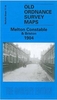

Melton Mowbray And District 1898 (Colour Edition)
Melton Mowbray and District in 1898 in a series of reproductions of Ordnance Survey’s famous ”Inch to the Mile” maps published in the Alan Godfrey Editions to provide a historical record of England and Wales in the second half of 19th and early 20th century.Two versions have been published for this area, with coverage stretching from the eastern outskirts of Loughborough eastward to Stonesby, and from Barkestone southward to Burton Lazars. Other locations on the map include: in LEICESTERSHIRE Ab Kettleby, Asfordby, Belvoir, Bescaby, Branston, Brooksby, Burton on the Wolds, Cotes, Eastwell, Freeby, Frisby on the Wreak, Goadby Marwood, Grimston, Harby, Hoby, Holwell, Hose, Horton, Kirby Bellars, Knipton, Long Clawson, Melton Mowbray, Nether Broughton, Old
Dalby, Plungar, Quorndon, Ragdale, Rotherby, Saxby, Saxelby, Seagrave, Shoby, Stapleford, Stathern, Sysonby, Thorpe Arnold, Waltham on the Wolds, Walton on the Wolds, Wartnaby, Woodthorpe and Wymeswold; plus in NOTTINGHAMSHIRE Bradmore, Bunny, Clipston, Colston Basset, Costock, East Leake, Edwalton, Hickling, Keyworth, Kinoulton, Langar cum Barnstone, Owthorpe, Plumtree, Rempstone, Ruddington, Stanford upon Soare, Stanton on the Wolds, Tollerton, Upper Broughton, Widnerpool, Willoughby on the Wolds and Wysall. The 1898 version is in colour and has a map of Barrow upon Soar on the reverse. The 1912 version includes a map of Scalford, complete with directory. About the Alan Godfrey Editions of the OS Inch to the Mile Maps: the maps provide an invaluable
overview of a wider area, typically 18 x 12 miles (29 x 19 kms approx.), and offer historical mapping for small towns and villages not covered by the more detailed series for which the Godfrey Editions are better known. On the reverse all the maps have historical notes and most titles also include a more detailed, large scale map of a small town or a village in the area.To see other titles in this series please click on the series link.
Product Description
Reviews/Comments
Add New
Vouchers
No voucher codes found.
Do you know a voucher code for this product or supplier? Add it to Insights for others to use.
Do you know a voucher code for this product or supplier? Add it to Insights for others to use.
 Denmark