More From Contributor

£4.99
Durable & waterproof, with a handy slipcase & an easy-fold format, Lonely Planet Melbourne City Map is your conveniently-sized passport to traveling with ease. Get more from your map & your trip with images & information about top city attractions, transport maps, itinerary suggestions, extensive street & site index, & practical travel tips & directory. With this easy-to-use, full colour navigation tool in your rear pocket, you can truly get to the heart of Melbourne. Covers City Centre, Docklands, Southbank, Williamstown, South Melbourne, Port Melbourne, Albert Park, South Yarra, Prahran, Windsor, East Melbourne, Richmond, Fitzroy, Collingwood, Carlton, North Melbourne, St Kilda. ...
Archived Product
£6.99
Melbourne in the Luxe guides series, which are slim & small enough to fit easily in a pocket or handbag. Information is distilled from elite suggestions by city residents, specially selected for their style, knowledge & expertise. Luxe guides aim at the upper end of the market & subjectively edit to choose the very best recommendations for shopping, restaurants, leisure options & nightlife. Half day shopping & activity itineraries are suggested for you to mix & match your visit to suit your timetable. When folded close the cardboard guide slots into its own protective plastic frame. Vanity Fair magazine calls them “delightful, de-lovely, & deluxe”, & that’s just what they are. ...
Archived Product
£14.99
Melbourne is a right bobby dazzler, but unlike her flashier sister Sydney, she ain`t one to show off her goodies
- most of her
...
Archived Product
£3.99
Melbourne Pop Out Map: pop-up city street map of Melbourne city centre
- folded pocket size travel map with transit map included
...
Archived Product
£2.99
Melbourne Pop-Out Map from Compass Maps in a series designed to provide two street plans, the city centre plus a wider area around it, in a handy format to fit neatly all but the smallest pockets, with, as appropriate, transport network diagrams, additional useful maps, etc. Each title ...
Archived Product
£10.99
The southern coastal region of Australia between Melbourne & Adelaide on a road map from Hema in their “ City to City” series linking Australia’s main centres of population; plus more detailed coverage of the Great Ocean Road & extensive additional tourist information. The main map at 1:900, 000 covers the coast between Melbourne & Adelaide, extending north to Victoria’s northern border along the Murray River. The map highlights the three main intercity connections: the princes Highway, the Western & Duke Highways, & the Calder & Strut Highways. Road network indicates freeways, sealed & unsealed roads & tracks, presenting them as appropriate with road numbers and/or names. Driving distances are marked on main & many local routes. Topography is indicated by names of hill ranges, plus graphics for swamps, dry lakes, salt flats, etc. National park & other protected areas are prominently highlighted. Symbols show campsites & caravan parks, rest areas with overnight accommodation, 24hour fuel supplies, information centres, other places of interest, etc. Latitude & longitude lines are drawn at 1º intervals. The map is accompanied by two panels showing main roads across the suburbs of Melbourne & Adelaide, plus distance tables for the three main highway connections. On the reverse the Great Ocean Road between Geelong & Victoria’s border with South Australia is presented in greater detail at 1:450, 000, with descriptions of 24 points of special interest highlighted on the map. The reverse side also carries descriptions of other places of interest in the whole region covered by the main map, a list of accredited information centres, plus a table of facilities on local national parks. To see the list of other titles in Hema’s City to City series please click on the series link. ...
Archived Product
£10.99
The south-eastern corner of Australia between Melbourne & Sydney on an indexed road map at 1:900, 000 from Hema, with enlargements showing suburban roads in these two cities, distance tables for the Hume & Princes Highways, plus on the reverse extensive tourist information including a table of facilities in the national parks. Coverage inland extends to the Lachan Valley in NSW in the north-western corner of the map & in the Sydney region

Includes::
the Great Western Highway across the Blue Mountain National Park, with Bathurst on the northern edge of the map. Road network indicates sealed or unsealed roads & 4WD tracks, with driving distances marked on main routes. The two main routes between the two cities, the Hume & the Prices Highway are highlighted, with a distance table for each placed one next to the map. Icons indicate various facilities including camping areas & caravan parks, different types of rest areas, a selection of 24hr fuel stations, visitor centres, etc. Topography is very effectively presented by relief shading plus spot heights & names of mountain ranges, etc, plus colouring indicating national or state parks & other protected areas where the map also shows numerous hiking trails. Latitude & longitude lines are drawn at 1º intervals. The map is indexed &

Includes::
two additional panels presenting in greater detail through roads across the suburbs or Melbourne & Sydney. On the reverse is a table showing what facilities can be found in over 90 national parks, contact details for Visitor Information Centres, plus extensive notes about the region’s best sights, many illustrated with colour photos. To see the list of titles in this series please click on the series link.


...
Archived Product
£6.99
Melbourne City Pocket Map from UBD Gregpry’s combining street plans of Melbourne’s CDB districts, indexed for streets & selected buildings/institutions, with on the reverse a road map of the city with its outer suburbs. On one side is a very detailed street plan of the city’s Central Business District, extending south to the Government House. The plan highlights main traffic arteries & shows one way streets. Numerous individual buildings are named & streets are annotated with selected house numbers for easier identification of addresses. Symbols highlight various facilities & places of interest. The plan has both a street index & a separate extensive “ Building Index” listing hotels/motels, major banks, car parks, shopping complexes/markets, theatres/cinemas & tourist information offices. On the reverse is a road map of the city & its suburbs at 1:120, 000 with an index of localities & main streets, plus of Melbourne’s suburban highlights. To see a list of other street plans & directories from UBD Gregory`s please click on the series link. ...
Archived Product
£6.95
Melbourne in the Wallpaper* City Guide series, published by Phaidon & encompassing a collection of pocket-size guides dedicated to the best design elements in major cities. Compiled by experts at the Wallpaper* magazine, the guides are widely recognized for appealing to design-conscious travellers & are aimed at those interested in art, design & architecture. Each guide identifies the best bars, restaurants, hotels, places to shop, leisure activities & excursions with a unique emphasis on the finest examples of unusual architecture & design. Each Wallpaper* City Guide has the same layout, with separate tabs allowing readers & travellers to access individual sections easily. The tabs consist of Landmarks, Hotels, 24 Hours, Urban Life, Architour, Shopping, Sports & Escapes. High quality colour photographs appear alongside brief descriptions of each hotel, bar or attraction, highlighting distinctive & unusual styles of architecture & design. Extra pages are provided at the back of each guide, allowing readers to record their own notes & sketches. ...
Archived Product
£4.00
An Appetite for Melbourne in a series of City Map/ Guides from Herb Lester Associates with 40 recommendations for how to get the best of the city, grouped into four sections: Easting & Drinking, Coffee, Shopping & Supplies, & Things to Do & See. Maps in this series are an eclectic selection of quirky titles designed to illuminate particular aspects of a city or a district. Each title lists publishers’ recommendations, ranging from the already famous attractions to little gems known only to the well informed locals, all with brief descriptions &, where appropriate, contact details. Accompanying maps are designed to highlight the locations of the recommended places rather than to provide an accurate presentation of the street network. To see other titles in this series please click on the series link. ...
Archived Product

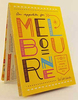
Melbourne Step By Step Insight Guide

Melbourne in the Step by Step series by Insight Guides focuses on providing tailor made walks and tours around the city. The guide features fourteen route recommendations that link up better known sights and take you off of the more beaten track; they are written by local experts who have personally selected places to eat and drink en-route and who offer insider tips on culture, shopping and nightlife.The guide has an array of colour photographs which help bring to life the background and descriptive information provided for destinations and attractions. An overview chapter opens the guide and reviews geography, customs and culture, history, food and drink, shopping, culture and entertainment. Next feature the selected itineraries for walks and/or tours, each of which have a good
amount of accompanying information and come with a simple route plan. A user friendly alphabetical directory lists practical information to do with day to day basics and listings of hand-picked hotels and restaurants are provided to suit different budgets and tastes. The publisher
RIP - This product is no longer available on our network. It was last seen on 25.09.2019

This page now acts as a permanent archive for this product. Add more information using the comments box below to ensure it can still be found by future generations.

Use our search facility to see if it is available from an alternative contributor.
  • Availability: Out Of Stock
  • Supplier: Stanfords
  • SKU: 9781780050454
Availability: In Stock
£8.99

Product Description

Melbourne in the Step by Step series by Insight Guides focuses on providing tailor made walks & tours around the city. The guide features fourteen route recommendations that link up better known sights & take you off of the more beaten track; they are written by local experts who have personally selected places to eat & drink en-route & who offer insider tips on culture, shopping & nightlife. The guide has an array of colour photographs which help bring to life the background & descriptive information provided for destinations & attractions. An overview chapter opens the guide & reviews geography, customs & culture, history, food & drink, shopping, culture & entertainment. Next feature the selected itineraries for walks and/or tours, each of which have a good amount of accompanying information & come with a simple route plan. A user friendly alphabetical directory lists practical information to do with day to day basics & listings of h&-picked hotels & restaurants are provided to suit different budgets & tastes. The publisher

Reviews/Comments

Add New

Price History

Vouchers

No voucher codes found.
Do you know a voucher code for this product or supplier? Add it to Insights for others to use.

Facebook

Jargon Buster

Hand - A part of the body at the end of the arm
Hand - A pointer which indicates time on a clock face
History - Anything that happens in the past. An acedemic subject.
Entertainment - Something that provides amusement
Colour - The categorised spectrum of light visable to humans
Day - The time it takes a planet or other space objects to complete one rotation.
Simple - Basic, easy no difficulty in understanding.
Practical - Weather a task is easy to carry out and realistically succeed.
Feature - An attribute that makes something stand out.

Supplier Information

Stanfords
Stanfords was established in 1853 and opened their iconic Covent Garden flagship store in 1901. They have become the top retailer of maps, travel books and accessories in the UK and arguably offer the largest selection of maps and travel books worldwide. Famous names such as Captain Robert Falcon Scott, Ranulph Fiennes and Michael Palin have purchased from Stanfords. They now have a shop in Bristol and both stores together with other venues operate a calendar of events including talks, book signings and exhibitions. As a specialist map retailer, the map selection is comprehensive and includes road maps, street maps and walking maps from worldwide destinations, as well as a selection of world atlases and wall maps. Books include travel guides and travel literature. Stanfords also stock globes, from miniatures made of blue marble to magnificent floor-standing globes. The website features a selection of interesting articles on travel topics.
Page Updated: 2023-11-12 20:15:36

Community Generated Product Tags

Oh No! The productWIKI community hasn't generated any tags for this product yet!
Menu