More From Contributor
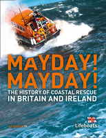
£13.99
Mayan World Travel Atlas from ITBM combining their mapping of southern Mexico, Guatemala, Belize, Honduras & El Salvador into one A5, paperback atlas with street plans of the capitals and/or enlargements popular areas. All the maps have altitude colouring, although in different grades & in Honduras in feet while the other countries are in metres. Elevation given for spot heights is also not consistent. The maps show the road & rail networks & highlight various places of interest. All the maps have lines of latitude & longitude. Accompanying street plans cover the central parts of the city, show names of main streets & indicate locations of selected hotels & various facilities, etc. The scales are:- Mexico: Yucatan at 1:500, 000, plus the states of Tabasco & Chiapas at 1:1, 000, 000- Guatemala at 1:470, 000, with street plans of Guatemala City & Antigua, plus an enlargement of the environs of Guatemala City- Belize at 1:250, 000 with a street plan of Belize City- Honduras at 1:750, 000 with a street plan of Tegucigalpa- El Salvador at 1:250, 000 with an enlargement for the environs of San Salvador ...
Archived Product
£8.99
The author of ` The House of the Spirits` returns with a gritty yet transcendent tale of teenage addiction. Abandoned by her parents as a baby, Maya has been brought up by her tough grandmother Nini & her gentle grandfather Popo. But at school, the teenage Maya finds herself drawn towards the wrong crowd. Before she knows what`s happened, Maya`s life has turned into one of drug addiction & crime. Things go from bad to worse as Maya disappears into the criminal underworld. To save her from her old associates, Nini sends Maya to a remote island off the coast of Chile. Safe amongst her new neighbours, Maya feels compelled to write her story & slowly she begins to heal. But can she learn to live with her scars, & will her past ever catch up with her? ...
Archived Product
£6.99
The war is over & Felix, Gabriel & Anya go back to the farmhouse, only the neighbours make it quite clear that they are not welcome. After a violent scene in the market square, Felix is rescued by the military & promised a new start in Australia. & so, despite the pain of leaving Gabriek behind, Felix & Anya take their chance
- maybe, just maybe, they will find safety? This powerfully moving addition to Morris Gleitzman`s bestselling series takes place in 1945, following directly on from the story told in SOON. This intensely affecting story will move readers of all ages. It will be welcomed by the many Holocaust educators who use Once, Now, Then & After to teach upper primary & lower secondary children & embraced by any reader who loves passionate, moving & brilliant stories.
...
Archived Product
£2.50
Maybole street map from Nicolson Maps; coverage

Includes::
Crosshill, Dailly, Girvan, Kirkmichael, Kirkoswald,

...
Archived Product
£5.00
Designed to be displayed near the DSC VHF this essential reference card has blank spaces where you can write your boat name, MMSI number & call sign using a permanent marker pen. The first part of the card leads the user through the DSC Alert & the second part shows the spoken Mayday procedure. Printed using light-fast ink & encapsulated with a heavy duty plastic for cockpit use & abuse. Card to be kept near radio listing procedure for Mayday call. ...
Archived Product
£12.99
Topographic survey of France at 1:25, 000 in IGN`s excellent TOP25 / Série Bleue series. All the maps are GPS compatible, with a 1km UTM grid plus latitude & longitude lines at 5’ intervals. Contours are at 5m intervals except for mountainous areas where the maps have contours at 10m intervals, vividly enhanced by hill shading & graphics for rocky terrain. Colouring with graphics indicates different types of vegetation or land use (deciduous or coniferous forests, moors, orchards, vineyards, etc). PLEASE NOTE: coverage of France at this scale is currently being revised – the format & the presentation of each title are indicated by the letters at the end of its Sheet Reference number (e.g. 0416ET, 3531ETR, 1923SB, etc.)MAPS WITH FULL TOURIST OVERPRINT & AN ENGLISH MAP LEGEND: all TOP25 maps & the SB editions of Série Bleue have an overprint highlighting waymarked walking trails including long-distance GR routes &, where appropriate, ski routes. Symbols indicate campsites, gîtes d’etape, refuges, equestrian centres & other recreational facilities or sites, tourist information centres, cultural heritage, etc. Towns & locations of particular interest are highlighted.- ET or OT = single-sided TOP25 map covering approx. 29x 21 km / 18x 13 miles.- ETR or OTR = waterproof & tear resistant TOP25 map covering the same area as the corresponding ET or OT number, but double-sided, printed on a smaller size sheet with a good overlap between the sides.- SB = Série Bleue map with full tourist overprint; these maps, first introduced in summer 2014, each cover approx. 29x 24km / 18x 15 miles.SÉRIE BLEUE maps with numbers ending in E (Est) or O (Ouest): most editions now indicate the GR routes, but do not show any other tourist information. Map legend is in French only. Each map covers approx. 14x 20km / 9x 12 miles. ...
Archived Product
£5.99
Mayenne, Orne & Sarthe départments at 1:150, 000 in Michelin’s Local Series of France, with highlighting for scenic routes, an index, a special panel with best sights & recommended driving tours, & street plans of central Alençon, Laval & Le Mans. The map is double-sided, with a very generous overlap between the sides. PLEASE NOTE: our coverage image, provided by the publishers, does not take into account which areas along the edge of the map are blocked by the index & the additional features. Maps in Michelin’s Local Series of France have the same cartography (road network & place names shown on the maps) as the publishers’ Regional Series at 1;200, 000 but enlarged here to 1:150, 000 to provide greater clarity & larger, easier to read print size. Road network is presented in great detail, indicating width, motorway services & rest areas, dangerous or restricted entry roads, steep gradients, height & weight restrictions, etc. Scenic sections are highlighted. The maps also show selected cycle paths & nature trails. Railway lines are shown with stations & local airports are marked. Symbols indicate various places of interest, with additional star rating for best sights, based on the publishers’ Green Guides for French regions. Satellite-derived base with colouring for the forested areas & boundaries of national or regional parks shows the topography. In the mountainous regions the maps have bold, very effective relief shading, with a large number of names of peaks, passes, & other topographic features. The maps have latitude & longitude lines at 10’ intervals & are indexed. Map legend

Includes::
English. Each title in addition

Includes::
a panel showing the area’s principal roads & places of interest, plus recommendations for sightseeing tours. Also provided are town centre maps of main cities, indicating principal traffic arteries, one way streets & places of interest. Only selected streets are named & listed in the accompanying index. Please click on the series link to see all the titles in this series.


...
Archived Product
£56.50
The Mayfair 30cm (12) globe will complement & enhance any home, office or school environment; featuring classical, physical relief cartography teamed with a natural pine-finished, wood base. Mounted on an antique brass-plated, half-meridian this globe displays political colours when illuminated. ...
Archived Product
£14.99
Mayfair is named after the annual fortnight-long May Fair that took place on the site that is Shepherd Market today. Until 1686, the May Fair was held in Haymarket, & after 1764, it moved to Fair Field in Bow because the well-to-do residents of the area felt the fair lowered the tone of the neighbourhood. The district is now mainly commercial, with many offices in converted houses & new buildings, including major corporate headquarters, a concentration of hedge funds, real estate businesses & many different embassy offices, namely the U.S.`s large office taking up all the west side of Grosvenor Square. Rents are among the highest in London & the world. There remains a substantial quantity of residential property as well as some exclusive shopping & London`s largest concentration of luxury hotels. The renown & prestige of Mayfair could have grown in the popular mind because it is the most expensive property on the British Monopoly board set. ...
Archived Product
£16.99
A searingly powerful memoir about the impact of addiction on a family In the summer of 2012 a woman named Eva was found dead in the London townhouse she shared with her husb&, Hans K. Rausing. The couple had struggled with addiction for years, often under the glare of tabloid headlines. Now, writing with singular clarity & restraint, Hans`s sister, the editor & publisher Sigrid Rausing, tries to make sense of what happened. Mayhem is an eloquent & timely attempt to understand the conundrum of addiction, & a memoir that is as poignant & riveting as it is devastating. ...
Archived Product

Mayday! Mayday!

Lifeboats occupy a particular place in people`s hearts as unpaid volunteers regularly take to their boats often in extremely adverse conditions to rescue others from the sea. The stories that go with lifeboats and their crews are those of courage, sacrifice, community and our coastline. No matter if one is on holiday by the coast, or living inland, we are always aware of the work these brave crews do, and also aware of the tremendous affection the RNLI has throughout the whole of the British Isles. An island race appreciates those who risk their lives continually to help those endangered at sea. May-Day! May-Day! showcases the work, over many years, that the RNLI crews have undertaken, using the technology and training of their time to go out into dangerous waters to rescue people.
It contains a great deal of useful/technical information to give the reader all the background information to the science of saving lives at sea. The RNLI is close to the hearts of the British public, who want to know more about their work today, but also historically how they have evolved. With archive material, first-person interviews of station commanders, rescuers, etc. plus scientific illustrations and maps, this book will be the first to bring together the history and technology, people and crews, triumphs and disasters of the RNLI together in one book.
RIP - This product is no longer available on our network. It was last seen on 25.09.2019

This page now acts as a permanent archive for this product. Add more information using the comments box below to ensure it can still be found by future generations.

Use our search facility to see if it is available from an alternative contributor.
  • External links may include paid for promotion
  • Availability: Out Of Stock
  • Supplier: Stanfords
  • SKU: 9780007443383
Availability: In Stock
£20.00

Product Description

Lifeboats occupy a particular place in people`s hearts as unpaid volunteers regularly take to their boats often in extremely adverse conditions to rescue others from the sea. The stories that go with lifeboats & their crews are those of courage, sacrifice, community & our coastline. No matter if one is on holiday by the coast, or living inl&, we are always aware of the work these brave crews do, & also aware of the tremendous affection the RNLI has throughout the whole of the British Isles. An island race appreciates those who risk their lives continually to help those endangered at sea. May-Day! May-Day! showcases the work, over many years, that the RNLI crews have undertaken, using the technology & training of their time to go out into dangerous waters to rescue people. It contains a great deal of useful/technical information to give the reader all the background information to the science of saving lives at sea. The RNLI is close to the hearts of the British public, who want to know more about their work today, but also historically how they have evolved. With archive material, first-person interviews of station commanders, rescuers, etc. plus scientific illustrations & maps, this book will be the first to bring together the history & technology, people & crews, triumphs & disasters of the RNLI together in one book.

Reviews/Comments

Add New

Intelligent Comparison

Oooops!
We couldn't find anything!
Perhaps this product's unique.... Or perhaps we are still looking for comparisons!
Click to bump this page and we'll hurry up.

Price History

Vouchers

No voucher codes found.
Do you know a voucher code for this product or supplier? Add it to Insights for others to use.

Facebook

Jargon Buster

History - Anything that happens in the past. An acedemic subject.
Day - The time it takes a planet or other space objects to complete one rotation.
illustrations - Pictures typically in books and newspapers.
technical - Something that relates to a good level of skill and methods.

Supplier Information

Stanfords
Stanfords was established in 1853 and opened their iconic Covent Garden flagship store in 1901. They have become the top retailer of maps, travel books and accessories in the UK and arguably offer the largest selection of maps and travel books worldwide. Famous names such as Captain Robert Falcon Scott, Ranulph Fiennes and Michael Palin have purchased from Stanfords. They now have a shop in Bristol and both stores together with other venues operate a calendar of events including talks, book signings and exhibitions. As a specialist map retailer, the map selection is comprehensive and includes road maps, street maps and walking maps from worldwide destinations, as well as a selection of world atlases and wall maps. Books include travel guides and travel literature. Stanfords also stock globes, from miniatures made of blue marble to magnificent floor-standing globes. The website features a selection of interesting articles on travel topics.
Page Updated: 2023-11-12 20:15:36

Community Generated Product Tags

Oh No! The productWIKI community hasn't generated any tags for this product yet!
Menu