
 United Kingdom
 France
 Germany
 Netherlands
 Sweden
 USA
USA
 Italy
Italy
 Spain
Spain
More From Contributor


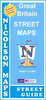


Mayan World ITMB Travel Atlas
Mayan World Travel Atlas from ITBM combining their mapping of southern Mexico, Guatemala, Belize, Honduras and El Salvador into one A5, paperback atlas with street plans of the capitals and/or enlargements popular areas.All the maps have altitude colouring, although in different grades and in Honduras in feet while the other countries are in metres. Elevation given for spot heights is also not consistent. The maps show the road and rail networks and highlight various places of interest. All the maps have lines of latitude and longitude. Accompanying street plans cover the central parts of the city, show names of main streets and indicate locations of selected hotels and various facilities, etc.The scales are:- Mexico: Yucatan at 1:500, 000, plus the states of Tabasco and Chiapas at
1:1, 000, 000- Guatemala at 1:470, 000, with street plans of Guatemala City and Antigua, plus an enlargement of the environs of Guatemala City- Belize at 1:250, 000 with a street plan of Belize City- Honduras at 1:750, 000 with a street plan of Tegucigalpa- El Salvador at 1:250, 000 with an enlargement for the environs of San Salvador
1:1, 000, 000- Guatemala at 1:470, 000, with street plans of Guatemala City and Antigua, plus an enlargement of the environs of Guatemala City- Belize at 1:250, 000 with a street plan of Belize City- Honduras at 1:750, 000 with a street plan of Tegucigalpa- El Salvador at 1:250, 000 with an enlargement for the environs of San Salvador

Product Description
Reviews/Comments
Add New
Vouchers
No voucher codes found.
Do you know a voucher code for this product or supplier? Add it to Insights for others to use.
Do you know a voucher code for this product or supplier? Add it to Insights for others to use.
 Denmark