
 United Kingdom
 France
 Germany
 Netherlands
 Sweden
 USA
USA
 Italy
Italy
 Spain
Spain
More From Contributor


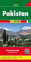
Pakistan F&B
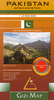
This Pakistan at 1:1, 500, 000 large indexed road map from Freytag & Berndt, with street plans of central Islamabad, Karachi, Lahore and Peshawar, provides a good presentation of the country’s topography.The map has bold relief shading with spot heights and names of main geographical features, plus colouring and/or graphics to show swamps and lakes, deserts and depressions, wells, natural preserves, etc. Also marked are oil fields and internal administrative boundaries with names of the provinces. Road network includes main roads and motorways as well as secondary roads and tracks and sections under construction. It also shows driving distances in kilometres on main and secondary routes. Railway lines are marked and international and local airports are indicated. Symbols
highlight various places of interest, including UNESCO World Heritage sites, monasteries, temples and antique sites. All place names are in Latin alphabet only. Latitude and longitude lines are drawn at intervals of 1º. Extensive index is on the reverse and the multilingual map legend includes English.Also provided are street plans of central Islamabad, Karachi, Lahore and Peshawar, naming main streets and highlighting places of interest.
highlight various places of interest, including UNESCO World Heritage sites, monasteries, temples and antique sites. All place names are in Latin alphabet only. Latitude and longitude lines are drawn at intervals of 1º. Extensive index is on the reverse and the multilingual map legend includes English.Also provided are street plans of central Islamabad, Karachi, Lahore and Peshawar, naming main streets and highlighting places of interest.

Product Description
Reviews/Comments
Add New
Vouchers
No voucher codes found.
Do you know a voucher code for this product or supplier? Add it to Insights for others to use.
Do you know a voucher code for this product or supplier? Add it to Insights for others to use.
 Denmark