
 United Kingdom
 France
 Germany
 Netherlands
 Sweden
 USA
USA
 Italy
Italy
 Spain
Spain
More From Contributor


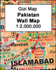

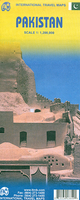
Pakistan ITMB
Pakistan at 1:1, 200, 000 on a double-sided, indexed road map from ITMB with a street plan of central Karachi. Altitude colouring indicates the country’s topography and various places of interest are highlighted on the map.The map divides the country north/south, with a generous overlap between the sides. The country’s topography is shown by bold altitude colouring and spot heights (both in feet), with graphics for glaciers, salt pans, etc, plus names of various mountain ranges and deserts. Road network includes selected secondary roads and tracks, with driving distances shown on primary roads and border crossings marked. Railway lines are included and local airports are marked. Symbols highlight various places of interest, many annotated with brief descriptions about their
history. Latitude and longitude lines are drawn at 1° intervals. Each side of the map has a separate extensive index.Also provided in a street plan of Karachi showing main traffic routes across the city and highlighting various facilities and places of interest, including selected hotels, tourist information centre, foreign consulates, etc.
history. Latitude and longitude lines are drawn at 1° intervals. Each side of the map has a separate extensive index.Also provided in a street plan of Karachi showing main traffic routes across the city and highlighting various facilities and places of interest, including selected hotels, tourist information centre, foreign consulates, etc.

Product Description
Reviews/Comments
Add New
Vouchers
No voucher codes found.
Do you know a voucher code for this product or supplier? Add it to Insights for others to use.
Do you know a voucher code for this product or supplier? Add it to Insights for others to use.
 Denmark