
 United Kingdom
 France
 Germany
 Netherlands
 Sweden
 USA
USA
 Italy
Italy
 Spain
Spain
More From Contributor
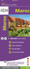


Morocco Marco Polo Map
Morocco at 1:800, 000 from Marco Polo Travel Publishing with special features to aid route planning, street plans of central Rabat, Marrakesh, Tangier, Fès and Meknès and an index also listing geographical features. Western Sahara is shown at 1:2, 500, 000.A fold-out extension of the map cover gives at-a-glance overview of the whole area covered by the map with the adjoining regions, highlighting main places of interest and making it much easier to find various localities on the main map and/or plan a route. A set of seven peel-on/peel-off stickers, removable without damaging the map, is provided to make routes or locations more prominent when navigating.Cartography is from the renowned German publishers MairDumont. Topography is shown by relief shading with plenty of spot heights
and names of mountain ranges. In the desert areas oasis and seasonal rivers are marked. Road network includes local roads and desert tracks, with intermediate driving distances marked on main and many local routes. Seasonal closures, steep gradients, etc, are indicated and scenic routes are highlighted. The map also includes railways and shows local airports.Picturesque towns or villages as well as many natural curiosities are prominently highlighted. Symbols indicate numerous other places of interest. The map shows the country’s internal administrative boundaries with names of the provinces and gives all place names in the Latin alphabet only, with major cities also in the Arabic version (Casablanca/Ad-dar-Al-Bayda). Latitude and longitude lines are drawn at 2° intervals.
Multilingual map legend includes English. The index in a separate booklet attached to the map cover includes names of geographical features such as mountains or rivers, and has separate lists of World Heritage sites and National Parks.

Product Description
Reviews/Comments
Add New
Vouchers
No voucher codes found.
Do you know a voucher code for this product or supplier? Add it to Insights for others to use.
Do you know a voucher code for this product or supplier? Add it to Insights for others to use.
 Denmark