
 United Kingdom
 France
 Germany
 Netherlands
 Sweden
 USA
USA
 Italy
Italy
 Spain
Spain
More From Contributor

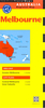


Melbourne And Region Hema
Melbourne and Region in a series of maps from Hema presenting Australia’s main cities with three maps: a detailed street plan of the central area, a road map of the city with its outer suburbs, plus a map of the wider surrounding region for out-of-town excursions. The Melbourne map includes:- A street plan of city centre highlighting locations of 56 places of interest, 14 theatres, 12 travel information centres and 38 hotels. - A road map of Greater Melbourne at 1:115, 000 extending south to include the Mornington Peninsula with the French and Phillip Islands, west to Werribee, and north-west to Sunbury. The index lists locations with their postcodes.- Large, clear diagrams of Melbourne’s train and tram networks. - A regional map at 1:360, 000 approx covering a wider area around
the city extending out to Ballarat in the west and Seymour in the north. Both the suburban and the regional maps are indexed and show the road network indicating unsurfaced roads and tracks. Symbols mark roadside rest areas, campsites, accredited information centres, places of interest, etc. Topography is indicates by names of mountain ranges and selected peaks, plus rivers and lakes; national and state parks, conservation areas and reserves are all highlighted. To see other titles in this series please click on the series link.
the city extending out to Ballarat in the west and Seymour in the north. Both the suburban and the regional maps are indexed and show the road network indicating unsurfaced roads and tracks. Symbols mark roadside rest areas, campsites, accredited information centres, places of interest, etc. Topography is indicates by names of mountain ranges and selected peaks, plus rivers and lakes; national and state parks, conservation areas and reserves are all highlighted. To see other titles in this series please click on the series link.

Product Description
Reviews/Comments
Add New
Vouchers
No voucher codes found.
Do you know a voucher code for this product or supplier? Add it to Insights for others to use.
Do you know a voucher code for this product or supplier? Add it to Insights for others to use.
 Denmark