
 United Kingdom
 France
 Germany
 Netherlands
 Sweden
 USA
USA
 Italy
Italy
 Spain
Spain
More From Contributor


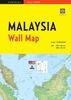


Malaysia West - Singapore Nelles
Road map fro Nelles Verlag presenting the Peninsular Malaysia at 1:1, 500, 000 with additional street plans and enlargements, plus on the reverse an indexed street plan of Singapore City and maps of Singapore Island and an enlargement of Sentosa Island. Smaller size sheet offers a convenient format for use when travelling and map legend for all the sections of this title includes English.On one side is a road map of the western, peninsular part of Malaysia. Vivid relief shading, spot and names of mountain ranges, plus graphics for marshlands present the topography. National parks and other protected area are marked. Road network distinguishes between highways in good and poor condition and includes partially paved roads and cart tracks, with distances shown on main routes. Railway
lines and local airports are included, and the map also shows internal administrative boundaries with names of the states. Numerous places of interest are prominently marked. Latitude and longitude margin ticks are at 1° intervals. The map has no index of localities. The map is accompanied by enlargements showing in greater detail the Kuala Lumpur region, Penang and Pangkor, plus street plans highlighting main places of interest in central Kuala Lumpur, Georgetown and Melaka/Malacca.On the reverse central Singapore is shown on a street plan at 1:15, 000, clearly indicating metro stations and showing public buildings and various places of interest. The plan is indexed for streets, housing and industrial estates, places of interest, hotels, embassies and medical centres. 64
institutions marked on the plan within the Business District are cross-referenced to a list of their names. Also included is a map of the whole Singapore Island at 1:125, 000 clearly showing railway connections, plus an enlargement of the Sentosa Island at 1:22, 500.

Product Description
Reviews/Comments
Add New
Vouchers
No voucher codes found.
Do you know a voucher code for this product or supplier? Add it to Insights for others to use.
Do you know a voucher code for this product or supplier? Add it to Insights for others to use.
 Denmark