
 United Kingdom
 France
 Germany
 Netherlands
 Sweden
 USA
USA
 Italy
Italy
 Spain
Spain
More From Contributor
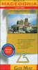

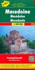

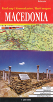
Macedonia Road Map
Macedonia at 1:300, 000 on an indexed road map from the Skopje-based publishers Trimaks with a vivid presentation of the country’s topography by a combination of relief shading, altitude colouring, spot heights, mountain passes, and names of mountain ranges. All place names are in the Latin alphabet. Road network includes selected local roads and shows locations of petrol stations and border crossings. Driving distances are marked on main and secondary routes. Railway lines are included and symbols indicate locations with hotels and motels. The map has latitude and longitude lines at 15’ intervals. The index is on the reverse. Map legend includes English.Also provided is a distance table, plus facts and figures about the country.

Product Description
Reviews/Comments
Add New
Vouchers
No voucher codes found.
Do you know a voucher code for this product or supplier? Add it to Insights for others to use.
Do you know a voucher code for this product or supplier? Add it to Insights for others to use.
 Denmark