More From Contributor

£17.99
Macedonia in the Travel Guide series from Bradt; encompassing a comprehensive range of titles to destinations worldwide, with a particular focus on Africa, Central & South America. Bradt are one of the country’s leading independent publishers & have an ethos that focuses on responsible travel, in alliance with a philosophy of sustainability; both in the destinations the guides cover but also in encouraging tourists to limit the impact they have on the local environment. Bradt guides have a reputation for appealing to more independent travelers & often cover destinations that are not available from other publishers. Each guide opens with two comprehensive chapters on Background & Practical Information, covering details of the country’s geography, culture, natural history, government & politics, economy, people, language, religion, education & culture. Important practical advice

Includes::
when to visit, highlights, suggested itineraries, tour operators, red tape, embassies & consulates, getting there & away, health, safety, what to take, money, budgeting, getting around, accommodation, eating & drinking, public holidays, shopping, arts & entertainment, media & communications, business, travel culture & cultural etiquette. Individual sections are organized geographically by region & typically open with information on practicalities & orientation, before focusing on what to see & where to go. Information on what to see, where to stay, where to eat & how to find your way around is provided, with a range of budgets catered for. Simple black & white maps locate key visitor sites & places of accommodation. Bradt Travel Guides include appendices that provide an in-depth introduction to the language of each country, a glossary of terms & a listing of books & internet resources providing further information on the destination.

...
Archived Product
£8.50
Road Macedonia at 1:300, 000 from the Skopje-based publishers Trimaks highlighting locations of over 500 churches, monasteries & other institutions of the Macedonian Orthodox Church. All place names on the map are in the Latin alphabet. The index, grouped by Eparchy (dioceses), is next to the map. On the reverse, several locations have a short description accompanied by a colour photo. Map legend & all the text include English. ...
Archived Product
£10.99
Macedonia at 1:200, 000 on a large map in Freytag & Berndt’s “ Top 10 Tips” series with the index booklet also providing multilingual descriptions of the country’s 10 most interesting locations, plus a street plan of central Skopje. Names of towns & villages are in both Latin & Cyrillic alphabets; administrative regions, geographical features & places of interest are in the Latin alphabet only. Topography is presented by relief shading & spot heights, with names of mountain ranges, peaks, etc, plus colouring for woodlands. Road network

Includes::
local roads & selected cart tracks, indicates border crossings, & gives driving distances on most local roads. Scenic routes are highlighted. Railway lines are shown with stations. The map also shows the country’s internal administrative boundaries. Picturesque locations & other places of interest are highlighted & the map also indicates the country’s 10 best sights which are given multilingual descriptions in the booklet. Latitude & longitude lines are drawn at 10’ intervals. The index lists locations with their postcodes. The booklet also

Includes::
a street plan of central Skopje. Map legend & descriptions of the 10 best sights include English.


...
Archived Product
£8.50
Macedonia at 1:300, 000 on an indexed road map from the Skopje-based publishers Trimaks with a vivid presentation of the country’s topography by a combination of relief shading, altitude colouring, spot heights, mountain passes, & names of mountain ranges. All place names are in the Latin alphabet. Road network

Includes::
selected local roads & shows locations of petrol stations & border crossings. Driving distances are marked on main & secondary routes. Railway lines are included & symbols indicate locations with hotels & motels. The map has latitude & longitude lines at 15’ intervals. The index is on the reverse. Map legend

Includes::
English. Also provided is a distance table, plus facts & figures about the country.


...
Archived Product
£13.50
Macedonia Wall Map at 1:250, 000 from Gizi Map, size 100 x 68cm (39.5” x 27” approx) with a street plan of central Skopje. The map offers excellent presentation of the country’s topography through relief shading, altitude colouring, peak heights & plenty of names of mountain ranges. Road network

Includes::
local roads & tracks, shows driving distances on main & many secondary routes, & indicates border crossings from the neighbouring countries. Railway lines & local airports are included. Symbols indicate locations with tourist accommodation, campsites, & other places of interest; national parks are highlighted. Names of larger towns are also shown in Cyrillic alphabet. Latitude & longitude lines are drawn at intervals of 15’. The index is next to the map. Map legend

Includes::
English. Also provided is a street plan of central Skopje annotated with places interest. Please note: this title is also available in a folded format.


...
Archived Product
£8.50
Popular recreational areas of Macedonia on detailed maps from the Skopje-based Trimaks, indicating various tourist facilities & places of interest. On the reverse is further useful information, including on some maps street plans of local towns. Map scale, presentation of the topography & GPS compatibility vary – please see individual descriptions for further details. ...
Archived Product
£7.95
Macerata Province in a series of handy size road maps from Litografia Artistica Cartografica (LAC) with more minor local roads & tracks than can be found on most regional maps. The series is gradually being changed to a new style of digitally derived cartography, so presentation of adjoining titles may vary. All the maps have hill shading to represent the general relief with spot heights for selected peaks, & show a few more local roads & rough tracks than the other road map series. Intermediate road distances are indicated. Regional, provincial & communal borders are marked, & railways, funiculars, airports, sea ferry links & campsites are shown. The legend is in Italian only. The new, digitally produced editions are indexed & have enhanced, more finely drawn cartography: the hill-shading is less bold, motorway service areas are marked, natural parks are highlighted & an expanded range of symbols indicates various landmarks & sites, e.g. antiquities, churches, etc. Two styles of the new cartography are produced, differing only in the colour of the predominant background shading: grey or yellow/green. Some of the new editions include geographical coordinates for the map corners. The index of localities is on the reverse. This title is still produced in the traditional cartographic style. ...
Archived Product
£10.95
Macgillycuddy's Reeks at 1:30, 000 on a waterproof & tear-resistant, GPS compatible map from Harvey Map Services in their Superwalker series covering popular hiking areas of Great Britain & Irel&, annotated with additional information for walkers. The maps have contours at 15m intervals, with additional graphics for various types of terrain (crags, large boulders, scattered rocks) & colouring for different kinds of land use or vegetation (pastures, bogs, forests or woodl&, etc). The maps show local hiking paths, indicating, where appropriate, long-distance routes & boundaries of national parks or other protected areas. Scottish titles also indicate Munro, Corbett & Graham hills. Some maps in addition highlight local cycle routes.A range of symbols mark various facilities for walkers including youth or independent hostels, campsites & caravan sites, information points, etc. Each map has a 1-km with British or Irish national grid. ...
Archived Product
£12.50
Macgillycuddy`s Reeks & the Killarney National Park on a double-sided, GPS compatible map at 1:25, 000 from the Ordnance Survey Ireland with cartography of the country’s topographic survey, plus the central part of the Reeks at 1:12, 500. Coverage extends from Killarney westwards to Lough Caragh. Where appropriate place names are given in both Irish & English versions. Topography is vividly presented by contours at 10m intervals with additional graphics and/or colouring to show bogs, moraine, scree, different types of woodlands, etc. Waymarked hiking paths & their trailheads are highlighted, & the map also shows the Ring of Kerry cycle route. Symbols indicate camping & caravan sites, youth hostels, locarions for horse riding or angling, information offices, bus stops, etc. The map has a 1km ITM (Irish Transverse Mercator) grid, plus latitude & longitude margin ticks at 1’. An enlargement presents the central part of the Macgillycuddy’s Reeks, around Carrauntoohil & Lough Callee in greater detail & clarity at 1:12, 500. ...
Archived Product
£12.95
Cairn Gorm & Ben Avon area in the heart of the Scottish Highlands at 1:25, 000 on a waterproof & tear-resistant map from Harvey Map Services in their Superwalker series. The peak of Cairn Gorm is on the eastern side of the map, with coverage extending north to Glanmore & the outskirts of Aviemore, west to Achlean & River Feshie & south to the Glenfeshire Forest & Sgòr Mòr.PLEASE NOTE: this title is also available as a pocket-size Ultramap with its scale reduced to 1:40, 000
- to see the list of titles available in this series please click on the series link. Maps in Harvey’s Superwalker series have contours at 15m intervals, with additional graphics for various types of terrain (crags, large boulders, scattered rocks) & colouring for different kinds of land use or vegetation (pastures, bogs, forests or woodl&, etc). The maps show local hiking paths, indicating where appropriate long-distance routes, & boundaries of national parks or other protected areas. Scottish titles also indicate Munro, Corbett & Graham hills. Some maps in addition highlight local cycle routes. A range of symbols mark various facilities for walkers including youth or independent hostels, campsites & caravan sites, information points, etc. Each map has a 1-km British or Irish national grid.
...
Archived Product

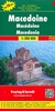
Macedonia Wineries Map

Road Macedonia at 1:300, 000 from the Skopje-based publishers Trimaks highlighting locations of wineries, with on the reverse an enlargement showing in greater detail the main wine growing Kavadarci – Negotino region.On one side a road map of the whole country, framed in a decorative border, is overprinted with icons of wineries, which are also listed in the accompanying index. On the reverse, the main wine growing region around Kavadarci, Negotino, Gradsko and Demir Kapija is shown in greater detail. All place names on the main map and the enlargement are shown in the Latin alphabet. The reverse side also has brief descriptions of Macedonia’s 12 main vineyards and adverts for various vineries. Map legend and all the text include English.
RIP - This product is no longer available on our network. It was last seen on 25.09.2019

This page now acts as a permanent archive for this product. Add more information using the comments box below to ensure it can still be found by future generations.

Use our search facility to see if it is available from an alternative contributor.
  • Availability: Out Of Stock
  • Supplier: Stanfords
  • SKU: 9786082040745
Availability: In Stock
£8.50

Product Description

Road Macedonia at 1:300, 000 from the Skopje-based publishers Trimaks highlighting locations of wineries, with on the reverse an enlargement showing in greater detail the main wine growing Kavadarci – Negotino region. On one side a road map of the whole country, framed in a decorative border, is overprinted with icons of wineries, which are also listed in the accompanying index. On the reverse, the main wine growing region around Kavadarci, Negotino, Gradsko & Demir Kapija is shown in greater detail. All place names on the main map & the enlargement are shown in the Latin alphabet. The reverse side also has brief descriptions of Macedonia’s 12 main vineyards & adverts for various vineries. Map legend & all the text include English.

Reviews/Comments

Add New

Intelligent Comparison

Oooops!
We couldn't find anything!
Perhaps this product's unique.... Or perhaps we are still looking for comparisons!
Click to bump this page and we'll hurry up.

Price History

Vouchers

No voucher codes found.
Do you know a voucher code for this product or supplier? Add it to Insights for others to use.

Facebook

Jargon Buster

Wine - An alcoholic drink made from fermented grapes.
Road - a manmade lane or a path that is used to speed up travel.
Decorative - Making things look more appealing and attractive.

Supplier Information

Stanfords
Stanfords was established in 1853 and opened their iconic Covent Garden flagship store in 1901. They have become the top retailer of maps, travel books and accessories in the UK and arguably offer the largest selection of maps and travel books worldwide. Famous names such as Captain Robert Falcon Scott, Ranulph Fiennes and Michael Palin have purchased from Stanfords. They now have a shop in Bristol and both stores together with other venues operate a calendar of events including talks, book signings and exhibitions. As a specialist map retailer, the map selection is comprehensive and includes road maps, street maps and walking maps from worldwide destinations, as well as a selection of world atlases and wall maps. Books include travel guides and travel literature. Stanfords also stock globes, from miniatures made of blue marble to magnificent floor-standing globes. The website features a selection of interesting articles on travel topics.
Page Updated: 2023-11-12 20:15:36

Community Generated Product Tags

Oh No! The productWIKI community hasn't generated any tags for this product yet!
Menu