More From Contributor

£19.99
Jungfrau Region of the Bernese Oberland at 1:60, 000, including Interlaken, Grindelwald, Wengen, Mürren, Lauterbrunnen, Meiringen, Kandersteg, the peaks of Jungfrau, Eiger & Mönch, the mountain railway to Jungfraujoch, Brünigpass, Brienzer See & Thuner See, in Kümmerly + Frey’s hiking series of Switzerl&, with most titles now printed on light, waterproof & tear-resistant plastic paper. The series offers a popular alternative to Swiss survey maps & cartography which many walkers find easier to follow. Coverage of the whole country is designed so that each title presents a popular hiking area. The maps have contours at 50 or 25-metre intervals according to the terrain, enhanced by graphic relief & shading. An overprint distinguishes between sign-posted hiking paths, mountain path where proper walking shoes are necessary, & alpine paths requiring special equipment. Most titles now also indicate national & regional long-distance hiking routes, each annotated with its official number. Mountain huts are marked, plus various types of accommodation: campsites, youth hostels, “ Friends of Nature” houses, & secluded hotels & restaurants. Road network indicates local bus routes with stops. Railways, narrow gauge mountain railways, cable car lines, & chair lifts are shown, with various symbols highlighting places of interest, viewpoints, picnic sites, swimming pools, etc. Each title covers an area of Approx. 60 x 42 km (37 x 26 miles). The maps have a 1km Swiss national grid, plus latitude & longitude margin ticks at 5’ intervals. * Map legend

Includes::
English.* On the reverse, an index of towns & villages

Includes::
names of geographical features such as mountains, alpine passes, glaciers, lakes, rivers, as well as places of interest. Also provided is an overview road map of surrounding region.


...
Archived Product
£20.99
Map No. 2520, Jungfrau Region
- STANDARD EDITION, in the topographic survey of Switzerland at 1:25, 000 from Swisstopo, covering
...
Archived Product
£14.00
Tour of the Jungfrau Region is accomplished walker Kev Reynolds’ Cicerone guide to the trek through the Swiss Alps. The guide describes the entire 9-12 day trek &

Includes::
the main peaks of the Wetterhorn, Eiger, Monch & Jungfrau, relevant accommodation & also various bad-weather alternatives along the trek. This 2nd edition has also been updated with 3 new alternative stages, between First & Hotel Wetterhorn, the hotel & Berghaus Baregg & from Stechelberg to Obersteinberg. The guide is organised into 10 stages describing the trek &

Includes::
descriptions of places of interest & World Natural Heritage sites. Each stage has an information box providing details on total distance & time, high & low altitude points, height gain & loss & suggested accommodation along the route. A comprehensive introduction offers practical advice on accommodation, suggested itineraries, language, equipment recommendations, relevant maps & safety in the mountains. Detailed route descriptions are accompanied by colour sketch diagrams mapping the route in addition to colour photographs illustrating some of the highlights of the Alpine landscape.


...
Archived Product
£18.95
Jungfrau Region Winter Map from Hallwag presenting the area at 1:50, 000 with extensive information for ski & snowshoe tours, cross-country tracks, sledge tracks, winter hiking routes, tourist facilities, etc, printed on waterproof & tear-resistant synthetic paper. Coverage

Includes::
Grindelwald, Wengen, Lauterbrunnen, M

...
Archived Product
£12.99
Jungfrau, map No. 264, in the standard topographic survey of Switzerland at 1:50, 000 from Swisstopo, i.e. without the special overprint highlighting walking trails, local bus stops, etc, presented in Swisstopo’s hiking editions of the 50K survey. With the resort of Mürren at the top of the map, coverage

Includes::
the peaks of Mönch & Jungfrau with the upper station of the Jungfraujoch Railway, & extends southwards to cover the whole of the Aletschgletscher, the larger glacier in the Alps. Highly regarded for their superb use of graphic relief & hill shading, the maps give an almost 3-D picture of Switzerland`s mountainous terrain. Contours are at 20m intervals. All the maps have a 1-km grid with the Swiss national coordinates. This standard version of the 50K survey covers the whole country on 78 small format sheets, with special larger format maps published for several popular tourist destinations. Small format sheets cover an area of 35 x 24 km (21 x 15 miles approx) & have map legend in the language of the area covered by the map. The special larger sheets cover 50 x 35 km (31 x 22 miles approx) & have no map legend, but a separate leaflet can be provided instead.PLEASE NOTE: the hiking editions of the 1:50, 000 Swisstopo survey are listed on our website in a separate series.

...
Archived Product
£19.99
JUNGLE features exotic animals in vivid colour & vibrant motion: A tree frog blinks his big red eyes. A tiger stalks his prey. A blue leaf monkey scratches his back. A tarantula scurries across the ground. A butterfly drinks from a tropical flower. A whipsnake darts its tongue. A nocturnal tarsier scans for food. A vividly patterned macaw comes in for a landing. ...
Archived Product
£12.99
Every page of the spectacular pop-up book bursts with life, colour & sound. Peer through the jungle undergrowth to spot screeching howler monkeys, trumpeting elephants & growling leopards. Each jungle scene is accompanied by fascinating information about the creatures living there, so you can look, listen & learn! Ready to explore? The sounds of the wild are calling! ...
Archived Product
£4.99
This title features short stories that is designed to help kids learn how to read & learn to love reading. Jungle Adventures is a ” Reading Alone” reader, perfect for children who are proficient readers. These short stories for children develop the habit of reading widely for both pleasure & information. DK Reads proves that good reads build great readers. Join Charlotte & a team of scientists on an expedition to explore Cambodia`s wildlife. Experience the mosquitoes, snakes & torrential rain of the rainforest, & join the team as they encounter frogs, monkeys & even a tiger! ...
Archived Product
£9.99
Look out! Giant pop-up animals ahead! Open the cover of Face to Face Safari &.. .look out! It`s an elephant! & right behind that, a lion! A giraffe! A rhinoceros, a hippopotamus, & a chimpanzee! Six Big, bright animals really pop off the pages so children can get up close & personal with all their jungle favorites. Sturdy construction means many happy safaris ahead while whimsical rhymes add to the fun in a book that will make young imaginations run wild. ...
Archived Product
£16.99
From the moment a little naked cub wanders into the lair of Father Wolf & Mother Wolf to the moment when the master of the jungle returns to his own people, Mowgli`s adventures comprise a fable of human life. Along with these stories are other animal tales. This is a magnificent new edition of the best-loved story featuring over 80 beautiful illustrations by award-winning Australian illustrator Robert Ingpen. The third book in Templar`s best-selling classics series illustrated by Robert Ingpen that

Includes::
” Peter Pan & Wendy” (2004) & ” Treasure Island” (2005).

...
Archived Product

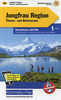
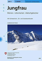
Jungfrau Swisstopo SKI 264S

Detailed ski map at 1:50, 000 from Swisstopo, the country’s national survey organization, showing routes for skiing and/or snowboarding, access by public transport, recommended itineraries, lists of mountain huts, etc. The series uses the cartography of Switzerland’s topographic survey, with additional colouring to show slopes steeper than 30°. An overprint highlights ski routes, indicating suggested direction, difficult passages and sections which must be covered on foot. Also marked are areas where it is forbidden to leave the routes shown on the map. The maps also highlight roads with bus routes, indicating individual bus stops, show ski lifts and funiculars, plus mark locations of refuges or other mountain accommodation. Each title has the Swiss national grid at
intervals of 1km, plus latitude and longitude margin ticks at 1’. Some titles cover a larger area, with a part of an adjoining sheet printed on the reverse of the main map as indicated on our series grid. Where appropriate, ski information extends across the border to France and Italy. On the reverse are itineraries of routes recommended by the Swiss Alpine Club, indicating the degree of difficulty, plus lists of alpine huts with contact details. Map legend for the overprint includes English. The text about the routes and accommodation is in the main language of the area covered by the map.To see the list of all the titles in this series please click on the series link.
RIP - This product is no longer available on our network. It was last seen on 25.09.2019

This page now acts as a permanent archive for this product. Add more information using the comments box below to ensure it can still be found by future generations.

Use our search facility to see if it is available from an alternative contributor.
  • Availability: Out Of Stock
  • Supplier: Stanfords
  • SKU: 9783302202648
Availability: In Stock
£22.99

Product Description

Detailed ski map at 1:50, 000 from Swisstopo, the country’s national survey organization, showing routes for skiing and/or snowboarding, access by public transport, recommended itineraries, lists of mountain huts, etc. The series uses the cartography of Switzerland’s topographic survey, with additional colouring to show slopes steeper than 30°. An overprint highlights ski routes, indicating suggested direction, difficult passages & sections which must be covered on foot. Also marked are areas where it is forbidden to leave the routes shown on the map. The maps also highlight roads with bus routes, indicating individual bus stops, show ski lifts & funiculars, plus mark locations of refuges or other mountain accommodation. Each title has the Swiss national grid at intervals of 1km, plus latitude & longitude margin ticks at 1’. Some titles cover a larger area, with a part of an adjoining sheet printed on the reverse of the main map as indicated on our series grid. Where appropriate, ski information extends across the border to France & Italy. On the reverse are itineraries of routes recommended by the Swiss Alpine Club, indicating the degree of difficulty, plus lists of alpine huts with contact details. Map legend for the overprint

Includes::
English. The text about the routes & accommodation is in the main language of the area covered by the map. To see the list of all the titles in this series please click on the series link.

Reviews/Comments

Add New

Intelligent Comparison

Oooops!
We couldn't find anything!
Perhaps this product's unique.... Or perhaps we are still looking for comparisons!
Click to bump this page and we'll hurry up.

Price History

Vouchers

No voucher codes found.
Do you know a voucher code for this product or supplier? Add it to Insights for others to use.

Facebook

Jargon Buster

Foot - A part of the body at the bottom end of the leg
Foot - or Feet - a measurement equivilent to 30cm
France - A state situated in Western Europe with several overseas territories.
swiss - Short for Switzerland, one of the richest countries in the world
switzerland - A landlocked country in western Europe. One of the richest countries in the world
Italy - a country in Europe.
Language - the method of communication used in different areas. Humans and computers have many different languages.
Accommodation - A room in which someone can live in, for example in a hotel
Degree - An angle measurement, also can be the measurement of an extent that something happens, can also relate to an university academic measurement.
degree - The extremity of something or the angle. Can also relate to a university achievement.
Individual - A single separate item or person.
Transport - Something that carries people or goods.
Language - The way humans communicate either written and spoken.

Supplier Information

Stanfords
Stanfords was established in 1853 and opened their iconic Covent Garden flagship store in 1901. They have become the top retailer of maps, travel books and accessories in the UK and arguably offer the largest selection of maps and travel books worldwide. Famous names such as Captain Robert Falcon Scott, Ranulph Fiennes and Michael Palin have purchased from Stanfords. They now have a shop in Bristol and both stores together with other venues operate a calendar of events including talks, book signings and exhibitions. As a specialist map retailer, the map selection is comprehensive and includes road maps, street maps and walking maps from worldwide destinations, as well as a selection of world atlases and wall maps. Books include travel guides and travel literature. Stanfords also stock globes, from miniatures made of blue marble to magnificent floor-standing globes. The website features a selection of interesting articles on travel topics.
Page Updated: 2023-11-12 20:15:36

Community Generated Product Tags

Oh No! The productWIKI community hasn't generated any tags for this product yet!
Menu