
 United Kingdom
 France
 Germany
 Netherlands
 Sweden
 USA
USA
 Italy
Italy
 Spain
Spain
More From Contributor


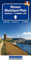
Hesse - Rhineland-Palatinate - Saarland K+F Regional Map
Berlin - Brandenburg - Saxony-Anhalt region at 1:275, 000 in a series of eight regional road maps from Kümmerly + Frey printed on sturdy waterproof and tear-resistant plastic paper, indexed and with highlighting of picturesque locations and other places of interest.Each title is double-sided, with part of one of the sides taken by the index. Road network clearly shows the motorways with junction numbers, parking places and roadside facilities. Smaller roads indicate scenic sections and/or special tourist routes, entry restrictions, seasonal closures, roads not recommended for caravans, steep gradients, etc. Main railway lines are shown with stations, local airports are marked, and where appropriate car or passenger ferry connections are also indicated.Picturesque towns or
villages are prominently highlighted. Other places of tourist interest are also clearly marked, but with their names in German (e.g. Uhrenmuseum, Röm. Gutshof, Hexenlochmühle, etc.). The maps also show boundaries of national or natural parks. Topography is indicated by light relief shading with names of mountain chains, valleys, etc, plus colouring for woodlands. Latitude and longitude lines are drawn at 10’ intervals.Map legend includes English.
villages are prominently highlighted. Other places of tourist interest are also clearly marked, but with their names in German (e.g. Uhrenmuseum, Röm. Gutshof, Hexenlochmühle, etc.). The maps also show boundaries of national or natural parks. Topography is indicated by light relief shading with names of mountain chains, valleys, etc, plus colouring for woodlands. Latitude and longitude lines are drawn at 10’ intervals.Map legend includes English.

Product Description
Reviews/Comments
Add New
Vouchers
No voucher codes found.
Do you know a voucher code for this product or supplier? Add it to Insights for others to use.
Do you know a voucher code for this product or supplier? Add it to Insights for others to use.
 Denmark