
 United Kingdom
 France
 Germany
 Netherlands
 Sweden
 USA
USA
 Italy
Italy
 Spain
Spain
More From Contributor
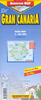


Gran Canaria F&B
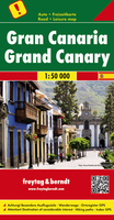
Gran Canaria at 1:50, 000 on a GPS-compatible road map from Freytag & Berndt prominently highlighting the island’s main places of interest described in a multilingual booklet attached to the map cover. Many place names are in larger size print than found on most maps of the island.Gran Canaria’s landscape is presented by contours and relief shading, with plenty of names of peaks, valleys and other topographic features. Road network emphasises main roads, with interchange names prominently marked, and includes local roads and selected country tracks. Driving distances are marked on main routes. Scenic roads are highlighted, as are hiking trails. Icons indicate various facilities and places of interest, including campsites, viewpoints, etc. The island’s best sights are
prominently highlighted and described in the accompanying booklet attached to the map cover. The map has a 5km UTM grid plus latitude and longitude margin ticks at 2’ intervals. The index, also in the booklet, lists locations with their GPS coordinates. Map legend and the text of sights descriptions include English.
prominently highlighted and described in the accompanying booklet attached to the map cover. The map has a 5km UTM grid plus latitude and longitude margin ticks at 2’ intervals. The index, also in the booklet, lists locations with their GPS coordinates. Map legend and the text of sights descriptions include English.

Product Description
Reviews/Comments
Add New
Vouchers
No voucher codes found.
Do you know a voucher code for this product or supplier? Add it to Insights for others to use.
Do you know a voucher code for this product or supplier? Add it to Insights for others to use.
 Denmark