
 United Kingdom
 France
 Germany
 Netherlands
 Sweden
 USA
USA
 Italy
Italy
 Spain
Spain
More From Contributor


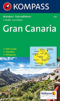
Gran Canaria Kompass 237
Gran Canaria in a series of maps of the Canary Islands from Kompass, Europe’s leading publisher of detailed, contoured hiking maps. Excellent also for exploring each island on bike or by car, the maps highlight numerous hiking trails, indicating difficult sections, and show cycle routes. A wide range of symbols highlight various facilities and places of interest, including campsites and youth hostels, beaches, sport and leisure facilities, etc. The maps have a UTM grid for GPS users. Map legends included English. Street plans of main towns or holiday resorts are also provided.*In this title:* contour lines are at 100m intervals, with relief shading, spot heights and plenty of names of peaks, mountain ranges and other geographical features. Boundaries of the national park and
other protected areas are marked. Overprint for hiking trails indicates steep sections and paths suitable only for experienced climbers. Local bus stops are marked. The map has a 2km UTM grid.Street plans show Las Palmas de Gran Canaria (1:23, 000) and the Maspalomas - Playa del Inglés - San Augustin area (1:34, 000)Please note before ordering: the map comes with an illustrated booklet, in German only, describing the main sights. The booklet is not available in English edition. The map itself has a legend in English and can be used without the booklet.
other protected areas are marked. Overprint for hiking trails indicates steep sections and paths suitable only for experienced climbers. Local bus stops are marked. The map has a 2km UTM grid.Street plans show Las Palmas de Gran Canaria (1:23, 000) and the Maspalomas - Playa del Inglés - San Augustin area (1:34, 000)Please note before ordering: the map comes with an illustrated booklet, in German only, describing the main sights. The booklet is not available in English edition. The map itself has a legend in English and can be used without the booklet.

Product Description
Reviews/Comments
Add New
Vouchers
No voucher codes found.
Do you know a voucher code for this product or supplier? Add it to Insights for others to use.
Do you know a voucher code for this product or supplier? Add it to Insights for others to use.
 Denmark