
 United Kingdom
 France
 Germany
 Netherlands
 Sweden
 USA
USA
 Italy
Italy
 Spain
Spain
More From Contributor

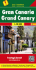
Gran Canaria
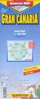
Gran Canaria, Las Palmas and the island’s main resorts on a clear and informative, waterproof and tear-resistant map from Berndtson, with both the road map and the street plans indexed and highlighting the island’s 15 top rated sites and other places of interest, as well as providing general tourist information. On one side a map at 1:100, 000 shows the island’s road network, including selected cart tracks and footpaths. Scenic routes are highlighted and boundaries of national parks are marked. A wide range of symbols indicate various places of interest, including beaches, campsites, viewpoints, wildlife reserves, sport and recreational facilities, etc. 15 of the island’s main sights are marked, with a separate panel providing brief descriptions. Topography is shown by
relief shading with names of numerous peaks. The index has a separate list of places of interest and beaches. The map has no geographical coordinates.On the reverse is a street plan of Las Palmas at 1:10, 000. One way streets, car parks, places of interest and selected hotels are highlighted. Street index includes lists of sights, consulates, parks, etc. Also included are plans of Puerto Rico (1:10, 000) and the Maspalomas - Playa del Inglés area (1:25, 000), with indexes and lists of accommodation facilities, etc.The map also provides an overview of the whole of the Canary Islands (1:1, 200, 000) showing ferry connections, panels with climate details month by month and other useful tourist information. The map is printed on light, waterproof and tear-resistant plastic paper.Map
legend includes English. All descriptions and notes are in English only.

Product Description
Reviews/Comments
Add New
Vouchers
No voucher codes found.
Do you know a voucher code for this product or supplier? Add it to Insights for others to use.
Do you know a voucher code for this product or supplier? Add it to Insights for others to use.
 Denmark