
 United Kingdom
 France
 Germany
 Netherlands
 Sweden
 USA
USA
 Italy
Italy
 Spain
Spain
More From Contributor


China Central Wall Map
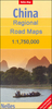
Central China Wall Map at 1:2, 000, 000 from Gizi Map, size 124 x 88cm (49” x 34.5” approx), with attractive presentation of the region’s varied topography, tourist sights including the Great Wall, and coverage from Shenyang to Shanghai.Bold altitude colouring with plenty of names of mountain ranges and other geographical features, peak heights, etc, provides an excellent picture of the region’s geography. Names of main towns are also given in Chinese script and, where appropriate, with local alternatives. The map shows the region’s road and rail networks, with intermediate driving distances marked on many routes. Also marked are provincial boundaries with names of the provinces. The map shows both the Great Wall of China and the Wall of Genghis Khan, and symbols
highlight various places of interest. Latitude and longitude lines are drawn at 1° intervals. The index is on the reverse side. Multilingual legend includes English.Please note: this title is part of Gizi Map’s coverage of China at 1:2, 000, 000, available both as folded maps and as wall maps – to see the full list of the titles and the exact coverage by each map please click on the series link.
highlight various places of interest. Latitude and longitude lines are drawn at 1° intervals. The index is on the reverse side. Multilingual legend includes English.Please note: this title is part of Gizi Map’s coverage of China at 1:2, 000, 000, available both as folded maps and as wall maps – to see the full list of the titles and the exact coverage by each map please click on the series link.

Product Description
Reviews/Comments
Add New
Vouchers
No voucher codes found.
Do you know a voucher code for this product or supplier? Add it to Insights for others to use.
Do you know a voucher code for this product or supplier? Add it to Insights for others to use.
 Denmark