
 United Kingdom
 France
 Germany
 Netherlands
 Sweden
 USA
USA
 Italy
Italy
 Spain
Spain
More From Contributor


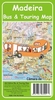


Madeira Bus And Touring Map
Madeira Bus and Touring Map presenting on one side the whole island at 1:60, 000 with topography, hiking routes and bus connections, whist on the reverse a street plan of Funchal shows bus routes within the city.On one side is a map of the whole island with contours and altitude colouring vividly presenting its topography. The map shows the road network including small country lanes and tracks and highlights hiking trails recommended by the publishers in their guidebooks to Madeira. Symbols indicate locations of various sights and facilities, including campsites, hotels, bars and restaurants, etc. Locations with bus service are clearly annotated with bus numbers and surrounding panels provide more detailed information about the various bus routes, departure times, etc. The map has
latitude and longitude lines at intervals of 5
latitude and longitude lines at intervals of 5
Product Description
Reviews/Comments
Add New
Intelligent Comparison
Archived Product
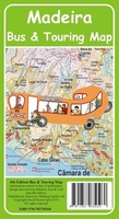
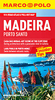
Madeira Bus & Touring Map Stanfords
£3.99
Archived Product
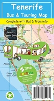
Tenerife Bus & Touring Map Stanfords
£3.99
Archived Product
Madeira Tour And Trail Map PAPER Stanfords
£5.99
Vouchers
No voucher codes found.
Do you know a voucher code for this product or supplier? Add it to Insights for others to use.
Do you know a voucher code for this product or supplier? Add it to Insights for others to use.
 Denmark