
 United Kingdom
 France
 Germany
 Netherlands
 Sweden
 USA
USA
 Italy
Italy
 Spain
Spain
More From Contributor


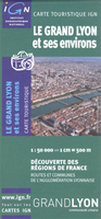
Lyon Environs IGN Map
Detail regional road map of Lyon and its surrounding area at 1:50, 000, with coverage extending north to south from Trevoux to Vienne, and east to west from Mountains of Lyon to Bourgoin-Jallieu. Detailed mapping of regional and minor local roads is combined with very clear presentation of motorways and main national routes.The map indicates road width and the number of lanes, access restrictions, unmaintained sections of minor local roads, etc. Sections in construction, both on main routes and local roads are displayed. The map also shows the railway network with stations. Topography is shown with relief shading and contour lines and intervals of 20metres, basic terrain variations denoted by simple use of colours. A wide range of symbols highlight numerous places of interest and
local facilities.Map legend includes English.
local facilities.Map legend includes English.

Product Description
Reviews/Comments
Add New
Intelligent Comparison
Archived Product

Limoges And Its Environs IGN Map Stanfords
£7.50
Archived Product

Lille And Its Environs IGN Map Stanfords
£7.50
Archived Product

Dijon And Its Environs IGN Map Stanfords
£7.50
Archived Product

Rouen And Its Environs IGN Map Stanfords
£7.50
Archived Product

Nancy And Its Environs IGN Map Stanfords
£7.50
Archived Product

Tours And Its Environs IGN Map Stanfords
£7.50
Archived Product

Pau And Its Environs IGN Map Stanfords
£7.50
Archived Product

Toulon And Its Environs IGN Map Stanfords
£7.50
Vouchers
No voucher codes found.
Do you know a voucher code for this product or supplier? Add it to Insights for others to use.
Do you know a voucher code for this product or supplier? Add it to Insights for others to use.
 Denmark