
 United Kingdom
 France
 Germany
 Netherlands
 Sweden
 USA
USA
 Italy
Italy
 Spain
Spain
More From Contributor


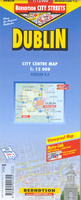
Lublin
Lublin in a series of indexed street plans from PPWK covering the cities with their outer suburbs and showing all public transport lines. Where necessary, an enlargement of centre is included. English map legend and GPS coordinates are provided.PPWK plans are usually double-sided, either covering the city in two parts or providing insets with plans of smaller neighbouring locations. The plans are particularly good for travelling by public transport to and from the outer suburbs - tram and bus routes are shown with line numbers and stops, and plenty of other detail and information on the map makes it easy to orientate oneself in the unfamiliar surroundings. For cars, one way streets are marked.Colours and graphics indicate historical monuments, public buildings, industrial areas,
parks, etc. Symbols mark various places of interest and facilities, including petrol stations, etc. Many plans also show hiking and cycling routes. Latest editions are GPS compatible with a latitude and longitude grid at intervals of 30
parks, etc. Symbols mark various places of interest and facilities, including petrol stations, etc. Many plans also show hiking and cycling routes. Latest editions are GPS compatible with a latitude and longitude grid at intervals of 30
Product Description
Reviews/Comments
Add New
Intelligent Comparison
Archived Product
Dublin Stanfords
£8.50
Archived Product
Dublin Stanfords
£4.99
Archived Product
Dublin Stanfords
£3.99
Archived Product
Dublin Stanfords
£8.50
Archived Product
Dublin Stanfords
£8.99
Archived Product
Dublin Stanfords
£14.99
Archived Product
Dublin Stanfords
£8.99
Archived Product
Dublin 3 Stanfords
£9.99
Vouchers
No voucher codes found.
Do you know a voucher code for this product or supplier? Add it to Insights for others to use.
Do you know a voucher code for this product or supplier? Add it to Insights for others to use.
 Denmark