
 United Kingdom
 France
 Germany
 Netherlands
 Sweden
 USA
USA
 Italy
Italy
 Spain
Spain
More From Contributor


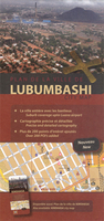
Lubumbashi
Street plan of Lubumbashi at 1:18, 500 from the Belgian publishers Aquaterra, with coverage of the suburbs extending to the Luano airport, street index and an extensive listing of institutions, services and places of interest.The plan indicates main traffic routes across the town and within its administrative boundary provides names of both neighbourhoods and streets. Locations of governmental and other public institutions, commercial businesses, various facilities and places of interest are highlighted and cross-referenced to accompanying lists, where many are shown with full addresses and contact numbers. Outside the city boundary only neighbourhoods and main streets are named. Map legend is in French and English.

Product Description
Reviews/Comments
Add New
Intelligent Comparison
Archived Product
Luumaki Stanfords
£17.99
Vouchers
No voucher codes found.
Do you know a voucher code for this product or supplier? Add it to Insights for others to use.
Do you know a voucher code for this product or supplier? Add it to Insights for others to use.
 Denmark