More From Contributor
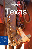
£17.95
Hornsey is a generally prosperous part of north London. The Highgate & Hornsey village sections are mainly Victorian, but much of the rest is well-built late Victorian or Edwardian, which appealed to people who wanted to escape overcrowded central London. They also found that they had marvellous views out over the capital, all the way to the Thames & beyond. ...
Archived Product
£9.99
Libya & Tunisia at 1:1, 650, 000 & 1: 800, 000 respectively, on a double-sided, indexed road map from ITMB including street plans of Tunis & Tripoli & a glossary of geographical terms. The map displays Libya on one side & Tunisia on the other, each accompanied by its capital city plan & a separate index. Road networks include main paved, secondary & unsurfaced minor roads & tracks, with intermediate distances on major roads. Symbols clearly indicate petrol stations, international & local airports, & railways & ferry routes are also shown. Topography is represented by altitude colouring & graphics indicate deserts, swamps, salt flats, oasis, water wells & seasonal rivers, etc. Numerous spot heights are marked & mountain ranges named, & other geographical features are present. Symbols mark locations of various places of interest including towns with tourist accommodation, campsites, historic ruins & archaeological sites, beaches, ports, etc. The map also shows gas & oil wells & pipelines. International boundaries & border crossing are marked. The map is annotated with historical & tourist information of places of interest & illustrated with colour pictures. It

Includes::
street plans of central Tunis & Tripoli & a glossary of geographical terms used on the map. The map is indexed & all place names are shown transliterated only. Latitude & longitude lines are drawn at intervals of 2°.

...
Archived Product
£3.50
Toxteth in 1906 in a fascinating series of reproductions of old Ordnance Survey plans in the Alan Godfrey Editions, ideal for anyone interested in the history of their neighbourhood or family. The map is double-sided & covers an area of south Liverpool, largely comprising the western half of Toxteth. Coverage of the main map stretches from the docks eastward to Maud Street & Park Hill Road, & from Parliament Street southward to Beresford Road. Features include Coburg Dock, Brunswick Dock, Toxteth Dock, part of Harrington Dock, Overhead Railway with several stations, Brunswick Goods station, South Docks Goods station, Brunswick Docks goods station, engine sheds & many sidings etc, tramways, countless streets of terraced houses, City Hospital, section of Cheshire Lines Railway, public baths, South End Mills, schools & chapels, Royal Southern Hospital, Mersey Brewery & bottling stores, etc. On the reverse is the adjacent sheet 113.06, extending coverage southward to include Herculaneum Dock, Park Hill Hospital, Petroleum Stores & Dingle Bank. A street directory for Caryl Street & Grafton Street is also included. About the Alan Godfrey Editions of the 25” OS Series: Selected towns in Great Britain & Ireland are covered by maps showing the extent of urban development in the last decades of the 19th & early 20th century. The plans have been taken from the Ordnance Survey mapping & reprinted at about 15 inches to one mile (1:4, 340). On the reverse most maps have historical notes & many also include extracts from contemporary directories. Most maps cover about one mile (1.6kms) north/south, one & a half miles (2.4kms) across; adjoining sheets can be combined to provide wider coverage.FOR MORE INFORMATION & A COMPLETE LIST OF ALL AVAILABLE TITLES PLEASE CLICK ON THE SERIES LINK. ...
Archived Product
£11.99
The Coast Near Livorno at 1:50, 000 in a series of hiking maps from Edizioni Multigraphic covering Tuscany, parts of Umbria, & the adjoining areas. The cartography is rather old fashioned & sometimes not as clear as in the other map series but for many areas, especially for parts of Tuscany, these are the only hiking maps available. Most maps have contours at 25-metre intervals, with some relief shading & colouring for forests. An overprint highlights hiking paths, including all the popular hiking routes such as the Grandi Sentieri della Provincia di Siena, etc. The overprint also shows campsites &, where appropriate, mountain refuges & other types of alpine accommodation. Some of the maps indicate latitude & longitude at the map corners, but with longitude sometimes based on Rome rather than Greenwich. Map legends vary, most maps include English. Many maps include street plans & additional notes on the region. For more details see individual descriptions.* In this title: double-sided map covering the coast of Tuscany from north of Livorno to Piombino & Follonica & extending about 35km inl&, The map has contours, although no interval is given, & spot heights. Local footpaths & towns & villages of particular interest are highlighted. Geographical coordinates at the map corners have longitude based on Greenwich. Map legend

Includes::
English.

...
Archived Product
£4.99
With Lonely Planet`s Tibetan Phrasebook, let no barriers
- language or culture
- get in your way. Grab this phrasebook & trek

...
Archived Product
£7.99
Reproduction by the Old House Book of a lovely official souvenir map originally produced for the New York World`s Fair in 1939, with street plans, a panorama of the Fair’s main exhibit area, beautiful drawings of the city’s famous buildings, lists of important sights & various other facilities – everything visitors needed to know to get the best from their visit to the Fair. On one side are two maps showing “elevated subway lines” & “principal auto routes” linking Manhattan & Brooklyn with Flushing Meadows in Queens where the Fair was held. This side of the map is decorated with panorama drawings of the Manhattan skyline & of 18 famous buildings, The reverse side provides more interesting information: a large panorama map of the Fair’s main exhibit area cross-referenced to a list of pavilions, a street plan of NYC’s theatre & “motion picture” district with a list of over 100 venues, several lists of various sights & facilities (tallest buildings, museums & parks, etc), plus an advert for Hotel Seymour on West 45th Street offering double rooms at $7 & suites at £10 – those were the days! The map is presented in an elegant decorative cover with notes about the history of the Fair. To see other titles in this series please click on the series link. ...
Archived Product
£3.50
Northampton in 1899 in a fascinating series of reproductions of old Ordnance Survey plans in the Alan Godfrey Editions, ideal for anyone interested in the history of their neighbourhood or family. The map covers most of central Northampton & extends southward to Bridge Street station & St Leonards Road. Features include the town centre, tramways, LNWR railway with Castle station, Northampton & Peterborough Branch with Bridge Street station, Midland Railway with terminus, Grand Junction Canal, Cotton End area, River Nene, St James End area, St James church, Northampton Brewery, Phoenix Brewery, Cattle Market, All Saints church, Market Square, St Sepulchre`s church, St Giles church, Infirmary, Vigo Brick Works, St Katharine`s church, Albion Brewery, St Peter`s church, County Hall, Castle Brewery, tanneries, boot factories, etc. On the reverse are street directory entries for Abington Square & Street, Guildhall Road, Horsemarket & Market Square. About the Alan Godfrey Editions of the 25” OS Series: Selected towns in Great Britain & Ireland are covered by maps showing the extent of urban development in the last decades of the 19th & early 20th century. The plans have been taken from the Ordnance Survey mapping & reprinted at about 15 inches to one mile (1:4, 340). On the reverse most maps have historical notes & many also include extracts from contemporary directories. Most maps cover about one mile (1.6kms) north/south, one & a half miles (2.4kms) across; adjoining sheets can be combined to provide wider coverage.FOR MORE INFORMATION & A COMPLETE LIST OF ALL AVAILABLE TITLES PLEASE CLICK ON THE SERIES LINK. ...
Archived Product
£5.99
Elasticated cord line with small metal hooked ends & alternative suction cups. The twisted cord eliminates the need for pegs. Simply secure the line at both ends & insert the garment`s ends between the strands put the garment over the line. This line is ideal for small bathrooms, caravans & camping. Length 1.2m
- 2m (6 feet).
...
Archived Product
£8.99
The Delta of the Po on a light, waterproof & tear resistant map from the Touring Club Italiano, with street plans of central Ferrara & Ravenna, plus extensive text, all in Italian only, on recommended sights, etc. This title, unlike most other maps in the TCI Smart Map series, is at 1:200, 000. The map covers an area from Stellata on the Po, just west of Ferrara, extending along the coast from Chioggia in the north to Cesenático. Cartography is from TCI’s excellent regional series at 1:200, 000, with an additional overprint to highlight a cycle route along the Po & various places of interest including beaches, bird watching & other natural sites, etc. The map & the accompanying street plans of central Ravenna & Ferrara in addition indicate the publishers’ choices of 10 best sights in the region. The plans also show other places of interest & car parks. The reverse side provides extensive notes about the region, its cultural & historical heritage, gastronomy, landscape, leisure activities, etc. Also provided is more information about the cycle route along the Po, including a route profile. Map legend & all the text are in ITALIAN only. To see the list of titles in this series please click on the series link. ...
Archived Product

Lonely Planet Texas

Texas in the Countries and Regions series from Lonely Planet, market-leading comprehensive guides aimed at independent travellers and serving a large range of international destinations. Frank and informal in style, the guides explore an extensive range of sights, activities, accommodation, restaurants and nightlife and are designed for practical use while travelling on the road. Written and researched by a team of experts, each book is independent in its recommendations and suggestions, often offering individual takes on individual destinations.Widely recognised for their reliability, each Lonely Planet country and region guide has the same layout. Introductory sections profile the destination with individual chapters on particular highlights, getting started, (including when to
go) itineraries, history, culture, arts, food and drink and the environment. Each guide is organised geographically by region, with individual sections detailing an extensive range of sights, places of interest, attractions, restaurants, nightlife, accommodation and any local activities. The guides have detailed explanations of historical context where relevant. There is also practical guidance on ‘getting there and around’, allowing visitors to plan their trip accordingly. Information boxes throughout the text give insights into local culture and customs as well as offering suggestions for restaurants and bars and notable shopping opportunities. There are dedicated sections on major cities and towns within each region, with relevant information on orientation, sights,
activities, eating and drinking, tours, courses, festivals and events. Accommodation is divided into budget, mid-range and top-end in order to cater for a wide range of budgets. All places highlighted in the text are cross-referenced to black and white overview maps showing their respective locations. ‘Don’t Miss’ information boxes give bullet-pointed lists of notable local attractions and their relevant page numbers in the guide. An extensive Directory section gives important practical guidance on accommodation, activities, business hours, children, climate charts, customs, dangers and annoyances, embassies, insurance, internet access, maps, money, photography, shopping, solo travellers, transport, travellers with disabilities, visas, volunteering and women
travellers, among other useful information.
RIP - This product is no longer available on our network. It was last seen on 25.09.2019

This page now acts as a permanent archive for this product. Add more information using the comments box below to ensure it can still be found by future generations.

Use our search facility to see if it is available from an alternative contributor.
  • Availability: Out Of Stock
  • Supplier: Stanfords
  • SKU: 9781742201993
Availability: In Stock
£15.99

Product Description

Texas in the Countries & Regions series from Lonely Planet, market-leading comprehensive guides aimed at independent travellers & serving a large range of international destinations. Frank & informal in style, the guides explore an extensive range of sights, activities, accommodation, restaurants & nightlife & are designed for practical use while travelling on the road. Written & researched by a team of experts, each book is independent in its recommendations & suggestions, often offering individual takes on individual destinations. Widely recognised for their reliability, each Lonely Planet country & region guide has the same layout. Introductory sections profile the destination with individual chapters on particular highlights, getting started, (including when to go) itineraries, history, culture, arts, food & drink & the environment. Each guide is organised geographically by region, with individual sections detailing an extensive range of sights, places of interest, attractions, restaurants, nightlife, accommodation & any local activities. The guides have detailed explanations of historical context where relevant. There is also practical guidance on ‘getting there & around’, allowing visitors to plan their trip accordingly. Information boxes throughout the text give insights into local culture & customs as well as offering suggestions for restaurants & bars & notable shopping opportunities. There are dedicated sections on major cities & towns within each region, with relevant information on orientation, sights, activities, eating & drinking, tours, courses, festivals & events. Accommodation is divided into budget, mid-range & top-end in order to cater for a wide range of budgets. All places highlighted in the text are cross-referenced to black & white overview maps showing their respective locations. ‘ Don’t Miss’ information boxes give bullet-pointed lists of notable local attractions & their relevant page numbers in the guide. An extensive Directory section gives important practical guidance on accommodation, activities, business hours, children, climate charts, customs, dangers & annoyances, embassies, insurance, internet access, maps, money, photography, shopping, solo travellers, transport, travellers with disabilities, visas, volunteering & women travellers, among other useful information.

Reviews/Comments

Add New

Intelligent Comparison

Oooops!
We couldn't find anything!
Perhaps this product's unique.... Or perhaps we are still looking for comparisons!
Click to bump this page and we'll hurry up.

Price History

Vouchers

No voucher codes found.
Do you know a voucher code for this product or supplier? Add it to Insights for others to use.

Facebook

Jargon Buster

Black - A colour which does not emit any colour of the spectrum. Black absorbs all frequencies of the spectrum.
White - A colour combining all colours
team - A group of people or animals linked by a common purpose.
History - Anything that happens in the past. An acedemic subject.
Large - something that takes up more space than normal.
Road - a manmade lane or a path that is used to speed up travel.
Wide - Something with a large width.
Accommodation - A room in which someone can live in, for example in a hotel
Practical - Weather a task is easy to carry out and realistically succeed.
Children - A young life form within the early stages of physical development,
Individual - A single separate item or person.
Transport - Something that carries people or goods.
Environment - The conditions and surrounding area.

Supplier Information

Stanfords
Stanfords was established in 1853 and opened their iconic Covent Garden flagship store in 1901. They have become the top retailer of maps, travel books and accessories in the UK and arguably offer the largest selection of maps and travel books worldwide. Famous names such as Captain Robert Falcon Scott, Ranulph Fiennes and Michael Palin have purchased from Stanfords. They now have a shop in Bristol and both stores together with other venues operate a calendar of events including talks, book signings and exhibitions. As a specialist map retailer, the map selection is comprehensive and includes road maps, street maps and walking maps from worldwide destinations, as well as a selection of world atlases and wall maps. Books include travel guides and travel literature. Stanfords also stock globes, from miniatures made of blue marble to magnificent floor-standing globes. The website features a selection of interesting articles on travel topics.
Page Updated: 2023-11-12 20:15:36

Community Generated Product Tags

Oh No! The productWIKI community hasn't generated any tags for this product yet!
Menu