More From Contributor

£15.99
Texas in the Countries & Regions series from Lonely Planet, market-leading comprehensive guides aimed at independent travellers & serving a large range of international destinations. Frank & informal in style, the guides explore an extensive range of sights, activities, accommodation, restaurants & nightlife & are designed for practical use while travelling on the road. Written & researched by a team of experts, each book is independent in its recommendations & suggestions, often offering individual takes on individual destinations. Widely recognised for their reliability, each Lonely Planet country & region guide has the same layout. Introductory sections profile the destination with individual chapters on particular highlights, getting started, (including when to go) itineraries, history, culture, arts, food & drink & the environment. Each guide is organised geographically by region, with individual sections detailing an extensive range of sights, places of interest, attractions, restaurants, nightlife, accommodation & any local activities. The guides have detailed explanations of historical context where relevant. There is also practical guidance on ‘getting there & around’, allowing visitors to plan their trip accordingly. Information boxes throughout the text give insights into local culture & customs as well as offering suggestions for restaurants & bars & notable shopping opportunities. There are dedicated sections on major cities & towns within each region, with relevant information on orientation, sights, activities, eating & drinking, tours, courses, festivals & events. Accommodation is divided into budget, mid-range & top-end in order to cater for a wide range of budgets. All places highlighted in the text are cross-referenced to black & white overview maps showing their respective locations. ‘ Don’t Miss’ information boxes give bullet-pointed lists of notable local attractions & their relevant page numbers in the guide. An extensive Directory section gives important practical guidance on accommodation, activities, business hours, children, climate charts, customs, dangers & annoyances, embassies, insurance, internet access, maps, money, photography, shopping, solo travellers, transport, travellers with disabilities, visas, volunteering & women travellers, among other useful information. ...
Archived Product
£4.99
With Lonely Planet`s Tibetan Phrasebook, let no barriers
- language or culture
- get in your way. Grab this phrasebook & trek

...
Archived Product
£7.99
Reproduction by the Old House Book of a lovely official souvenir map originally produced for the New York World`s Fair in 1939, with street plans, a panorama of the Fair’s main exhibit area, beautiful drawings of the city’s famous buildings, lists of important sights & various other facilities – everything visitors needed to know to get the best from their visit to the Fair. On one side are two maps showing “elevated subway lines” & “principal auto routes” linking Manhattan & Brooklyn with Flushing Meadows in Queens where the Fair was held. This side of the map is decorated with panorama drawings of the Manhattan skyline & of 18 famous buildings, The reverse side provides more interesting information: a large panorama map of the Fair’s main exhibit area cross-referenced to a list of pavilions, a street plan of NYC’s theatre & “motion picture” district with a list of over 100 venues, several lists of various sights & facilities (tallest buildings, museums & parks, etc), plus an advert for Hotel Seymour on West 45th Street offering double rooms at $7 & suites at £10 – those were the days! The map is presented in an elegant decorative cover with notes about the history of the Fair. To see other titles in this series please click on the series link. ...
Archived Product
£3.50
Northampton in 1899 in a fascinating series of reproductions of old Ordnance Survey plans in the Alan Godfrey Editions, ideal for anyone interested in the history of their neighbourhood or family. The map covers most of central Northampton & extends southward to Bridge Street station & St Leonards Road. Features include the town centre, tramways, LNWR railway with Castle station, Northampton & Peterborough Branch with Bridge Street station, Midland Railway with terminus, Grand Junction Canal, Cotton End area, River Nene, St James End area, St James church, Northampton Brewery, Phoenix Brewery, Cattle Market, All Saints church, Market Square, St Sepulchre`s church, St Giles church, Infirmary, Vigo Brick Works, St Katharine`s church, Albion Brewery, St Peter`s church, County Hall, Castle Brewery, tanneries, boot factories, etc. On the reverse are street directory entries for Abington Square & Street, Guildhall Road, Horsemarket & Market Square. About the Alan Godfrey Editions of the 25” OS Series: Selected towns in Great Britain & Ireland are covered by maps showing the extent of urban development in the last decades of the 19th & early 20th century. The plans have been taken from the Ordnance Survey mapping & reprinted at about 15 inches to one mile (1:4, 340). On the reverse most maps have historical notes & many also include extracts from contemporary directories. Most maps cover about one mile (1.6kms) north/south, one & a half miles (2.4kms) across; adjoining sheets can be combined to provide wider coverage.FOR MORE INFORMATION & A COMPLETE LIST OF ALL AVAILABLE TITLES PLEASE CLICK ON THE SERIES LINK. ...
Archived Product
£5.99
Elasticated cord line with small metal hooked ends & alternative suction cups. The twisted cord eliminates the need for pegs. Simply secure the line at both ends & insert the garment`s ends between the strands put the garment over the line. This line is ideal for small bathrooms, caravans & camping. Length 1.2m
- 2m (6 feet).
...
Archived Product
£10.99
The High Route along the Rhine between Wiesbaden / Mainz & Bonn on a detailed, GPS compatible map at 1:50, 000 from Kompass printed on durable, waterproof & tear-resistant synthetic paper. The map presents the route on five separate panels & highlights its course along both banks of the river. Also marked are numerous other local & long-distance hiking & cycling routes, various accommodation options, places of interest, etc. Contour interval is 10m & additional colouring indicates local wine & hop growing fields. Accompanying text describing the route & various locations along it is in German only. Map legend

Includes::
English.KOMPASS HIKING & RECREATIONAL MAPS: this title is part of an extensive series covering Austria, much of Germany & the Slovenian Alps. Kompass are Europe’s largest publishers of hiking maps; their mapping of other countries, including expanding coverage of Italy, is listed on our website separately.CARTOGRAPHY: the maps are contoured with additional shading, graphic relief & colouring to provide a more detailed picture of the terrain, vegetation and/or land use. Contour interval varies from 10m in the coastal areas of Northern Germany to 40 or 50 metres in the mountainous regions. All the maps highlight local & long-distance waymarked footpaths, including climbing trails. Most titles also show cycling routes, mountain bike trails, &, the in mountainous areas, ski routes. The maps indicate various types of accommodation (selected inns & hotels, youth hostels, campsites, mountain refuges), as well as recreational facilities, places of interest, etc. Latest editions also show access by public transport with bus stops and/or Park+ Ride facilities.GEOGRAPHICAL COORDINATES: unless indicated to the contrary in the individual description, the maps have a UTM grid for GPS users. MAP LEGEND: most maps now include full English legend, particularly titles covering the Alpine areas. Some maps covering mainly eastern Austria or the less popular parts of Germany may still have a legend in German only.OTHER

Features:
selected titles include on the reverse panorama drawings of their area with names of villages, peaks, valleys, etc. and/or have a booklet with pictures of local wild flowers with their Latin names. Many titles are now published as competitively priced sets of two or more maps, offering a wider coverage.BOOKLETS: PLEASE NOTE BEFORE ORDERING!
- many titles come with a booklet describing the area and/or various hiking routes. Unless indicated in the individual description that the booklet

Includes::
English, these booklets are IN GERMAN only. The booklets are not necessary to use the maps since, as stated above, full English language map legend is provided.


...
Archived Product
£13.95
The Ridgway, a 139km / 87 mile national trail from Overton Hill in Wiltshire to Ivinghoe Beacon in Buckinghamshire, presented at 1:40, 000 on a light, waterproof & tear-resistant map from Harvey Map Services. The route is shown on six overlapping panels. Maps in the Harvey’s series covering Great Britain’s national trails & other long-distance footpaths are printed on light, waterproof & tear-resistant synthetic paper & cover the routes at 1:40, 000 or 1:60, 000. Topography is shown by contours at 15m intervals, with additional spot heights plus colouring and/or graphics to provide a very detailed picture of the terrain (boulder fields, scree, crags, etc) & vegetation / land use (pastures, moorl&, woodlands, etc). In Scotland peaks & hills classified as Munros, Corbetts & Donalds are marked. The overprint for the long-distance trail shows sections on local or main roads (highlighting danger points), on tracks, & on footpaths, indicating intermittent or not visible paths. The maps also show other right of way paths, including permissive paths & bridleways. Symbols indicate various facilities & accommodation options (including campsites & youth hostels), pubs & refreshments, food shops, banks, information points, etc, both along the route itself & in the nearby locations. All maps are GPS compatible, with the British National Grid overprinted on each panel. The maps also include useful contact details & general advice. To see other titles in this series please click on the series link. ...
Archived Product
£11.99
Map No. 696, The Chestnut Trail (Sentiero del Castagno / Keschtnweg) at 1:25, 000 on a durable, waterproof & tear-resistant map from Kompass in their series of detailed maps of the Dolomites. The map is double-sided &, in addition to the usual overprint for local & long-distance trails, etc, highlights the Chestnut Trail along the Isarco/ Eisack Valley linking Novacella/ Neustift, just north of Bressanone/ Brixen, with Bolzano.CARTOGRAPHY: Kompass maps of the Dolomites at 1:25, 000 have contours at 25-m intervals. An overprint shows local & long-distance footpaths, including all the high level routes (Alte Vie). The maps also show the ”via ferrata” paths along the iron rails & ladders fitted into the rock faces. Other information

Includes::
various types of accommodation (campsites, alpine huts & refuges, etc.), recreational facilities, places of interest, local bus stops, etc. Many titles also have mountain bike trails or ski routes. Selected titles include on the reverse panorama drawings of the area, as indicated in the individual descriptions.GEOGRAPHICAL COORDINATES: most maps are now GPS compatible
- titles without geographical coordinates are annotated to that effect in their individual description.MAP LEDENG

Includes::
English.BOOKLETS
- PLEASE NOTE BEFORE ORDERING
- many titles come with booklets describing the area and/or various hiking routes. These booklets are in Italian & German only, apart from a handful of titles where an English language booklet is specifically indicated in the individual description. So, unless English language booklet is actually mentioned, the map can only be supplied with an Italian/ German booklet. These booklets are not necessary to use the maps since, as stated above, full English language map legend is provided.


...
Archived Product
£10.99
The Speyside Way, a 128km /80 miles trail from Buckie on Scotland’s Moray Firth to Aviemore in the Cairngorms, presented by Rucksack Readers in handy A5 size, spiral-bound, waterproof guide with mapping at 1:110, 000. Coverage

Includes::
the spur to Tomintoul. The guide provides general advice on when to go, availability of accommodation, etc, &

Includes::
notes on the region’s famous whisky distilleries, railway heritage, habitats & wildlife, etc. Detailed route descriptions, arranged in daily stages, are preceded by a summary of each section of the route giving distance, terrain, grade, side trips (including distilleries), & availability of food & drink. The guide is illustrated with numerous colour photos. The guide shows the route highlighted on fold-out flap of the cover at 1:105, 000. The map has altitude colouring to show the topography & also indicates various facilities & places of interest. No geographical coordinates for GPS users are provided. The publishers recommend as more detailed & GPS compatible coverage the maps of the route from Harvey Map Services or from Footprint. Combined with the Rucksack Readers’ guide to the Moray Coast Trail with the Dava Way, this title can present a circular route in the region. To see other titles in this series please click on the series link.


...
Archived Product
£6.50
Indexed street map with a detailed enlargement of the town centre. Important buildings & places of interest are highlighted, including hotels & campsites, leisure, sports & cultural facilities, petrol stations, car parks, etc. The centre is also shown at 1:5, 000 in greater detail. Contours show the topography of the hills on the town ...
Archived Product

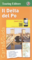
Po Delta TCI Smart Map

The Delta of the Po on a light, waterproof and tear resistant map from the Touring Club Italiano, with street plans of central Ferrara and Ravenna, plus extensive text, all in Italian only, on recommended sights, etc. This title, unlike most other maps in the TCI Smart Map series, is at 1:200, 000.The map covers an area from Stellata on the Po, just west of Ferrara, extending along the coast from Chioggia in the north to Cesenático. Cartography is from TCI’s excellent regional series at 1:200, 000, with an additional overprint to highlight a cycle route along the Po and various places of interest including beaches, bird watching and other natural sites, etc. The map and the accompanying street plans of central Ravenna and Ferrara additionally indicate the publishers’
choices of 10 best sights in the region. The plans also show other places of interest and car parks.The reverse side provides extensive notes about the region, its cultural and historical heritage, gastronomy, landscape, leisure activities, etc. Also provided is more information about the cycle route along the Po, including a route profile. Map legend and all the text are in ITALIAN only.To see the list of titles in this series please click on the series link.
RIP - This product is no longer available on our network. It was last seen on 25.09.2019

This page now acts as a permanent archive for this product. Add more information using the comments box below to ensure it can still be found by future generations.

Use our search facility to see if it is available from an alternative contributor.
  • Availability: Out Of Stock
  • Supplier: Stanfords
  • SKU: 9788836559510
Availability: In Stock
£8.99

Product Description

The Delta of the Po on a light, waterproof & tear resistant map from the Touring Club Italiano, with street plans of central Ferrara & Ravenna, plus extensive text, all in Italian only, on recommended sights, etc. This title, unlike most other maps in the TCI Smart Map series, is at 1:200, 000. The map covers an area from Stellata on the Po, just west of Ferrara, extending along the coast from Chioggia in the north to Cesenático. Cartography is from TCI’s excellent regional series at 1:200, 000, with an additional overprint to highlight a cycle route along the Po & various places of interest including beaches, bird watching & other natural sites, etc. The map & the accompanying street plans of central Ravenna & Ferrara in addition indicate the publishers’ choices of 10 best sights in the region. The plans also show other places of interest & car parks. The reverse side provides extensive notes about the region, its cultural & historical heritage, gastronomy, landscape, leisure activities, etc. Also provided is more information about the cycle route along the Po, including a route profile. Map legend & all the text are in ITALIAN only. To see the list of titles in this series please click on the series link.

Reviews/Comments

Add New

Intelligent Comparison

Oooops!
We couldn't find anything!
Perhaps this product's unique.... Or perhaps we are still looking for comparisons!
Click to bump this page and we'll hurry up.

Price History

Vouchers

No voucher codes found.
Do you know a voucher code for this product or supplier? Add it to Insights for others to use.

Facebook

Jargon Buster

Italian - A word used ot descibe something from Italy
Waterproof - Resistant to water, usualy specified by depth in metres
Car - A machine used for transport which runs on roads
Natural - not manmade
Resistant - Something that can repel against something.
Regional - An adjective to describe a set geographic area.

Supplier Information

Stanfords
Stanfords was established in 1853 and opened their iconic Covent Garden flagship store in 1901. They have become the top retailer of maps, travel books and accessories in the UK and arguably offer the largest selection of maps and travel books worldwide. Famous names such as Captain Robert Falcon Scott, Ranulph Fiennes and Michael Palin have purchased from Stanfords. They now have a shop in Bristol and both stores together with other venues operate a calendar of events including talks, book signings and exhibitions. As a specialist map retailer, the map selection is comprehensive and includes road maps, street maps and walking maps from worldwide destinations, as well as a selection of world atlases and wall maps. Books include travel guides and travel literature. Stanfords also stock globes, from miniatures made of blue marble to magnificent floor-standing globes. The website features a selection of interesting articles on travel topics.
Page Updated: 2023-11-12 20:15:36

Community Generated Product Tags

Oh No! The productWIKI community hasn't generated any tags for this product yet!
Menu