
 United Kingdom
 France
 Germany
 Netherlands
 Sweden
 USA
USA
 Italy
Italy
 Spain
Spain
More From Contributor


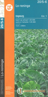
Lo-Reninge NGI Topo 20/5-6 - WWI Ypres Salient Battlefields
Lo-Reninge - Langemark, map No. 20/5-6 in the topographic survey of Belgium at 1:20, 000 covering the central part of the Ypres Salient battlefields of World War I. With Langemark, Bikschote and Steenstraat towards the southern edge of the map, this title covers the northernmost part of the Ypres Salient area.Although not specifically designed to highlight locations connected with WWI, the map contains all the information expected of detailed topographic mapping at this scale and provides excellent background for exploring the area with more specialist maps or guides. Map legend includes English. For full specifications of Belgian topographic mapping at 1:20, 000 and a list of other titles in this series please click on the series link.

Product Description
Reviews/Comments
Add New
Vouchers
No voucher codes found.
Do you know a voucher code for this product or supplier? Add it to Insights for others to use.
Do you know a voucher code for this product or supplier? Add it to Insights for others to use.
 Denmark