
 United Kingdom
 France
 Germany
 Netherlands
 Sweden
 USA
USA
 Italy
Italy
 Spain
Spain
More From Contributor


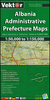


Libya
General map with plans of Tripoli and Benghazi, an enlargement for the environs of the capital, and an administrative map of the country. The map does not cover the whole of Libya, but only the coastal area and the western part of the country, extending south to just beyond 26º (i.e. most of Marzuk and Al Kufrah provinces are not included). The country’s topography is very attractively presented by contours with relief shading and spot heights, indicating wadis, saline mashes and intermittent salt lakes, wells and oasis, sand and stony deserts, lava-fields, tree savannas and grasslands.Six different types of roads plus tracks are shown with petrol stations, service stations, intermediate driving distances, and road numbers on main roads. Also marked are border crossings,
airports and airfields, shipping lines and ports, and railways, but the map provides no details of the country’s oil industry and has relatively less tourist information than on other maps. Longitude and latitude lines are drawn at 2º intervals and the multilingual legend includes English. Index of place names is on the reverse.The map includes plans showing mains streets in Tripoli and Benghazi, highlighting various facilities and places of interest. An enlargement shows the area around Tripoli in greater detail. There is also an administrative map, showing the country’s provinces with their main towns.
airports and airfields, shipping lines and ports, and railways, but the map provides no details of the country’s oil industry and has relatively less tourist information than on other maps. Longitude and latitude lines are drawn at 2º intervals and the multilingual legend includes English. Index of place names is on the reverse.The map includes plans showing mains streets in Tripoli and Benghazi, highlighting various facilities and places of interest. An enlargement shows the area around Tripoli in greater detail. There is also an administrative map, showing the country’s provinces with their main towns.

Product Description
Reviews/Comments
Add New
Intelligent Comparison
Archived Product
Libya Stanfords
£9.95
Archived Product
Libya Stanfords
£12.79
Archived Product

Libra Stanfords
£10.99
Archived Product

Lisboa Stanfords
£17.99
Archived Product

Lisboa Stanfords
£17.99
Archived Product

Lisboa Stanfords
£17.99
Vouchers
No voucher codes found.
Do you know a voucher code for this product or supplier? Add it to Insights for others to use.
Do you know a voucher code for this product or supplier? Add it to Insights for others to use.
 Denmark