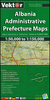
More From Contributor

£9.99
Librazhdi Prefecture at 1:110, 000 in a series of handy size, waterproof & tear-resistant, contoured & GPS compatible road maps from the Tirana-based publishers Vektor. Landscape is presented by altitude colouring & contours lines at 100m intervals, with spot heights & a few more names of topographic features than found on Vektor’s 200K road maps of the country. National parks & nature reserves are prominently highlighted. The prefecture maps appear to show the same small local dirt roads as in the 200K series, but given the increase in scale do so with greater clarity & also provide more detailed GPS coordinates (latitude & longitude lines are drawn at 5’ intervals), useful when travelling across the more remote parts of the country. Railway lines are included & local airports are marked. Symbols highlight campsites, beaches, archaeological & historical sites, caves, etc. The maps also show subdivisions of prefectures & names of the communes, & indicate administrative status of towns. Map legend

Includes::
English. Please note: border crossings are prominently marked but beyond topographic colouring no road or other information is provided outside the country’s borders.

...
Archived Product
£9.95
Waterproof & tear-resistant map, with a small plan of central Tripoli. Altitude colouring is used to convey the general relief, with different patterns representing s&, lava, dunes, hamada, etc. Hydrographic information shows numerous waterholes & wells. Communications network

Includes::
restricted private roads, as well as railways & ferry routes. Oil wells & pipelines are also marked. Tourist information

Includes::
beaches, oasis, parks & reserves, archaeological sites & other places of interest, plus selected hotels, campsites, rest houses, etc. The index of place names has a glossary of terms used in names of locations & geographical features. Latitude & longitude grid is drawn at intervals of 2


...
Archived Product
£8.99
General map with plans of Tripoli & Benghazi, an enlargement for the environs of the capital, & an administrative map of the country. The map does not cover the whole of Libya, but only the coastal area & the western part of the country, extending south to just beyond 26º (i.e. most of Marzuk & Al Kufrah provinces are not included). The country’s topography is very attractively presented by contours with relief shading & spot heights, indicating wadis, saline mashes & intermittent salt lakes, wells & oasis, sand & stony deserts, lava-fields, tree savannas & grasslands. Six different types of roads plus tracks are shown with petrol stations, service stations, intermediate driving distances, & road numbers on main roads. Also marked are border crossings, airports & airfields, shipping lines & ports, & railways, but the map provides no details of the country’s oil industry & has relatively less tourist information than on other maps. Longitude & latitude lines are drawn at 2º intervals & the multilingual legend

Includes::
English. Index of place names is on the reverse. The map

Includes::
plans showing mains streets in Tripoli & Benghazi, highlighting various facilities & places of interest. An enlargement shows the area around Tripoli in greater detail. There is also an administrative map, showing the country’s provinces with their main towns.


...
Archived Product
£12.79
Libya in the Countries & Regions series from Lonely Planet, market-leading comprehensive guides aimed at independent travellers & serving a large range of international destinations. Frank & informal in style, the guides explore an extensive range of sights, activities, accommodation, restaurants & nightlife & are designed for practical use while travelling on the road. Written & researched by a team of experts, each book is independent in its recommendations & suggestions, often offering individual takes on individual destinations. Widely recognised for their reliability, each Lonely Planet country & region guide has the same layout. Introductory sections profile the destination with individual chapters on particular highlights, getting started, (including when to go) itineraries, history, culture, arts, food & drink & the environment. Each guide is organised geographically by region, with individual sections detailing an extensive range of sights, places of interest, attractions, restaurants, nightlife, accommodation & any local activities. The guides have detailed explanations of historical context where relevant. There is also practical guidance on ...
Archived Product
£9.99
When the oil-rich Kingdom of Libya descended into corruption & irresolution, a young Libyan army officer named Muammar Gaddafi seized power in a brilliant coup on 1 September 1969. Under his rule Libya became a pariah state, harbouring terrorists from nearly every dissident group in the world & accumulating an enormous arsenal of lethal weaponry. Gaddafi was autocratic & cruel, & his people finally rose up against him in February 2011. But how did he survive for so long? In this book, John Oakes traces Libya`s colourful history & details the events which shaped Gaddafi`s personality, the influences which moulded his career, the security apparatus which kept him in power & the human rights violations he committed. It is a story of Roman legions, Barbary pirates, slave traders, camel caravans & Ottoman Beys; & of Italian colonists, Bedouin tribes, Texan oil barons, the Lockerbie disaster & mass murder in the Abu Salim jail. Foremost, it is the story of the human cost of freeing Libya from Gaddafi. ...
Archived Product
£12.99
Since a bloodless coup in 1969, Libya has become synonymous with Mu'ammar al-Qaddafi, the charismatic leader Nelson Mandela dubbed one of the revolutionary icons of our time. However, falling prey to empire-builders from the ancient Greeks to Mussolini's Italy, Libya was embroiled in controversy long before his meteoric rise to power. Skillfully navigating the nation's history, Ronald Bruce St John explores Libya's struggle to establish its political & economic identity. From the infamous Lockerbie bombing to Qaddafi's astonishing return to the international stage, this is a thoughtful & engrossing introduction to this turbulent land on the cusp of Africa & the Middle East. ...
Archived Product
£10.99
Skilfully navigating Libya`s eventful past, this fully updated edition of Ronald Bruce St John`s authoritative work


...
Archived Product
£13.50
Libya Geographical Edition Wall Map at 1:1.750, 000 from Gizi Map, size 97 x 87cm (38” x 34” approx), with bold altitude colouring to show its topography, oil & gas wells & pipelines, water aqueducts, ancients sites & other places of interest, etc. Names of larger towns & selected smaller locations, as well as of many topographic features are also shown in Arabic. The map provides a very fine presentation of the country’s geography through bold altitude colouring & graphics for sandy or stone deserts, swamps, salt flats, oasis, & water wells, plus numerous spot heights & plenty of names of mountain ranges, wadis, etc. Road network shows desert tracks & gives distances on main routes. Railway lines are included & domestic airports/aerodromes are marked. The map also shows oil or gas wells & pipelines, water aqueducts & boundaries of administrative provinces. Symbols indicate locations with campsites or youth hostels, various places of interest including archaeological sites & natural curiosities, etc. Latitude & longitude lines are drawn at 1° intervals. The index is next to the map. Map legend

Includes::
English & Arabic. Also provided is a distance table.PLEASE NOTE: this wall map is also available in a road edition with altitude colouring replaced by relief shading to make the road network stand out better from the background – all other information is the same. Both versions are also available folded.

...
Archived Product
£9.99
Libya at 1:1, 750, 000 on an indexed map from Gizi Map with bold altitude colouring to show its physical geography, oil & gas wells & pipelines, water aqueducts, ancients sites & other places of interest, etc. Names of larger towns & selected smaller locations, as well as of many topographic features are also shown in Arabic. The map provides a very fine presentation of the country’s geography through bold altitude colouring & graphics for sandy or stone deserts, swamps, salt flats, oasis, & water wells, plus numerous spot heights & plenty of names of mountain ranges, wadis, etc. Road network shows desert tracks & gives distances on main routes. Railway lines are included & domestic airports/aerodromes are marked. The map also shows oil or gas wells & pipelines, water aqueducts & boundaries of administrative provinces. Symbols indicate locations with campsites or youth hostels, various places of interest including archaeological sites & natural curiosities, etc. Latitude & longitude lines are drawn at 1° intervals. The index is next to the map. Map legend

Includes::
English & Arabic. Also provided is a distance table.PLEASE NOTE: this map is also available in a road edition with altitude colouring replaced by relief shading to make the road network stand out better from the background – all other information is the same. Both versions are also published as wall maps.

...
Archived Product
£5.99
Libya in the Pocket Guide series from Berlitz; a collection of handy, pocket-sized guides dedicated to an extensive range of cities, regions & countries worldwide. Written in narrative form, individual guides explore the history, main sights & attractions, food & drink, accommodation & local culture of the destination in detail. Each Berlitz pocket guide has a similar format, with colour-coded sections helping readers locate information quickly in addition to distinctive chapters exploring the city or region. An introduction outlines the destination for visitors & a section dedicated to 'A Brief History' actually explores the area in relative depth. A where to go chapter is organized by region & city & is written in prose form with references to individual sites highlighted in bold for clarity. There are also further suggestions on where & when to eat. Recommendations for leisure activities in the region, including sport, nightlife & shopping, are also provided & tailored accordingly for each destination. Handy travel tips are listed alphabetically in a dedicated section, providing practical guidance & helping visitors make the most of their stay. The main hotels, particularly for cities, are also listed in an accommodation section, offering a brief overview with approximate price bandings & relevant contact details. ...
Archived Product

Libya - Culture Smart!

Libya in the Culture Smart range of pocket-sized guide books; providing detailed information on local customs, culture, etiquette and manners and ensuring that visitors are prepared for a diverse range of social environments. The series covers an extensive number of countries worldwide and are designed both for those working and living abroad, as well as for visitors who do not want to offend, either intentionally or inadvertently. Their aim is to prevent readers from making embarrassing mistakes and feel confident in unfamiliar situations, while preparing them before arrival on what to expect and how to behave. Each guide is arranged thematically, with dedicated individual chapters on land and people, values and attitudes, customs and traditions, making friends, people at home,
‘time-out’, travelling and communicating. There is also a separate chapter for business travelers, with important information on subjects such as business culture, meetings and making appointments. A Further Reading section also offers a list of recommended other history, travel literature and language titles available on the country.
RIP - This product is no longer available on our network. It was last seen on 25.09.2019

This page now acts as a permanent archive for this product. Add more information using the comments box below to ensure it can still be found by future generations.

Use our search facility to see if it is available from an alternative contributor.
  • Availability: Out Of Stock
  • Supplier: Stanfords
  • SKU: 9781857334531
Availability: In Stock
£6.95

Product Description

Libya in the Culture Smart range of pocket-sized guide books; providing detailed information on local customs, culture, etiquette & manners & ensuring that visitors are prepared for a diverse range of social environments. The series covers an extensive number of countries worldwide & are designed both for those working & living abroad, as well as for visitors who do not want to offend, either intentionally or inadvertently. Their aim is to prevent readers from making embarrassing mistakes & feel confident in unfamiliar situations, while preparing them before arrival on what to expect & how to behave. Each guide is arranged thematically, with dedicated individual chapters on land & people, values & attitudes, customs & traditions, making friends, people at home, ‘time-out’, travelling & communicating. There is also a separate chapter for business travelers, with important information on subjects such as business culture, meetings & making appointments. A Further Reading section also offers a list of recommended other history, travel literature & language titles available on the country.

Reviews/Comments

Add New

Price History

Vouchers

No voucher codes found.
Do you know a voucher code for this product or supplier? Add it to Insights for others to use.

Facebook

Jargon Buster

Friends - A close associate or a popular US based sitcom about a group of friends
History - Anything that happens in the past. An acedemic subject.
Language - the method of communication used in different areas. Humans and computers have many different languages.
Home - A place of permanent residence for families.
Pocket - A bag shaped insert in clothing used to carry items
Individual - A single separate item or person.
Language - The way humans communicate either written and spoken.

Supplier Information

Stanfords
Stanfords was established in 1853 and opened their iconic Covent Garden flagship store in 1901. They have become the top retailer of maps, travel books and accessories in the UK and arguably offer the largest selection of maps and travel books worldwide. Famous names such as Captain Robert Falcon Scott, Ranulph Fiennes and Michael Palin have purchased from Stanfords. They now have a shop in Bristol and both stores together with other venues operate a calendar of events including talks, book signings and exhibitions. As a specialist map retailer, the map selection is comprehensive and includes road maps, street maps and walking maps from worldwide destinations, as well as a selection of world atlases and wall maps. Books include travel guides and travel literature. Stanfords also stock globes, from miniatures made of blue marble to magnificent floor-standing globes. The website features a selection of interesting articles on travel topics.
Page Updated: 2023-11-12 20:15:36

Community Generated Product Tags

Oh No! The productWIKI community hasn't generated any tags for this product yet!
Menu